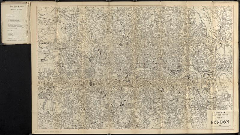
Cook's literary and historical map of London
Item Information
- Title:
- Cook's literary and historical map of London
- Publisher:
- Thomas Cook (Firm)
- Date:
-
1899
- Format:
-
Maps/Atlases
- Location:
-
Boston Public Library
Norman B. Leventhal Map & Education Center - Collection (local):
-
Norman B. Leventhal Map & Education Center Collection
- Subjects:
-
London (England)--Maps
Literary landmarks--England--London
- Places:
-
EnglandLondonLondon
- Extent:
- 1 map ; 54 x 84 cm, folded in cover 19 x 12 cm + text (96 pages ; 17 cm)
- Terms of Use:
-
No known copyright restrictions.
No known restrictions on use.
- Publisher:
-
London :
Thomas Cook & Son
- Scale:
-
Scale approximately 1:21,000
- Language:
-
English
- Notes:
-
Relief shown by hachures.
Accompanied by index (96 pages ; 17 cm).
Red overprint gridlines and railroad stations.
- Notes (citation):
-
Hyde, R. Printed maps of Victorian London, no. 302
- Identifier:
-
06_01_018740
- Call #:
-
G5754.L7 1899 .T56
- Barcode:
-
39999085955852


