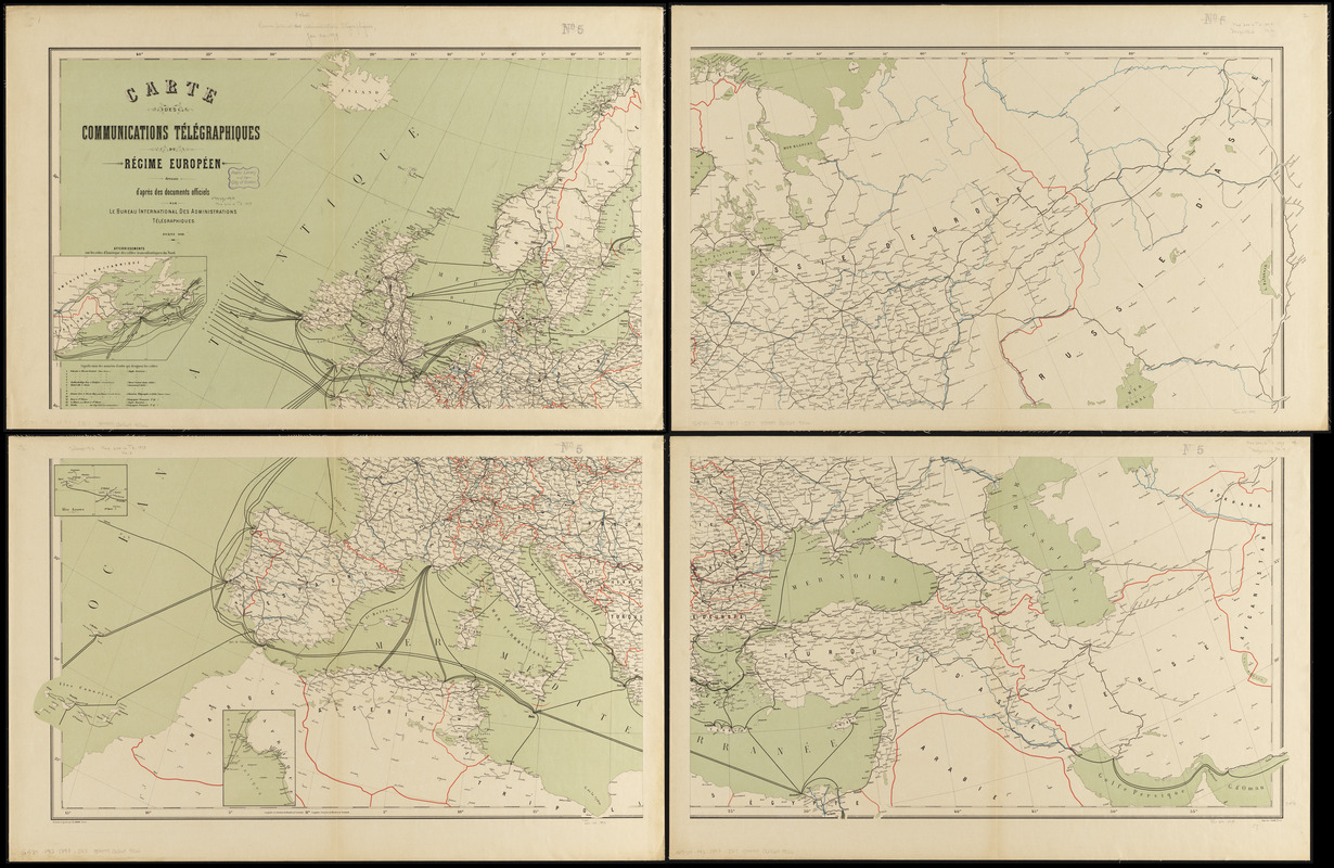
Carte des communications télégraphiques du régime européen
Item Information
- Title:
- Carte des communications télégraphiques du régime européen
- Cartographer:
- International Telegraph Bureau (Bern, Switzerland)
- Engraver:
- Van Hoven, C.
- Name on Item:
-
dressée d'après des documents officiels par Le Bureau International des Administrations Télégraphiques ; desinée et gravée par C. v. Hoven
- Date:
-
1898
- Format:
-
Maps/Atlases
- Location:
-
Boston Public Library
Norman B. Leventhal Map & Education Center - Collection (local):
-
Norman B. Leventhal Map & Education Center Collection
- Subjects:
-
Telegraph lines--Europe--Maps
Telecommunication--Europe--Maps
Europe--Maps
- Places:
-
Europe
Europe
- Extent:
- 1 map on 4 sheets : color ; 89 x 152 cm, on sheets 53 x 82 cm
- Terms of Use:
-
No known copyright restrictions.
No known restrictions on use.
- Publisher:
-
Berne :
Bureau International des Administrations Télégraphiques
- Scale:
-
Scale approximately 1:510,000
- Language:
-
French
- Notes:
-
Insets: Atterrissements sur les côtes d'Amérique des câbles transatlantiques du Nord -- Iles Açores -- [Côte d'Afrique].
- Identifier:
-
06_01_014130
- Call #:
-
G5701.P92 1898 .I57
- Barcode:
-
39999065699066