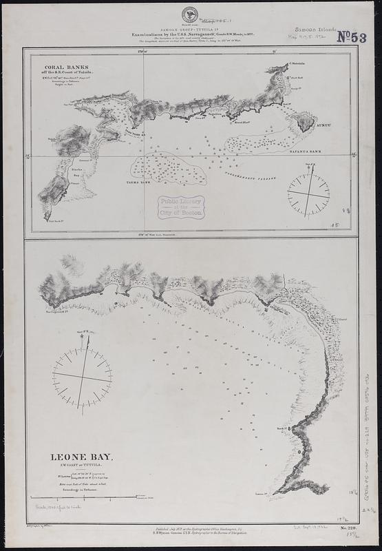
Samoan Group--Tutuila Id.
Item Information
- Title:
- Samoan Group--Tutuila Id.
- Issuing body:
- United States. Hydrographic Office
- Surveyor:
- Meade, Richard W. (Richard Worsam), 1837-1897
- Name on Item:
-
examinations by the U.S.S. Narragansett, Comdr. R.W. Meade, in 1872
- Date:
-
1872
- Format:
-
Maps/Atlases
- Genre:
-
Nautical charts
- Location:
-
Boston Public Library
Norman B. Leventhal Map & Education Center - Collection (local):
-
Norman B. Leventhal Map & Education Center Collection
- Subjects:
-
Tutuila Island (American Samoa)--Maps
Leone Bay (American Samoa)--Maps
Navigation--American Samoa--Tutuila Island
Navigation--American Samoa--Leone Bay
Coral reefs and islands--American Samoa--Tutuila Island--Maps
- Places:
-
American Samoa (territory)Tutuila (island)
American Samoa (territory)Leone
- Extent:
- 2 maps on 1 sheet ; 57 x 40 cm
- Terms of Use:
-
No known copyright restrictions.
No known restrictions on use.
- Publisher:
-
Washington, D.C. :
Hydrographic Office
- Scale:
-
Scale approximately 1:14,600
Scale approximately 1:60,000
- Language:
-
English
- Table of Contents:
-
Coral banks off the s.e. coast of Tutuila
Leone Bay, s.w. coast of Tutuila.
- Notes:
-
Relief shown by hachures and spot heights. Depths shown by soundings and pictorially.
- Identifier:
-
06_01_017645
- Call #:
-
G9096.P5 svar .U55 no. 229
- Barcode:
-
39999085960936


