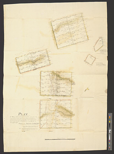
Plan of fifty different tracts of land, (of 1000 acres each) containing in the whole 50,000 acres, situate on the waters of Rocky Springs, called Poplar Branch, Cedar Creek, on hollows of Dean Swamp, &c Sweet Water Branch, Marrow Bone Creek, Goose Patter Creek, & Burkelow Creek, waters of the south fork of Edisto River, in the district of Orangeburgh, State of South Carolina
This map is also available in American Revolutionary Geographies Online (ARGO), a collections portal especially built for material relating to the American Revolutionary War Era. Visit ARGO to learn more about this item and explore the historical geography of North America in the late eighteenth century.
Item Information
- Title:
- Plan of fifty different tracts of land, (of 1000 acres each) containing in the whole 50,000 acres, situate on the waters of Rocky Springs, called Poplar Branch, Cedar Creek, on hollows of Dean Swamp, &c Sweet Water Branch, Marrow Bone Creek, Goose Patter Creek, & Burkelow Creek, waters of the south fork of Edisto River, in the district of Orangeburgh, State of South Carolina
- Contributor:
- Brown, Robert
- Contributor:
- Walker, Nathaniel
- Creator:
- De Krafft, Charles
- Date:
-
[1793]
- Format:
-
Maps/Atlases
- Genre:
-
Manuscript maps
- Location:
- William L. Clements Library
- Collection (local):
-
William L. Clements Library Collection
- Subjects:
-
Real property--South Carolina--Orangeburg County--Maps
Orangeburg County (S.C.)--Maps
Warner, Thomas
- Places:
-
South CarolinaOrangeburg (county)
- Extent:
- 6 ms. surveys on 1 sheet : col. ; 94 x 69 cm
- Terms of Use:
-
The University of Michigan Library provides access to these materials for educational and research purposes. These materials may be under copyright. If you decide to use any of these materials, you are responsible for making your own legal assessment and securing any necessary permission. If you have questions about the collection, please contact the William L. Clements Library.
Contact host institution for more information.
- Scale:
-
Scale 1:19,800.
- Language:
-
English
- Catalog Record:
-
Catalog record
- Notes:
-
Signed below scale: Chas. de Kraffe.
Includes surveys done by Robert Brown and Nathaniel Walker.
Maps show property, roads, and various topographical features.
Map accompanied by deed.
- Notes (date):
-
This date is inferred.
- Identifier:
-
8710
- Barcode:
-
B1938674


