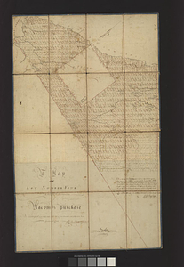
A Map of lot number four In The Division of Macomb's purchase
This map is also available in American Revolutionary Geographies Online (ARGO), a collections portal especially built for material relating to the American Revolutionary War Era. Visit ARGO to learn more about this item and explore the historical geography of North America in the late eighteenth century.
Item Information
- Title:
- A Map of lot number four In The Division of Macomb's purchase
- Creator:
- Brodhead, Charles C., surveyor
- Name on Item:
-
surveyed and partly laid into lots of four hundred and forty acres each Chs. C. Brodhead & assistants
- Date:
-
1796
- Format:
-
Maps/Atlases
- Genre:
-
Manuscript maps
- Location:
- William L. Clements Library
- Collection (local):
-
William L. Clements Library Collection
- Subjects:
-
Real property--New York (State)--Jefferson County--Maps
Jefferson County (N.Y.)--Maps
Macomb, Alexander, 1748-1831
- Places:
-
New YorkJefferson (county)
- Extent:
- 1 manuscript map : colored ; 109.5 x 71 cm
- Terms of Use:
-
The University of Michigan Library provides access to these materials for educational and research purposes. These materials may be under copyright. If you decide to use any of these materials, you are responsible for making your own legal assessment and securing any necessary permission. If you have questions about the collection, please contact the William L. Clements Library.
Contact host institution for more information.
- Scale:
-
Scale approximately 1:79,200.
- Language:
-
English
- Catalog Record:
-
Catalog record
- Notes:
-
North oriented toward upper right.
Ink and wash survey map showing numbered lots and some geographical features.
Includes individual lots' stake trees identified by species.
Also includes survey notes signed by Charles Brodhead.
- Identifier:
-
9138
- Barcode:
-
B8974042


