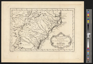
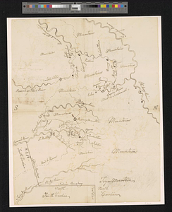
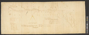
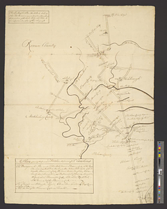
A plan of part of the principal roads in the province of No. Carolina
This map is also available in American Revolutionary Geographies Online (ARGO), a collections portal especially built for material relating to the American Revolutionary War Era. Visit ARGO to learn more about this item and explore the historical geography of North America in the late eighteenth century.
Item Information
- Title:
- A plan of part of the principal roads in the province of No. Carolina
- Date:
-
[1770–1779]
- Format:
-
Maps/Atlases
- Genre:
-
Manuscript maps
- Location:
- William L. Clements Library
- Collection (local):
-
William L. Clements Library Collection
- Subjects:
-
Roads--North Carolina--Maps
North Carolina--Maps
United States--History--Revolution, 1775-1783--Maps
- Places:
-
North Carolina
- Extent:
- 1 ms. map ; 76 x 55 cm.
- Terms of Use:
-
The University of Michigan Library provides access to these materials for educational and research purposes. These materials may be under copyright. If you decide to use any of these materials, you are responsible for making your own legal assessment and securing any necessary permission. If you have questions about the collection, please contact the William L. Clements Library.
Contact host institution for more information.
- Scale:
-
Scale 1:63,360.
- Language:
-
English
- Catalog Record:
-
Catalog record
- Notes:
-
Finished, pen and ink map indicating the main roads, principal plantations and towns of North Carolina, indicating distances between them.
A table of references lists bridges and ferries on the routes.
Clinton Maps 290.
- Notes (date):
-
This date is inferred.
- Identifier:
-
8303
- Barcode:
-
B2504224