In any study of how people migrate, maps are valuable tools to make sense of where and how people move. We can study the geographic regions that migrants came from as well as where they settled. Using maps showing different scales (world, country, city) can help us build background knowledge about the who/what/when/where/why of migration. We will also consider who is making the map and why.
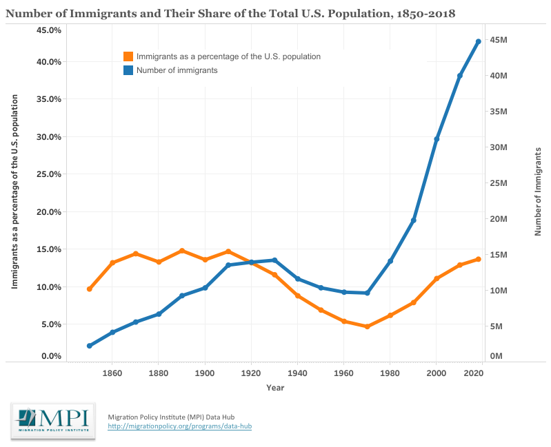
This map set is comprised of three maps, a graph, and a worksheet to be used in conjunction with the Migration to and within the United States in the late 1800s and early 1900s lesson plan which can be found on the following page.
The lesson can serve as an introductory activity (one-two class periods) for a unit on United States immigration. The goal is to familiarize students with some of the countries of origin for migrants in the 19th and early 20th centuries and to familiarize them with settlement patterns across the country in both urban and rural settings.
Essential Question
How can maps help us understand how people migrated to and within the United States in the late 1800s/early 1900s?
Learning Objectives
Students will use visual and spatial sources to understand the span and scope of migration to and within the United States in the late 19th century & early 20th century.
Students will be able to use the inquiry method to read map sources and compare them to statistical data related to immigration numbers to the United States. They will be able to consider the creators of different maps and think about purpose and point of view.
Students will look at maps that show different scales: worldwide migration in the mid-19th century, settlement patterns in the United States and settlement in one section of Chicago, IL.


