Toggle navigation
LMEC Home
Exhibitions
Georeferencing
Tools for Teachers
Collections
My Favorites
Sign Up / Log In
Search
Search the map portal
Map Collection
Map Collection
Map Sets
Search
Search
Search for
Search In
All Fields
Creator
Title
Subject
Place
Search All Digital Collections
Advanced Search
1 Results
My Search
Start Over
poland/
Remove constraint poland/
Date
1600
to
1649
Remove constraint Date: <span class='from'>1600</span> to <span class='to'>1649</span>
Filter your Search
Place
Brandenburg
1
Europe
1
Germany
1
Poland
1
Pomerania
1
Topic
Brandenburg (Germany)--Maps--Early works to 1800
1
Poland--Maps--Early works to 1800
1
Pomerania (Poland and Germany)--Maps--Early works to 1800
1
Date
1600
to
1649
[remove]
1
Date range begin
–
Date range end
Current results range from
1641
to
1641
1600
to
1604
0
1605
to
1609
0
1610
to
1614
0
1615
to
1619
0
1620
to
1624
0
1625
to
1629
0
1630
to
1634
0
1635
to
1639
0
1640
to
1644
1
1645
to
1649
0
Creator
Gothus, Olaus Joannis, 1600-1644
1
Format
Maps/Atlases
1
Georeferenced
No
1
Collection
Norman B. Leventhal Map Center Collection
1
Available to use
No known restrictions
1
Search Constraints
Search for
portland
or
plans
or
plant
or
plan
or
pond
instead?
Sort by relevance
relevance
title
date (asc)
date (desc)
Number of results to display per page
20 per page
10
per page
20
per page
50
per page
100
per page
View results as:
grid view
map view
Search Results
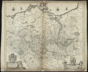
1.
Marchionatus Brandenburgicus