Toggle navigation
LMEC Home
Exhibitions
Georeferencing
Tools for Teachers
Collections
My Favorites
Sign Up / Log In
Search
Search the map portal
Map Collection
Map Collection
Map Sets
Search
Search
Search for
Search In
All Fields
Creator
Title
Subject
Place
Search All Digital Collections
Advanced Search
82 Results
My Search
Start Over
Date
1835
Remove constraint Date: <span class='single'>1835</span>
Filter your Search
Place
North and Central America
43
United States
36
Boston
12
Suffolk (county)
12
Europe
9
Massachusetts
4
Michigan
4
North Korea
4
more
Place
»
Topic
Boston (Mass.)--Maps
9
Ohio--Boundaries--Michigan--Maps
6
Michigan--Boundaries--Ohio--Maps
5
Korea--Maps
4
China--Maps
3
Japan--Maps
3
Maryland--Maps
3
Rome (Italy)--Maps
3
more
Topic
»
Date
1835
[remove]
82
Date range begin
–
Date range end
Current results range from
1770
to
1990
1835
to
1835
82
Creator
Bradford, T. G. (Thomas Gamaliel), 1802-1887
4
Fuller, Stephen P.
3
Bonner, John, ca. 1643-1726
2
Hood, Washington
2
Hood, Washington.
2
Pendleton's Lithography
2
Talcott, Andrew, 1797-1883
2
United States. Army. Corps of Engineers
2
more
Creator
»
Format
Maps/Atlases
80
Manuscripts
12
Drawings/Illustrations
1
Objects/Artifacts
1
Prints
1
Georeferenced
Yes
9
No
73
Collection
Norman B. Leventhal Map Center Collection
64
Urban Maps
17
Boston and New England Maps
15
American Revolutionary War-Era Maps
12
Library of Congress Collection
5
MacLean Collection Map Library
4
Sidney R. Knafel Map Collection at Phillips Academy
3
Newberry Library Collection
2
more
Collection
»
Available to use
No known restrictions
66
Creative Commons license
6
Search Constraints
Sort by relevance
relevance
title
date (asc)
date (desc)
Number of results to display per page
10 per page
10
per page
20
per page
50
per page
100
per page
View results as:
grid view
map view
Search Results
1.
1. Prise de Newport par d'Estaing, 1778 : 2. Embossage de Ternay à Newport, 1780
2.
Afrika
3.
Afrique
4.
America settle
5.
Asia Florente Persarum Imperio
6.
Brazil, Bolivia, & Peru
7.
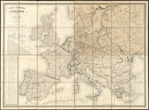
Carte itinéraire de l'Europe indiquant les limites actuelles des etats : dediée au Roi
8.
A chart of the gulf stream
9.
A comprehensive atlas geographical, historical & commercial [title page]
10.
Copy of an ancient plan belonging to the City (not dated probably about 1738)
‹ Prev
Next ›
1
2
3
4
5
…
8
9


![A comprehensive atlas geographical, historical & commercial [title page]](https://bpldcassets.blob.core.windows.net/derivatives/images/commonwealth:3f463182f/image_thumbnail_300.jpg)
