Toggle navigation
LMEC Home
Exhibitions
Georeferencing
Tools for Teachers
Collections
My Favorites
Sign Up / Log In
Search
Search the map portal
Map Collection
Map Collection
Map Sets
Search
Search
Search for
Search In
All Fields
Creator
Title
Subject
Place
Search All Digital Collections
Advanced Search
179 Results
My Search
Start Over
1884
Remove constraint 1884
Filter your Search
Place
North and Central America
158
United States
142
Massachusetts
57
Suffolk (county)
35
Boston
34
Canada
13
New Hampshire
11
Pennsylvania
11
more
Place
»
Topic
Boston (Mass.)--Maps
26
Fortification--Massachusetts--Boston--Maps
14
Landowners--Massachusetts--Boston--Maps
5
Real property--Massachusetts--Boston--Maps
5
Roxbury (Boston, Mass.)--Maps
5
Massachusetts--Maps
4
Cambridge (Mass.)--Maps
3
Charlestown (Boston, Mass.)--Maps
3
more
Topic
»
Date
Date range begin
–
Date range end
Current results range from
1694
to
1932
View distribution
Creator
Boynton, George W., d. 1884
24
United States. Hydrographic Office
15
O.H. Bailey & Co
14
Geo. H. Walker & Co.
10
Johnson, A. J. (Alvin Jewett), 1827-1884
9
Boynton, George W., -1884
8
Campbell-Copeland, T. (Thomas)
7
Harper & Brothers
7
more
Creator
»
Format
Maps/Atlases
178
Books
3
Manuscripts
2
Prints
1
Georeferenced
Yes
21
No
158
Collection
Norman B. Leventhal Map & Education Center Collection
167
Urban Maps
86
Boston and New England Maps
75
Maritime Charts and Atlases
20
Massachusetts Real Estate Atlases
6
Robert E. Diefenbach Map Collection at Phillips Academy
4
Mapping Boston Collection
1
Ralph Finos Map Collection at Phillips Academy
1
more
Collection
»
Available to use
No known restrictions
171
Creative Commons license
1
Search Constraints
Sort by relevance
relevance
title
date (asc)
date (desc)
Number of results to display per page
20 per page
10
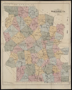
per page
20
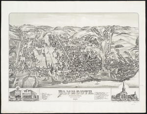
per page
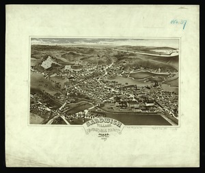
50
per page
100
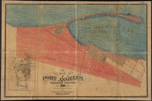
per page
View results as:
grid view
map view
Search Results
141.
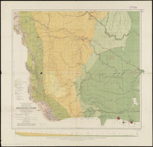
Geological map of the region in the vicinity of the Bow and Belly Rivers : embracing the southern portion of the District of...
142.
Hazleton : Pennsylvania
143.
Lewisburgh : Pennsylvania
144.
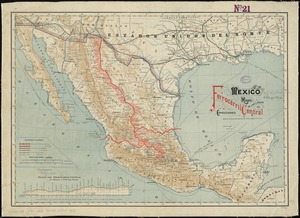
Mexico, mapa de las lineas del Ferrocarril Central Mexicano y conecciones
145.
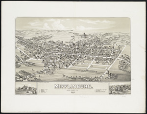
Mifflinburg : Union County, Pa
146.
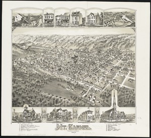
Mt. Carmel : Pennsylvania
147.
New driving road map of Worcester Co. Massachusetts
148.
Plan of Boston
149.
Plymouth : Pennsylvania
150.
Sandwich Village, Barnstable County, Mass., looking west
151.
Springfield, Ohio
152.
Stroudsburg : Pennsylvania
153.
Map of Port Angeles, Washington Territory : compiled from a true copy of the U.S. survey thereof on file in the General Land...
154.
Preliminary plan for Wood Island Park, East Boston
155.
Topographical map of West Roxbury park
156.
Atlas of Greenfield town, Massachusetts
157.
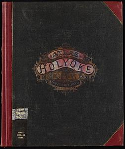
Atlas of Holyoke City, Massachusetts
158.
Atlas of Spencer town, Massachusetts
159.
Atlas of the city of Boston : vol. 5, West Roxbury
160.
Atlas of the city of Boston : Dorchester : volume three : from actual surveys and official records
‹ Prev
Next ›
1
2
…
4
5
6
7
8
9