Toggle navigation
LMEC Home
Exhibitions
Georeferencing
Tools for Teachers
Collections
My Favorites
Sign Up / Log In
Search
Search the map portal
Map Collection
Map Collection
Map Sets
Search
Search
Search for
Search In
All Fields
Creator
Title
Subject
Place
Search All Digital Collections
Advanced Search
150 Results
My Search
Start Over
1873
Remove constraint 1873
Filter your Search
Place
North and Central America
97
United States
65
Massachusetts
30
Europe
19
Boston
16
Suffolk (county)
16
Asia
12
Canada
9
more
Place
»
Topic
Pictorial maps
12
Boston (Mass.)--Maps
8
California, Gulf of (Mexico)--Maps
4
United States--Maps
4
Cambridge (Mass.)--Maps
3
Canada--Maps
3
Great Fire, Boston, Mass., 1872--Maps
3
Landowners--Massachusetts--Boston--Maps
3
more
Topic
»
Date
Date range begin
–
Date range end
Current results range from
1625
to
1985
View distribution
Creator
United States. Hydrographic Office
48
Harvey, William, 1796-1873
12
Hodder and Stoughton
12
Lancaster, Elizabeth Lilian, 1852-1939
12
Vincent Brooks, Day & Son
12
Maury, Matthew Fontaine, 1806-1873
5
Beers, F. W. (Frederick W.)
4
Comstock, C. B. (Cyrus Ballou), 1831-1910
4
more
Creator
»
Format
Maps/Atlases
150
Manuscripts
1
Georeferenced
Yes
16
No
134
Collection
Norman B. Leventhal Map & Education Center Collection
140
Maritime Charts and Atlases
53
Urban Maps
38
Boston and New England Maps
35
Massachusetts Real Estate Atlases
3
Town plans, 1830
3
American Revolutionary War-Era Maps
2
Boston Redevelopment Authority Collection
1
more
Collection
»
Available to use
No known restrictions
144
Creative Commons license
3
Search Constraints
Sort by relevance
relevance
title
date (asc)
date (desc)
Number of results to display per page
20 per page
10
per page
20
per page
50
per page
100
per page
View results as:
grid view
map view
Search Results
121.
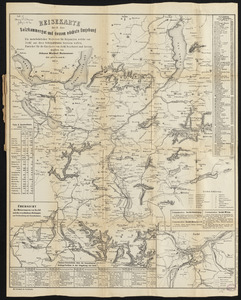
Reisekarte durch das Salzkammergut und dessen nächste umgebung : ein unentbehrlicher wegweiser für diejenigen, welche von...
122.
Town of Hingham Plymouth County, Mass : from recent and actual surveys
123.
Town of North Bridgewater Plymouth County Mass : from revent and actual surveys
124.
Plan of land on West Chester Park and Huntington Ave. belonging to the Boston Water Power Co
125.
Plan of the town of Brighton
126.
Plan of the town of West Roxbury : compiled from various plans and surveys, by order of the selectmen
127.
Trustees' sale : beautiful building lots on Walnut St. and Walnut Avenue, in West Roxbury, containing about 3,126,519 square feet
128.
Atlas of the city of Cambridge, Middlesex Co., Massachusetts
129.
Atlas of the county of Suffolk, Massachusetts : vol. 2nd late city of Roxbury, now wards 13-14 and 15, city of Boston
130.
Atlas of the county of Suffolk, Massachusetts, vol. 2 : late city of Roxbury, now wards 13-14 and 15, city of Boston
131.
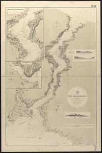
The Bosphorus : from French and British surveys in 1853, corrected to 1872
132.
County atlas of Hampshire, Massachusetts
133.
England--south coast, Portland Harbor : republished from British Admy. chart no. 2268
134.
Fitton Bay (Peel Id.) from the survey of Captain F.W. Beechey, R.N. 1827 ; Coffin Group by officers of the U.S. Ship Plymouth,...
135.
North Pacific Ocean, atolls in the Marshall Group : from an examination by the U.S.S. "Narragansett", Comdr. R.W. Meade, in 1872
136.
Ports in the Philippine Islands
137.
Red Sea, Suez Bay : from British surveys in 1870, corrected to 1872
138.
Shah Bay, Loo Choo I.
139.
South Pacific, Fiji or Viti Group, Matuku ; Matuku Harbor
140.
South Pacific, Fiji or Viti Group, Moala
‹ Prev
Next ›
1
2
3
4
5
6
7
8