Toggle navigation
LMEC Home
Exhibitions
Georeferencing
Tools for Teachers
Collections
My Favorites
Sign Up / Log In
Search
Search the map portal
Map Collection
Map Collection
Map Sets
Search
Search
Search for
Search In
All Fields
Creator
Title
Subject
Place
Search All Digital Collections
Advanced Search
14164 Results
Filter your Search
Place
North and Central America
10,832
United States
8,868
Massachusetts
2,832
Suffolk (county)
1,688
Boston
1,644
Europe
1,428
Canada
1,010
New York
684
more
Place
»
Topic
Boston (Mass.)--Maps
753
City planning--Massachusetts--Boston--Maps
419
United States--History--Revolution, 1775-1783--Maps
331
United States--Maps
331
Real property--Massachusetts--Boston--Maps
254
Urban renewal--Massachusetts--Boston--Maps
254
North America--Maps--Early works to 1800
241
Massachusetts--Maps
236
more
Topic
»
Date
Date range begin
–
Date range end
Current results range from
1482
to
2023
View distribution
Creator
United States. Hydrographic Office
597
Boston Redevelopment Authority
404
Des Barres, Joseph F. W. (Joseph Frederick Wallet), 1722-1824
247
Jefferys, Thomas, -1771
172
United States. National Ocean Service
170
Royal United Services Institute for Defence and Security Studies
160
George, III, King of Great Britain, 1738-1820
152
George, IV, King of Great Britain, 1762-1830
151
more
Creator
»
Format
Maps/Atlases
13,978
Manuscripts
985
Prints
102
Books
53
Drawings/Illustrations
44
Photographs
15
Objects/Artifacts
13
Documents
7
more
Format
»
Georeferenced
Yes
979
No
13,185
Collection
Norman B. Leventhal Map & Education Center Collection
9,162
American Revolutionary War-Era Maps
3,629
Boston and New England Maps
2,936
Urban Maps
2,511
Maritime Charts and Atlases
1,169
William L. Clements Library Collection
910
Library of Congress Collection
618
Boston Redevelopment Authority Collection
475
more
Collection
»
Available to use
No known restrictions
10,408
Creative Commons license
1,678
Search Constraints
Sort by relevance
relevance
title
date (asc)
date (desc)
Number of results to display per page
20 per page
10
per page
20
per page
50
per page
100
per page
View results as:
grid view
map view
Search Results
13641.
View of Palmer, Mass
13642.
A view of part of the town of Boston in New-England and Brittish [sic] ships of war landing their troops! 1768
13643.
A view of Partridge Island, from the west
13644.
A view of Partridge Island, from the west
13645.
View of Peabody, Mass : 1877
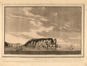
13646.
A view of Port Hood, sailing into the harbor : A view of the Plaister Cliffs, in George's Bay
13647.
A view of Portsmouth in Piscataqua River
13648.
[View of Portsmouth, N.H.]
13649.
View of Public Square, Atlanta, Ga.
13650.
View of Putnam, Conn : 1877
13651.
View of Randolph, Mass : 1882
13652.
View of Rockville, Conn : 1877
13653.
View of Saxonville, Mass
13654.
View of Sea Isle City : New Jersey
13655.
View of Seymour, Conn : 1879
13656.
View of Somerset, Massachusetts
13657.
View of South Braintree, Massachusetts : 1882
13658.
View of South Coventry, Conn : 1878
13659.
View of Southbridge, Mass : Center & Globe Village, 1878
13660.
View of SoWa food trucks
‹ Prev
Next ›
1
2
…
679
680
681
682
683
684
685
686
687
…
708
709