Toggle navigation
LMEC Home
Exhibitions
Georeferencing
Tools for Teachers
Collections
My Favorites
Sign Up / Log In
Search
Search the map portal
Map Collection
Map Collection
Map Sets
Search
Search
Search for
Search In
All Fields
Creator
Title
Subject
Place
Search All Digital Collections
Advanced Search
1484 Results
My Search
Start Over
Subject
"Boston (Mass.)--Maps"
Remove constraint Subject: "Boston (Mass.)--Maps"
Filter your Search
Place
North and Central America
1,483
United States
1,481
Suffolk (county)
1,399
Boston
1,395
Massachusetts
1,099
Boston Harbor
126
Roxbury
91
Charlestown
71
more
Place
»
Topic
Boston (Mass.)--Maps
747
City planning--Massachusetts--Boston--Maps
407
Real property--Massachusetts--Boston--Maps
245
Urban renewal--Massachusetts--Boston--Maps
245
Landowners--Massachusetts--Boston--Maps
161
Buildings--Massachusetts--Boston--Maps
123
Land use--Massachusetts--Boston--Maps
99
Roxbury (Boston, Mass.)--Maps
90
more
Topic
»
Date
Date range begin
–
Date range end
Current results range from
1689
to
2023
View distribution
Creator
Boston Redevelopment Authority
387
Bromley, George Washington
69
Bromley, Walter Scott
68
G.W. Bromley & Co.
46
Geo. H. Walker & Co
28
Boston (Mass.). Engineering Dept
21
Boynton, George W., d. 1884
21
Sampson, Davenport & Co
21
more
Creator
»
Format
Maps/Atlases
1,481
Manuscripts
50
Drawings/Illustrations
5
Posters
1
Prints
1
Georeferenced
Yes
140
No
1,344
Collection
Boston and New England Maps
1,209
Urban Maps
1,015
Norman B. Leventhal Map & Education Center Collection
1,003
Boston Redevelopment Authority Collection
449
American Revolutionary War-Era Maps
129
Mapping Boston Collection
52
Massachusetts Real Estate Atlases
38
Maritime Charts and Atlases
28
more
Collection
»
Available to use
No known restrictions
1,301
Creative Commons license
116
Search Constraints
Sort by relevance
relevance
title
date (asc)
date (desc)
Number of results to display per page
20 per page
10
per page
20
per page
50
per page
100
per page
View results as:
grid view
map view
Search Results
1161.
Plan of East Boston showing the land and water lots sold and unsold, also all buildings and other improvements
1162.
Plan of house lots, Mt. Vernon St., West Roxbury : owned by the Mt. Vernon Land Company, 257 Washington St., Room 3
1163.
Plan of land and street layout in Boston, Mass., Hyde Park : prepared for the Stoney Brook Land Trust
1164.
Plan of lands in West-Roxbury, belonging to the estate of Chas. M. Taft : to be sold by public auction on Wednesday June 9th...
1165.
Plan of lands in West-Roxbury, belonging to the estate of Chas. M. Taft : to be sold by public auction in Wednesday June 9th at...
1166.
Plan of sections of 1, 2 & 3, East Boston
1167.
Roxbury-N. Dorchester G.N.R.P. r-50 : proposed treatment and title I projects
1168.
Roxbury-N. Dorchester G.N.R.P. r-50 : proposed land use
1169.
Roxbury-N. Dorchester G.N.R.P. r-50 : existing population density
1170.
Rugby : belonging to Wood, Harmon & Co
1171.
South Boston urban renewal area r-51 : building conditions
1172.
South Boston urban renewal area r-51 : existing zoning
1173.
South Boston urban renewal area r-51 : proposed zoning
1174.
South Boston urban renewal area r-51 : existing building condition
1175.
South Cove property ownership 1950
1176.
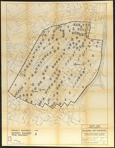
South End project no. Mass. r-56 : building deficiencies
1177.
South End urban renewal area R-56 : re-use parcels
1178.
South End urban renewal area R-56 : re-use parcels
1179.
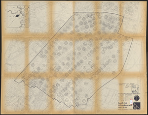
South End urban renewal area R-56 : building deficiencies
1180.
Thirty-miles round Boston
‹ Prev
Next ›
1
2
…
55
56
57
58
59
60
61
62
63
…
74
75