Toggle navigation
LMEC Home
Exhibitions
Georeferencing
Tools for Teachers
Collections
My Favorites
Sign Up / Log In
Search
Search the map portal
Map Collection
Map Collection
Map Sets
Search
Search
Search for
Search In
All Fields
Creator
Title
Subject
Place
Search All Digital Collections
Advanced Search
2843 Results
My Search
Start Over
atlas
Remove constraint atlas
Filter your Search
Place
North and Central America
1,401
United States
874
Europe
351
Canada
271
Suffolk (county)
163
Boston
157
Asia
136
South America
101
more
Place
»
Topic
Landowners--Massachusetts--Boston--Maps
115
Real property--Massachusetts--Boston--Maps
106
United States--Maps
87
Boston (Mass.)--Maps
63
United States--History--French and Indian War, 1754-1763--Maps
63
Saint Lawrence River--Maps
41
Nautical charts--Early works to 1800
39
North America--Maps--Early works to 1800
36
more
Topic
»
Date
Date range begin
–
Date range end
Current results range from
1482
to
2023
View distribution
Creator
United States. Hydrographic Office
582
Des Barres, Joseph F. W. (Joseph Frederick Wallet), 1722-1824
118
Ptolemy, 2nd cent
100
Bromley, George Washington
99
Bromley, Walter Scott
97
G.W. Bromley & Co.
75
Carey, Mathew, 1760-1839
74
Paullin, Charles Oscar, 1868 or 1869-1944
70
more
Creator
»
Format
Maps/Atlases
2,827
Manuscripts
58
Books
37
Prints
8
Documents
5
Drawings/Illustrations
1
Georeferenced
Yes
142
No
2,701
Collection
Norman B. Leventhal Map Center Collection
2,386
Maritime Charts and Atlases
1,150
American Revolutionary War-Era Maps
504
Boston and New England Maps
374
Urban Maps
250
Massachusetts Real Estate Atlases
144
William L. Clements Library Collection
92
Mapping Boston Collection
61
more
Collection
»
Available to use
No known restrictions
2,292
Creative Commons license
158
Search Constraints
Sort by date (asc)
relevance
title
date (asc)
date (desc)
Number of results to display per page
50 per page
10
per page
20
per page
50
per page
100
per page
View results as:
grid view
map view
Search Results
2701.
Ziron 1920 political map
2702.
Atlas of the city of Boston : West Roxbury
2703.
Atlas of the city of Boston : West Roxbury : from actual surveys and official plans
2704.
Rand McNally standard map of Toronto and environs
2705.
Richards standard atlas of the city of Lowell, Massachusetts
2706.
Richards standard atlas of the city of Lynn and the towns of Swampscott, Saugus and Nahant, Massachusetts : from official...
2707.
Richards standard atlas of the city of Lynn and the towns of Swampscott, Saugus, and Nahant, Massachusetts
2708.
Atlas of the city of Boston : Brighton : from actual surveys and official plans
2709.
Atlas of the city of Lawrence and the towns of Methuen, Andover and North Andover, Massachusetts
2710.
Atlas of the city of Lawrence and the towns of Methuen, Andover and North Andover, Massachusetts
2711.
Atlas of the town of Brookline, Norfolk County, Massachusetts : from actual surveys and official plans
2712.
Atlas of the town of Brookline, Norfolk County, Massachusetts
2713.
Atlas of the city of Boston : Boston proper and Back Bay
2714.
Atlas of the city of Boston : Boston proper and Back Bay : from actual surveys and official plans
2715.
George Washington's map, accompanying his "journal to the Ohio", 1754
2716.
Topographic & detail sheets of Rainy Lake & upper boundary waters
2717.
Atlas of the city of Newton, Massachusetts
2718.
Atlas of the city of Cambridge, Massachusetts : from actual surveys and official plans
2719.
Town of Brookline, Mass. assessors' plans 1930
2720.
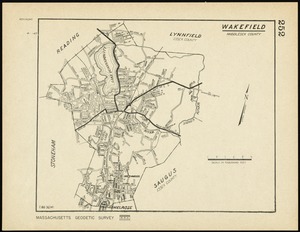
Wakefield, Massachusetts
2721.
Atlas of the city of Boston : Roxbury : from actual surveys and official plans
2722.
Town of Belmont Assessors plans
2723.
Abolition of Slavery, 1863
2724.
Alien and Sedition Acts, February 25, 1799, Votes on resolutions for repeal
2725.
American explorations in the West, 1803-1852
2726.
Compromise of 1850, September 6, 1850, vote on passage of Texas-New Mexico provisions
2727.
Density of population, 1790
2728.
Density of population, 1800
2729.
Density of population, 1810
2730.
Density of population, 1820
2731.
Density of population, 1830
2732.
Density of population, 1840
2733.
Density of population, 1850
2734.
Density of population, 1860
2735.
Density of population, 1870
2736.
Density of population, 1880
2737.
Density of population, 1890
2738.
Density of population, 1900
2739.
Density of population, 1910
2740.
Density of population, 1920
2741.
Electoral vote for President, 1789
2742.
Electoral vote for President, 1792
2743.
Electoral vote for President, 1796
2744.
Kansas-Nebraska Act, May 22, 1854, Vote on passage
2745.
Missouri Compromise, March 20, 1820, Vote on striking out provisions restricting slavery
2746.
Presidential and other elections, 1800
2747.
Presidential and other elections, 1804
2748.
Presidential and other elections, 1808
2749.
Presidential and other elections, 1812
2750.
Presidential and other elections, 1816
‹ Prev
Next ›
1
2
…
51
52
53
54
55
56
57