Toggle navigation
LMEC Home
Exhibitions
Georeferencing
Tools for Teachers
Collections
My Favorites
Sign Up / Log In
Search
Search the map portal
Map Collection
Map Collection
Map Sets
Search
Search
Search for
Search In
All Fields
Creator
Title
Subject
Place
Search All Digital Collections
Advanced Search
14164 Results
Filter your Search
Place
North and Central America
10,832
United States
8,868
Massachusetts
2,832
Suffolk (county)
1,688
Boston
1,644
Europe
1,428
Canada
1,010
New York
684
more
Place
»
Topic
Boston (Mass.)--Maps
753
City planning--Massachusetts--Boston--Maps
419
United States--History--Revolution, 1775-1783--Maps
331
United States--Maps
331
Real property--Massachusetts--Boston--Maps
254
Urban renewal--Massachusetts--Boston--Maps
254
North America--Maps--Early works to 1800
241
Massachusetts--Maps
236
more
Topic
»
Date
Date range begin
–
Date range end
Current results range from
1482
to
2023
View distribution
Creator
United States. Hydrographic Office
597
Boston Redevelopment Authority
404
Des Barres, Joseph F. W. (Joseph Frederick Wallet), 1722-1824
247
Jefferys, Thomas, -1771
172
United States. National Ocean Service
170
Royal United Services Institute for Defence and Security Studies
160
George, III, King of Great Britain, 1738-1820
152
George, IV, King of Great Britain, 1762-1830
151
more
Creator
»
Format
Maps/Atlases
13,978
Manuscripts
985
Prints
102
Books
53
Drawings/Illustrations
44
Photographs
15
Objects/Artifacts
13
Documents
7
more
Format
»
Georeferenced
Yes
979
No
13,185
Collection
Norman B. Leventhal Map & Education Center Collection
9,162
American Revolutionary War-Era Maps
3,629
Boston and New England Maps
2,936
Urban Maps
2,511
Maritime Charts and Atlases
1,169
William L. Clements Library Collection
910
Library of Congress Collection
618
Boston Redevelopment Authority Collection
475
more
Collection
»
Available to use
No known restrictions
10,408
Creative Commons license
1,678
Search Constraints
Sort by relevance
relevance
title
date (asc)
date (desc)
Number of results to display per page
20 per page
10
per page
20
per page
50
per page
100
per page
View results as:
grid view
map view
Search Results
10101.
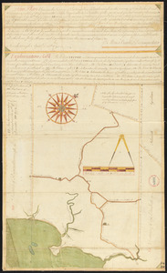
Plan of Savoy made by Levi Leonard, dated June 1831
10102.
Plan of Scarborough, made by Moses Banks, dated April 20, 1795. Showing country roads only.
10103.
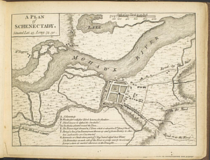
A plan of Schenectady situated lat. 43 long 74. 30
10104.
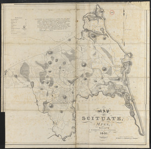
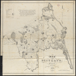
Plan of Scituate made by A. Robbins and S. A. Turner, dated 1831
10105.
Plan of Scituate made by A. Robbins and S. A. Turner, dated 1831
10106.
Plan of Scituate, made by Charles Turner, dated 1794-5.
10107.
Plan of Sea Shore Estate situated in Swampscott, Mass.
10108.
[Plan of section of proposed Charles River Park]
10109.
Plan of sections of 1, 2 & 3, East Boston
10110.
Plan of Sedgwick, surveyor's name not given, dated 1794-5.
10111.
Plan of Seekonk made by Joseph W. Capron, dated January 1831
10112.
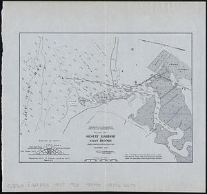
Plan of Sesuit Harbor in East Dennis : under chapter 32 resolves of 1907
10113.
A plan of Seven Island Harbour on the north side of the river St. Laurence latitude of the southermost [sic] island 50...
10114.
Plan of Shakspeare's birth-place
10115.
Plan of Shapleigh surveyed by Daniel Sewall, dated 1794-5.
10116.
Plan of Sharon made by Elijah Hewins, dated October, 1830
10117.
Plan of Sharon, surveyor's name not given, dated 1794-5.
10118.
Plan of Sheffield made by Chester Owen, dated 1830
10119.
Plan of Sheffield surveyed by David Fairchild, dated November, 1794.
10120.
Plan of Shelburne made by E. S. Darling, dated October 1830
‹ Prev
Next ›
1
2
…
502
503
504
505
506
507
508
509
510
…
708
709
![[Plan of section of proposed Charles River Park]](https://bpldcassets.blob.core.windows.net/derivatives/images/commonwealth:x059cc51b/image_thumbnail_300.jpg)

![A plan of Seven Island Harbour on the north side of the river St. Laurence latitude of the southermost [sic] island 50 [degrees] 22' north](https://bpldcassets.blob.core.windows.net/derivatives/metadata/commonwealth-oai:98810p69w/image_thumbnail_300.jpg)