Toggle navigation
LMEC Home
Exhibitions
Georeferencing
Tools for Teachers
Collections
My Favorites
Sign Up / Log In
Search
Search the map portal
Map Collection
Map Collection
Map Sets
Search
Search
Search for
Search In
All Fields
Creator
Title
Subject
Place
Search All Digital Collections
Advanced Search
14021 Results
Filter your Search
Place
North and Central America
10,683
United States
8,692
Massachusetts
2,808
Suffolk (county)
1,682
Boston
1,638
Europe
1,420
Canada
1,009
New York
674
more
Place
»
Topic
Boston (Mass.)--Maps
748
City planning--Massachusetts--Boston--Maps
418
United States--History--Revolution, 1775-1783--Maps
331
United States--Maps
328
Real property--Massachusetts--Boston--Maps
254
Urban renewal--Massachusetts--Boston--Maps
254
North America--Maps--Early works to 1800
240
Massachusetts--Maps
234
more
Topic
»
Date
Date range begin
–
Date range end
Current results range from
1482
to
2023
View distribution
Creator
United States. Hydrographic Office
597
Boston Redevelopment Authority
404
Des Barres, Joseph F. W. (Joseph Frederick Wallet), 1722-1824
247
Jefferys, Thomas, -1771
172
Royal United Services Institute for Defence and Security Studies
160
George, III, King of Great Britain, 1738-1820
152
George, IV, King of Great Britain, 1762-1830
151
O.H. Bailey & Co
148
more
Creator
»
Format
Maps/Atlases
13,839
Manuscripts
985
Prints
102
Books
49
Drawings/Illustrations
44
Photographs
15
Objects/Artifacts
13
Documents
7
more
Format
»
Georeferenced
Yes
979
No
13,042
Collection
Norman B. Leventhal Map & Education Center Collection
9,110
American Revolutionary War-Era Maps
3,627
Boston and New England Maps
2,921
Urban Maps
2,480
Maritime Charts and Atlases
1,169
William L. Clements Library Collection
910
Library of Congress Collection
618
Boston Redevelopment Authority Collection
475
more
Collection
»
Available to use
No known restrictions
10,268
Creative Commons license
1,678
Search Constraints
Sort by relevance
relevance
title
date (asc)
date (desc)
Number of results to display per page
20 per page
10
per page
20
per page
50
per page
100
per page
View results as:
grid view
map view
Search Results
9561.
Plan of lands belonging to the Commonwealth of Massachusetts
9562.
Plan of lands in the Ohio Companys purchase lying in sections no 1 & no 7 town no 2 range no 12
9563.
Plan of lands in West-Roxbury, belonging to the estate of Chas. M. Taft : to be sold by public auction on Wednesday June 9th...
9564.
Plan of lands in West-Roxbury, belonging to the estate of Chas. M. Taft : to be sold by public auction in Wednesday June 9th at...
9565.
Plan of lands of Holbrook Land Co. at Holbrook 1872
9566.
Plan of lands of Wollaston Land Associates at Wollaston Heights, Quincy
9567.
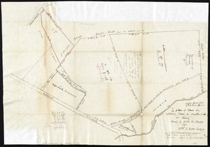
Plan of lands on the Back Bay belonging to the Boston Water Power Co., the Commonwealth and other parthies [i.e. parties],...
9568.
Plan of lands on the Back Bay, belonging to the Boston Water Power Co., the Commonwealth, and other parties, showing the system...
9569.
A plan of lands on Wilcocks, Shaws or Baxters Hill in Quincy owned by John M. Forbes 1846
9570.
Plan of lands owned by The Aspinwall Land Company in Brookline : July 1886
9571.
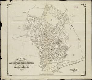
Plan of lands situated at Arlington Heights, Mass : owned by the Arlington Land Co
9572.
Plan of Lanesborough, made by William Douglas, dated November 1794.
9573.
Plan of Lanesborough, surveyor's name not given, dated November 1830
9574.
Plan of Lebanon (Towwoh) made by Daniel Wood, dated March 7, 1795.
9575.
Plan of Lee made by Daniel Wilcox, dated 1795.
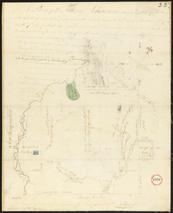
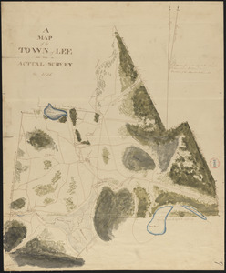
9576.
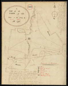
Plan of Lee, surveyor's name not given, dated October 1830
9577.
Plan of Leicester, made by Peter Silvester, Jr. dated May 23, 1795.
9578.
Plan of Leicester, surveyor's name not given, dated 1831
9579.
Plan of Lenox, made by Eldad Lewis, dated November 1794.
9580.
Plan of Lenox made by Solomon Cole, dated May 1831
‹ Prev
Next ›
1
2
…
475
476
477
478
479
480
481
482
483
…
701
702


![Plan of lands on the Back Bay belonging to the Boston Water Power Co., the Commonwealth and other parthies [i.e. parties], showing the system of streets, grades and sewers as laid out and recommended by the Back Bay Commissioners](https://bpldcassets.blob.core.windows.net/derivatives/images/commonwealth:1257bb305/image_thumbnail_300.jpg)