Toggle navigation
LMEC Home
Exhibitions
Georeferencing
Tools for Teachers
Collections
My Favorites
Sign Up / Log In
Search
Search the map portal
Map Collection
Map Collection
Map Sets
Search
Search
Search for
Search In
All Fields
Creator
Title
Subject
Place
Search All Digital Collections
Advanced Search
13385 Results
Filter your Search
Place
North and Central America
10,111
United States
8,249
Massachusetts
2,691
Suffolk (county)
1,664
Boston
1,621
Europe
1,386
Canada
949
New York
640
more
Place
»
Topic
Boston (Mass.)--Maps
741
City planning--Massachusetts--Boston--Maps
418
United States--History--Revolution, 1775-1783--Maps
329
United States--Maps
315
Urban renewal--Massachusetts--Boston--Maps
254
Real property--Massachusetts--Boston--Maps
252
Massachusetts--Maps
219
Insurance surveys
197
more
Topic
»
Date
Date range begin
–
Date range end
Current results range from
1482
to
2023
View distribution
Creator
United States. Hydrographic Office
595
Boston Redevelopment Authority
403
Des Barres, Joseph F. W. (Joseph Frederick Wallet), 1722-1824
247
Royal United Services Institute for Defence and Security Studies
160
Jefferys, Thomas, -1771
154
George, III, King of Great Britain, 1738-1820
152
George, IV, King of Great Britain, 1762-1830
151
O.H. Bailey & Co
148
more
Creator
»
Format
Maps/Atlases
13,205
Manuscripts
985
Prints
102
Books
49
Drawings/Illustrations
44
Photographs
15
Objects/Artifacts
13
Documents
7
more
Format
»
Georeferenced
Yes
979
No
12,406
Collection
Norman B. Leventhal Map & Education Center Collection
8,891
American Revolutionary War-Era Maps
3,305
Boston and New England Maps
2,804
Urban Maps
2,397
Maritime Charts and Atlases
1,150
William L. Clements Library Collection
910
Library of Congress Collection
618
Boston Redevelopment Authority Collection
475
more
Collection
»
Available to use
No known restrictions
9,952
Creative Commons license
1,677
Search Constraints
Sort by relevance
relevance
title
date (asc)
date (desc)
Number of results to display per page
20 per page
10
per page
20
per page
50
per page
100
per page
View results as:
grid view
map view
Search Results
9421.
Plan of real estate belonging to T.W. & J.H. Cox : situated in ward 16, Boston
9422.
Plan of real estate in Charlestown belonging to Seth Barker & others : to be sold on the premises at public auction, June 26th,...
9423.
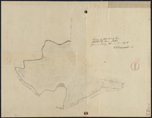
[Plan of real estate in Charlestown, showing park laid out]
9424.
Plan of real estate on Cambridge Street near Bowdoin Square, belonging to the heirs of the late Deacon Moses : to be sold by...
9425.
[Plan of real estate on Pearl Street, Boston]
9426.
Plan of region west of Back Bay Park, Boston, Mass. : proposed improvements
9427.
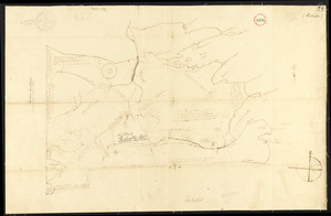
Plan of Rehoboth, surveyor's name not given, dated 1794-5.
9428.
Plan of Rehoboth, surveyor's name not given, dated 1830
9429.
[Plan of residences on Park Street in Boston]
9430.
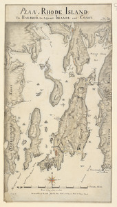
PLAN of RHODE ISLAND, the HARBOUR, the Adjacent ISLANDS, and COAST
9431.
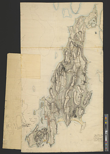
Plan of Rhode-Island
9432.
Plan of Richmond, surveyor's name not given, dated 1830
9433.
Plan of Richmond, surveyor's name not given, dated March 1, 1795.
9434.
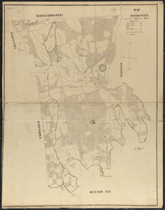
Plan of Rochester made by A. B. Hammond, dated 1830
9435.
Plan of Rochester, surveyor's name not given, dated 1794-5.
9436.
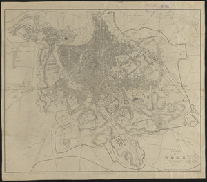
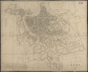
Plan of Rome
9437.
Plan of Rome
9438.
Plan of Rowe made by E. P. Farnsworth, dated June 1830
9439.
Plan of Rowe surveyed by Phineas Munn dated July 1793.
9440.
Plan of Rowe (Zoar) made by E. P. Farnsworth, dated 1839
‹ Prev
Next ›
1
2
…
468
469
470
471
472
473
474
475
476
…
669
670


![[Plan of real estate in Charlestown, showing park laid out]](https://bpldcassets.blob.core.windows.net/derivatives/images/commonwealth:1257bb01q/image_thumbnail_300.jpg)

![[Plan of real estate on Pearl Street, Boston]](https://bpldcassets.blob.core.windows.net/derivatives/images/commonwealth:9s161d705/image_thumbnail_300.jpg)

![[Plan of residences on Park Street in Boston]](https://bpldcassets.blob.core.windows.net/derivatives/images/commonwealth:9s161h36g/image_thumbnail_300.jpg)