Toggle navigation
LMEC Home
Exhibitions
Georeferencing
Tools for Teachers
Collections
My Favorites
Sign Up / Log In
Search
Search the map portal
Map Collection
Map Collection
Map Sets
Search
Search
Search for
Search In
All Fields
Creator
Title
Subject
Place
Search All Digital Collections
Advanced Search
13518 Results
My Search
Start Over
Date facet yearly ssim
1829
Remove constraint Date facet yearly ssim: <span class='single'>1829</span>
Filter your Search
Place
North and Central America
10,232
United States
8,367
Massachusetts
2,778
Suffolk (county)
1,675
Boston
1,631
Europe
1,386
Canada
949
New York
640
more
Place
»
Topic
Boston (Mass.)--Maps
746
City planning--Massachusetts--Boston--Maps
418
United States--History--Revolution, 1775-1783--Maps
329
United States--Maps
321
Real property--Massachusetts--Boston--Maps
254
Urban renewal--Massachusetts--Boston--Maps
254
Massachusetts--Maps
230
Insurance surveys
197
more
Topic
»
Date
Date range begin
–
Date range end
Current results range from
1482
to
2023
View distribution
Creator
United States. Hydrographic Office
596
Boston Redevelopment Authority
404
Des Barres, Joseph F. W. (Joseph Frederick Wallet), 1722-1824
247
Royal United Services Institute for Defence and Security Studies
160
Jefferys, Thomas, -1771
154
George, III, King of Great Britain, 1738-1820
152
George, IV, King of Great Britain, 1762-1830
151
O.H. Bailey & Co
148
more
Creator
»
Format
Maps/Atlases
13,337
Manuscripts
985
Prints
102
Books
49
Drawings/Illustrations
44
Photographs
15
Objects/Artifacts
13
Documents
7
more
Format
»
Georeferenced
Yes
979
No
12,539
Collection
Norman B. Leventhal Map & Education Center Collection
9,022
American Revolutionary War-Era Maps
3,305
Boston and New England Maps
2,900
Urban Maps
2,425
Maritime Charts and Atlases
1,167
William L. Clements Library Collection
910
Library of Congress Collection
618
Boston Redevelopment Authority Collection
475
more
Collection
»
Available to use
No known restrictions
10,085
Creative Commons license
1,677
Search Constraints
Sort by relevance
relevance
title
date (asc)
date (desc)
Number of results to display per page
20 per page
10
per page
20
per page
50
per page
100
per page
View results as:
grid view
map view
Search Results
8721.
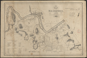
Plan of Bradford made by Benjamin Greenleaf and Jeremiah Spofford, dated 1831
8722.
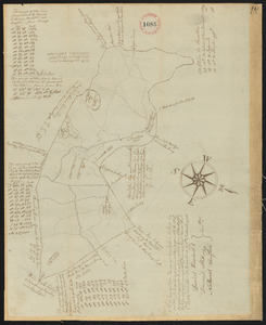
Plan of Bradford, surveyor's name not given, dated December 2, 1794.
8723.
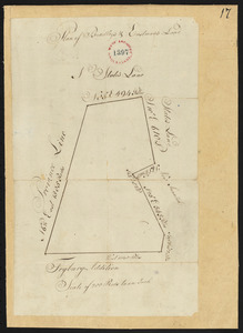
Plan of Bradley's and Eastman's Land (Stow, Me) surveyor's name not given, dated 1794-1795.
8724.
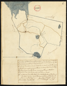
Plan of Braintree made by Jonathan Thayer, dated May 25, 1795.
8725.
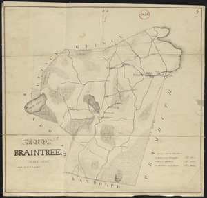
Plan of Braintree, surveyor's name not given, dated 1831
8726.
Plan of Bridgeton surveyed by Benjamin Kimball, Jr, dated May 21, 1795.
8727.
Plan of Bridgewater, surveyor's name not given, dated 1794.
8728.
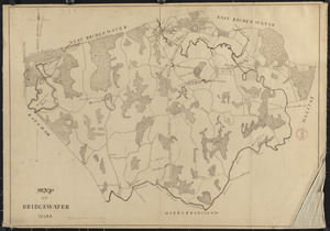
Plan of Bridgewater, surveyor's name not given, dated 1830
8729.
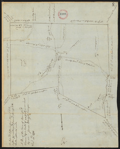
Plan of Briggs Place, in Newton
8730.
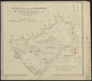
Plan of Brighton made by John G. Hales, dated April 1830
8731.
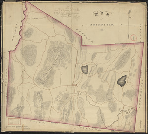
Plan of Brimfield, made by Jonas Blodgett, dated December 22, 1794.
8732.
Plan of Brimfield, surveyor's name not given, dated 1831
8733.
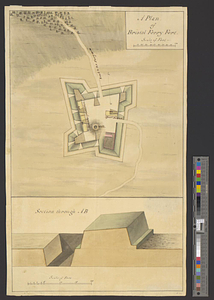
A plan of Bristol Ferry fort
8734.
Plan of Bristol (Pemaquid) surveyed by Thomas Boyd, dated June 20, 1795.
8735.
Plan of Brockton (North Bridgewater) made by Jesse Perkins, dated 1830
8736.
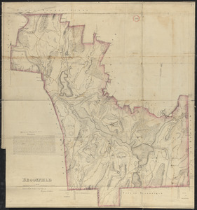
Plan of Brookfield made by Herman Stebbins dated 1830
8737.
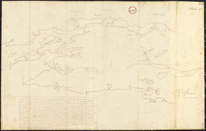
Plan of Brookfield surveyed by Thomas Hale Jr., dated November, 1794.
8738.
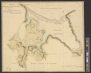
A plan of Brookhaven or Setalket Harbour with its environs
8739.
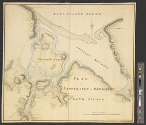
Plan of Brookhaven, or Setalket on Long Island
8740.
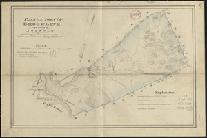
Plan of Brookline made by John G. Hales, dated August 1830
‹ Prev
Next ›
1
2
…
433
434
435
436
437
438
439
440
441
…
675
676