Toggle navigation
LMEC Home
Exhibitions
Georeferencing
Tools for Teachers
Collections
My Favorites
Sign Up / Log In
Search
Search the map portal
Map Collection
Map Collection
Map Sets
Search
Search
Search for
Search In
All Fields
Creator
Title
Subject
Place
Search All Digital Collections
Advanced Search
13518 Results
My Search
Start Over
Date facet yearly ssim
1829
Remove constraint Date facet yearly ssim: <span class='single'>1829</span>
Filter your Search
Place
North and Central America
10,232
United States
8,367
Massachusetts
2,778
Suffolk (county)
1,675
Boston
1,631
Europe
1,386
Canada
949
New York
640
more
Place
»
Topic
Boston (Mass.)--Maps
746
City planning--Massachusetts--Boston--Maps
418
United States--History--Revolution, 1775-1783--Maps
329
United States--Maps
321
Real property--Massachusetts--Boston--Maps
254
Urban renewal--Massachusetts--Boston--Maps
254
Massachusetts--Maps
230
Insurance surveys
197
more
Topic
»
Date
Date range begin
–
Date range end
Current results range from
1482
to
2023
View distribution
Creator
United States. Hydrographic Office
596
Boston Redevelopment Authority
404
Des Barres, Joseph F. W. (Joseph Frederick Wallet), 1722-1824
247
Royal United Services Institute for Defence and Security Studies
160
Jefferys, Thomas, -1771
154
George, III, King of Great Britain, 1738-1820
152
George, IV, King of Great Britain, 1762-1830
151
O.H. Bailey & Co
148
more
Creator
»
Format
Maps/Atlases
13,337
Manuscripts
985
Prints
102
Books
49
Drawings/Illustrations
44
Photographs
15
Objects/Artifacts
13
Documents
7
more
Format
»
Georeferenced
Yes
979
No
12,539
Collection
Norman B. Leventhal Map & Education Center Collection
9,022
American Revolutionary War-Era Maps
3,305
Boston and New England Maps
2,900
Urban Maps
2,425
Maritime Charts and Atlases
1,167
William L. Clements Library Collection
910
Library of Congress Collection
618
Boston Redevelopment Authority Collection
475
more
Collection
»
Available to use
No known restrictions
10,085
Creative Commons license
1,677
Search Constraints
Sort by relevance
relevance
title
date (asc)
date (desc)
Number of results to display per page
20 per page
10
per page
20
per page
50
per page
100
per page
View results as:
grid view
map view
Search Results
8541.
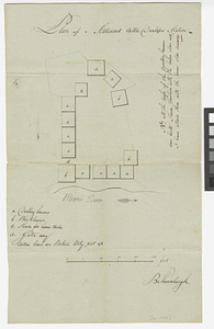
Plan of a settlement call'd Dunlaps Station
8542.
A plan of a survey made to explore the country for a road between Connecticut River & St. Francis
8543.
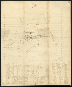
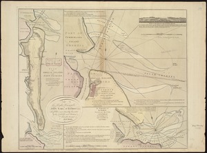
A plan of a survey of Noddles Island
8544.
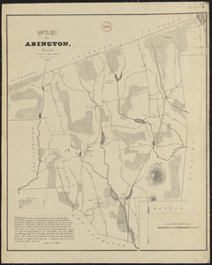
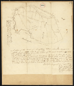
Plan of Abington, made by Daniel Shaw, dated 1795.
8545.
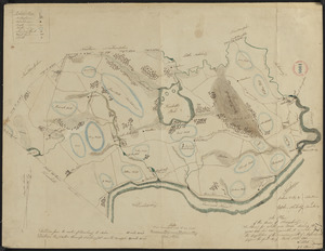
Plan of Abington made by James Bates, dated 1830
8546.
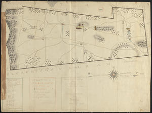
Plan of Acton, made by Jabez Brown, dated November, 1794.
8547.
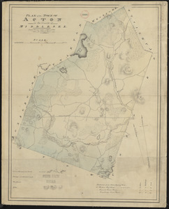
Plan of Acton made by John G. Hales, dated 1831
8548.
Plan of Adams made by Thomas A. Brayton, dated June, 1831
8549.
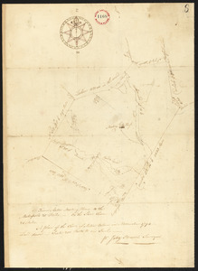
Plan of Adams surveyed by Israel Jones, dated November 1794.
8550.
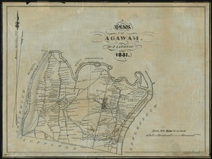
A plan of Agawam
8551.
A Plan of Albany, as it was in the year 1758
8552.
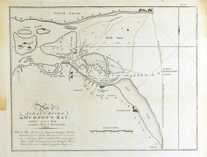
A plan of Albany River in Hudson's Bay : latitude 50⁰ 12' 0" North, longitude 82⁰ 40' 0" W. from London
8553.
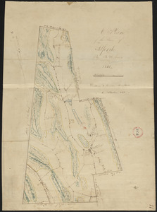
Plan of Alford made by B. H. Lewis, dated 1831
8554.
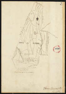
Plan of Alford surveyed by David Fairchild, dated October, 1794.
8555.
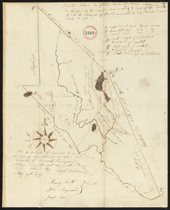
Plan of Alfred surveyed by Michel Bowden dated May 29, 1795.
8556.
Plan of Amelia Island in East Florida : A chart of the entrance into St. Mary's River taken by Captn. W. Fuller in November,...
8557.
Plan of Amesbury, made by Christopher Sergent, dated November, 1794.
8558.
Plan of Amesbury made by W. Nichols and J. S. Morse, dated 1831
8559.
Plan of Amherst made by E. S. Darling dated August 1830
8560.
Plan of an estate belonging to the City of Boston to be sold by public auction on Wednesday, Sept. 14th, 1881 ... : per order...
‹ Prev
Next ›
1
2
…
424
425
426
427
428
429
430
431
432
…
675
676