Toggle navigation
LMEC Home
Exhibitions
Georeferencing
Tools for Teachers
Collections
My Favorites
Sign Up / Log In
Search
Search the map portal
Map Collection
Map Collection
Map Sets
Search
Search
Search for
Search In
All Fields
Creator
Title
Subject
Place
Search All Digital Collections
Advanced Search
13385 Results
Filter your Search
Place
North and Central America
9,353
United States
7,286
Suffolk (county)
1,664
Boston
1,621
Europe
1,035
Canada
949
Massachusetts
875
New York
534
more
Place
»
Topic
Boston (Mass.)--Maps
741
City planning--Massachusetts--Boston--Maps
418
United States--History--Revolution, 1775-1783--Maps
329
United States--Maps
315
Urban renewal--Massachusetts--Boston--Maps
254
Real property--Massachusetts--Boston--Maps
252
Massachusetts--Maps
219
Insurance surveys
197
more
Topic
»
Date
Date range begin
–
Date range end
Current results range from
1482
to
2023
View distribution
Creator
United States. Hydrographic Office
595
Boston Redevelopment Authority
403
Des Barres, Joseph F. W. (Joseph Frederick Wallet), 1722-1824
247
Royal United Services Institute for Defence and Security Studies
160
Jefferys, Thomas, -1771
154
George, III, King of Great Britain, 1738-1820
152
George, IV, King of Great Britain, 1762-1830
151
O.H. Bailey & Co
148
more
Creator
»
Format
Maps/Atlases
13,205
Manuscripts
985
Prints
102
Books
49
Drawings/Illustrations
44
Photographs
15
Objects/Artifacts
13
Documents
7
more
Format
»
Georeferenced
Yes
979
No
12,406
Collection
Norman B. Leventhal Map Center Collection
8,891
American Revolutionary War-Era Maps
3,305
Boston and New England Maps
2,804
Urban Maps
2,397
Maritime Charts and Atlases
1,150
William L. Clements Library Collection
910
Library of Congress Collection
618
Boston Redevelopment Authority Collection
475
more
Collection
»
Available to use
No known restrictions
9,952
Creative Commons license
1,677
Search Constraints
Sort by date (desc)
relevance
title
date (asc)
date (desc)
Number of results to display per page
20 per page
10
per page
20
per page
50
per page
100
per page
View results as:
grid view
map view
Search Results
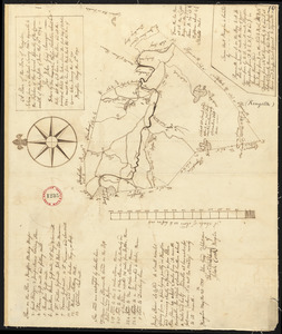
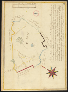
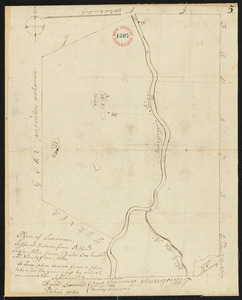
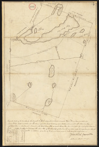
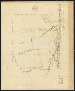
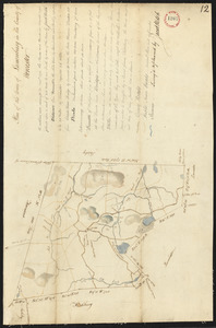
8501.
Plan of Kingston surveyed by John Gray, dated May 6, 1795.
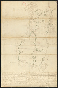
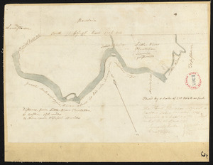
8502.
Plan of Lancaster surveyed by Matthias Mossman and Caleb Wilder, Jr., dated May 29, 1795.
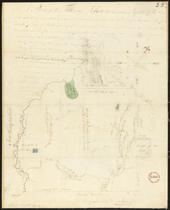
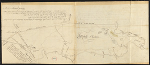
8503.
Plan of Lebanon (Towwoh) made by Daniel Wood, dated March 7, 1795.
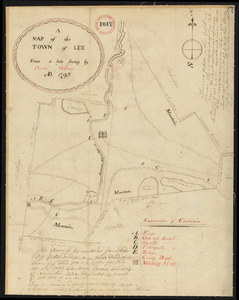
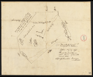
8504.
Plan of Lee made by Daniel Wilcox, dated 1795.
8505.
Plan of Leicester, made by Peter Silvester, Jr. dated May 23, 1795.
8506.
Plan of Lewiston, surveyor's name not given, dated November 1795.
8507.
Plan of Limerick, made by John Wingate, dated March 11, 1795.
8508.
Plan of Limington, surveyor's name not given, dated May 10, 1795.
8509.
Plan of Lincoln surveyed by Samuel Hoar, dated May, 1795.
8510.
Plan of Lisbon (Little River Plantation), surveyor's name not given, dated December 1795.
8511.
Plan of Little Falls (Hollis) surveyed by Daniel Grainger, dated 1795.
8512.
Plan of Littleton, made by William Prentice, dated May 27, 1795.
8513.
Plan of Livermore (Port Royal) surveyed by Sylvanus Boardman, dated 1795.
8514.
Plan of Lovell and Sweden (New Suncook), made by Nathaniel Merrill, dated December 1795.
8515.
Plan of Ludlow surveyed by Isreal Chapin, dated May 20, 1795.
8516.
Plan of Lunenburg, made by Jacob Welch, dated March 1795.
8517.
Plan of Lyman (Coxhall), made by Robert Swainson, dated May 20, 1795.
8518.
Plan of Lynn surveyed by Daniel Needham, dated April 1795.
8519.
Plan of Machias, ME, made by William Chaloner, dated December 1795.
8520.
Plan of Malden made by Peter Tufts, Jr., dated 1795.
‹ Prev
Next ›
1
2
…
422
423
424
425
426
427
428
429
430
…
669
670