Toggle navigation
LMEC Home
Exhibitions
Georeferencing
Tools for Teachers
Collections
My Favorites
Sign Up / Log In
Search
Search the map portal
Map Collection
Map Collection
Map Sets
Search
Search
Search for
Search In
All Fields
Creator
Title
Subject
Place
Search All Digital Collections
Advanced Search
14164 Results
Filter your Search
Place
North and Central America
10,811
United States
8,818
Massachusetts
2,820
Suffolk (county)
1,688
Boston
1,644
Europe
1,428
Canada
1,010
New York
683
more
Place
»
Topic
Boston (Mass.)--Maps
753
City planning--Massachusetts--Boston--Maps
419
United States--History--Revolution, 1775-1783--Maps
331
United States--Maps
331
Real property--Massachusetts--Boston--Maps
254
Urban renewal--Massachusetts--Boston--Maps
254
North America--Maps--Early works to 1800
241
Massachusetts--Maps
236
more
Topic
»
Date
Date range begin
–
Date range end
Current results range from
1482
to
2023
View distribution
Creator
United States. Hydrographic Office
597
Boston Redevelopment Authority
404
Des Barres, Joseph F. W. (Joseph Frederick Wallet), 1722-1824
247
Jefferys, Thomas, -1771
172
United States. National Ocean Service
170
Royal United Services Institute for Defence and Security Studies
160
George, III, King of Great Britain, 1738-1820
152
George, IV, King of Great Britain, 1762-1830
151
more
Creator
»
Format
Maps/Atlases
13,978
Manuscripts
985
Prints
102
Books
53
Drawings/Illustrations
44
Photographs
15
Objects/Artifacts
13
Documents
7
more
Format
»
Georeferenced
Yes
979
No
13,185
Collection
Norman B. Leventhal Map & Education Center Collection
9,162
American Revolutionary War-Era Maps
3,629
Boston and New England Maps
2,936
Urban Maps
2,511
Maritime Charts and Atlases
1,169
William L. Clements Library Collection
910
Library of Congress Collection
618
Boston Redevelopment Authority Collection
475
more
Collection
»
Available to use
No known restrictions
10,408
Creative Commons license
1,678
Search Constraints
Sort by relevance
relevance
title
date (asc)
date (desc)
Number of results to display per page
20 per page
10
per page
20
per page
50
per page
100
per page
View results as:
grid view
map view
Search Results
8241.
Ohio boundary no. 2 : map exhibiting the positions occupied on the Maumee Bay and river: viz: Turtle Island, the North Cape,...
8242.
Oil and gas fields of Pennsylvania
8243.
Oil and gas fields of the state of California
8244.
Oil and gas fields of the state of Illinois
8245.
Oil and gas fields of the state of Kansas
8246.
Oil and gas fields of the state of Kentucky
8247.
Oil and gas fields of the state of Louisiana
8248.
Oil and gas fields of the state of Oklahoma
8249.
Oil and gas fields of the state of Texas
8250.
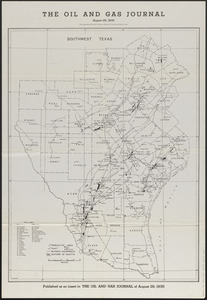
The oil and gas journal, August 29, 1935
8251.
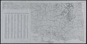
Oil and gas producing areas in Oklahoma
8252.
Oil City oil field, Fresno Co., California
8253.
Oil in America : a pictorial story of the petroleum industry in the United States
8254.
Old Boston, compiled from the Book of possessions
8255.
Old Colony & Newport railway and its connections
8256.
Old Colony Railroad and connections
8257.
Old Colony Silk Mills Corporation "Potter Street Plant," (Silk Throwing), New Bedford, Mass. [insurance map]
8258.
Old Colony Storage & Warehouse Co., Inc., Fall River, Mass. [insurance map]
8259.
Old map of Brooklyn and greater part of King's County, Long Island
8260.
Ye olde towne of Rumford : (Concord, N.H.)
‹ Prev
Next ›
1
2
…
409
410
411
412
413
414
415
416
417
…
708
709


![Old Colony Silk Mills Corporation "Potter Street Plant," (Silk Throwing), New Bedford, Mass. [insurance map]](https://bpldcassets.blob.core.windows.net/derivatives/images/commonwealth:ww72bz82p/image_thumbnail_300.jpg)
![Old Colony Storage & Warehouse Co., Inc., Fall River, Mass. [insurance map]](https://bpldcassets.blob.core.windows.net/derivatives/images/commonwealth:ww72bx442/image_thumbnail_300.jpg)