Toggle navigation
LMEC Home
Exhibitions
Georeferencing
Tools for Teachers
Collections
My Favorites
Sign Up / Log In
Search
Search the map portal
Map Collection
Map Collection
Map Sets
Search
Search
Search for
Search In
All Fields
Creator
Title
Subject
Place
Search All Digital Collections
Advanced Search
74 Results
My Search
Start Over
Date
1920
Remove constraint Date: <span class='single'>1920</span>
Filter your Search
Place
North and Central America
57
United States
51
Massachusetts
13
Europe
8
Canada
7
Boston
6
Essex (county)
6
Hampden (county)
6
more
Place
»
Topic
Fire risk assessment
9
Insurance surveys
9
Cotton manufacture
6
Textile factories
6
Longmeadow (Mass.)--Maps
5
Real property--Massachusetts--Longmeadow--Maps
5
Real property--Massachusetts--Springfield--Maps
5
Springfield (Mass.)--Maps
5
more
Topic
»
Date
1920
[remove]
74
Date range begin
–
Date range end
Current results range from
1770
to
1999
1920
to
1920
74
Creator
Associated Mutual Insurance Companies
8
Richards Map Company
5
Price & Lee Co.
4
Congdon, Herbert Wheaton, 1876-1965
3
Green Mountain Club
3
C.S. Hammond & Company
2
F. E. Gallup Map Co
2
Halsey, Edmund R.
2
more
Creator
»
Format
Maps/Atlases
73
Photographs
1
Georeferenced
Yes
7
No
67
Collection
Norman B. Leventhal Map & Education Center Collection
61
American Textile History Museum Image Collection
9
Boston and New England Maps
2
Massachusetts Real Estate Atlases
2
Urban Maps
2
American Revolutionary War-Era Maps
1
Robert E. Diefenbach Map Collection at Phillips Academy
1
Sidney R. Knafel Map Collection at Phillips Academy
1
Available to use
No known restrictions
61
Creative Commons license
1
Search Constraints
Sort by relevance
relevance
title
date (asc)
date (desc)
Number of results to display per page
20 per page
10
per page
20
per page
50
per page
100
per page
View results as:
grid view
map view
Search Results
61.
Public reservations on the banks of the Charles River between Watertown and Cragies Bridge
62.
Rand McNally official 1920 auto trails map : District number 6 : New England, eastern New York
63.
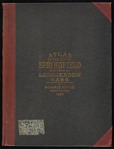
Richards Standard atlas of the city of Springfield and the town of Longmeadow, Massachusetts
64.
Richards standard atlas of the city of Springfield and the town of Longmeadow, Massachusetts
65.
Richards standard atlas of the city of Springfield and the town of Longmeadow, Massachusetts [plate 1]
66.
Richards standard atlas of the city of Springfield and the town of Longmeadow, Massachusetts [plate 10]
67.
Richards standard atlas of the city of Springfield and the town of Longmeadow, Massachusetts [plate 9]
68.
A small map of the sea coast of New England together with the outlines of several of the provinces lying thereon, 1738
69.
The south part of New-England, as it is planted this yeare, 1635
70.
St. Croix Paper Co., Woodland, Me. [insurance map]
71.
Street index map of Oakland, Albany, Berkeley, Emeryville, Piedmont, Alameda, San Leandro, Alameda Co., California
72.
To his excellency William Shirley Esqr., Captain General and Commander in Chief, in and over his Majesty's province of the...
73.
Town of Nahant
74.
Wamsutta Mills (Cotton Mill), New Bedford, Mass. [insurance map]
‹ Prev
Next ›
1
2
3
4


![Richards standard atlas of the city of Springfield and the town of Longmeadow, Massachusetts [plate 1]](https://bpldcassets.blob.core.windows.net/derivatives/images/commonwealth:3f463814r/image_thumbnail_300.jpg)
![Richards standard atlas of the city of Springfield and the town of Longmeadow, Massachusetts [plate 10]](https://bpldcassets.blob.core.windows.net/derivatives/images/commonwealth:3f463818v/image_thumbnail_300.jpg)
![Richards standard atlas of the city of Springfield and the town of Longmeadow, Massachusetts [plate 9]](https://bpldcassets.blob.core.windows.net/derivatives/images/commonwealth:3f4638169/image_thumbnail_300.jpg)


![St. Croix Paper Co., Woodland, Me. [insurance map]](https://bpldcassets.blob.core.windows.net/derivatives/images/commonwealth:4j03df479/image_thumbnail_300.jpg)


![Wamsutta Mills (Cotton Mill), New Bedford, Mass. [insurance map]](https://bpldcassets.blob.core.windows.net/derivatives/images/commonwealth:ww72bz961/image_thumbnail_300.jpg)