Toggle navigation
LMEC Home
Exhibitions
Georeferencing
Tools for Teachers
Collections
My Favorites
Sign Up / Log In
Search
Search the map portal
Map Collection
Map Collection
Map Sets
Search
Search
Search for
Search In
All Fields
Creator
Title
Subject
Place
Search All Digital Collections
Advanced Search
52 Results
My Search
Start Over
Date
1737
Remove constraint Date: <span class='single'>1737</span>
Filter your Search
Place
North and Central America
34
United States
14
Canada
6
New England
4
New York
4
Newfoundland and Labrador
4
North America
4
Atlantic Ocean
3
more
Place
»
Topic
World maps--Early works to 1800
3
Atlantic Coast (New England)--Maps--Early works to 1800
2
Coasts--New England--Maps--Early works to 1800
2
Jamaica--Maps--Early works to 1800
2
Maryland--Maps--Early works to 1800
2
Nautical charts--Atlantic Coast (North America)--Early works to 1800
2
Nautical charts--Atlantic Ocean--Early works to 1800
2
Nautical charts--New England--Early works to 1800
2
more
Topic
»
Date
1737
[remove]
52
Date range begin
–
Date range end
Current results range from
1699
to
1800
1737
to
1737
52
Creator
Nolin, Jean Baptiste, 1686-1762
3
Southack, Cyprian, 1662-1745
3
Thornton, John, 1641-1708
3
Burghers, M.
2
Moll, Herman, -1732
2
Tiddeman, Mark.
2
Amherst, Jeffery Amherst, Baron, 1717-1797
1
Chatelain, Henri Abraham.
1
more
Creator
»
Format
Maps/Atlases
52
Manuscripts
2
Georeferenced
Yes
3
No
49
Collection
Norman B. Leventhal Map & Education Center Collection
39
Maritime Charts and Atlases
26
American Revolutionary War-Era Maps
9
William L. Clements Library Collection
7
Boston and New England Maps
3
British Library Collection
2
MacLean Collection Map Library
2
Mapping Boston Collection
2
more
Collection
»
Available to use
No known restrictions
38
Creative Commons license
5
Search Constraints
Sort by relevance
relevance
title
date (asc)
date (desc)
Number of results to display per page
20 per page
10
per page
20
per page
50
per page
100
per page
View results as:
grid view
map view
Search Results
21.
Galliae Christianae Aquitanica quarta : Provincia ecclesiastica albiensis continens dioceses Albiensem, Castrensem, Mimatensem,...
22.
A generall chart of the western ocean
23.
The Gulf coast from the Mississippi Delta to the Bay of St. Joseph
24.
Harbor Grace
25.
In notitiam ecclesiasticam Africæ tabula geographica
26.
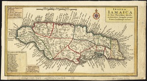
Insula Iamaica : in suas parochias divisa et secundum exemplar primitivum Londinense excusa
27.
The island of Jamaica
28.
[Island of St. Peters]
29.
A large draft of the island Antegua
30.
A map of lot no 1 in the Hardenbergh Patent
31.
A map of lot no 4 in the [Ha]rdenbergh Patent
32.
A map of part of the Isthmus of Darien : shewing the communication with Panama, from Portobello & Chagre both by land, and by...
33.
A map of the coast of New England, from Staten Island to the island of Breton
34.
Mappmonde ou description generale du globe terrestre
35.
A new and correct draught of the bay of Matanzas : on ye north side of ye island of Cuba ; done from a survey in the year 1729...
36.
A new and correct map of the world, laid down according to the newest discoveries, and from the most exact observations
37.
A new chart of the Bahama Islands and the Windward Passage
38.
A new generall chart for the West Indies of E. Wrights projection vul. Mercators chart
39.
A new map of North America shewing its principal divisions, chief cities, townes, rivers, mountains &c
40.
A new map of the terraqueous globe according to the latest discoveries and most general divisions of it into continents and oceans
‹ Prev
Next ›
1
2
3


![[Island of St. Peters]](https://bpldcassets.blob.core.windows.net/derivatives/images/commonwealth:cj82m507n/image_thumbnail_300.jpg)


![A map of lot no 4 in the [Ha]rdenbergh Patent](https://bpldcassets.blob.core.windows.net/derivatives/metadata/commonwealth-oai:zs262628v/image_thumbnail_300.jpg)