Toggle navigation
LMEC Home
Exhibitions
Georeferencing
Tools for Teachers
Collections
My Favorites
Sign Up / Log In
Search
Search the map portal
Map Collection
Map Collection
Map Sets
Search
Search
Search for
Search In
All Fields
Creator
Title
Subject
Place
Search All Digital Collections
Advanced Search
44 Results
My Search
Start Over
Date
1725
to
1729
Remove constraint Date: <span class='from'>1725</span> to <span class='to'>1729</span>
Filter your Search
Place
North and Central America
25
United States
11
Europe
6
Massachusetts
6
New Hampshire
4
New York
4
North America
4
World
4
more
Place
»
Topic
World maps--Early works to 1800
4
Boundary disputes--Maps, Manuscript--Early works to 1800
3
Massachusetts--Maps, Manuscript--Early works to 1800
3
Merrimack River (N.H. and Mass.)--Maps, Manuscript--Early works to 1800
3
New Hampshire--Maps, Manuscript--Early works to 1800
3
Western Hemisphere--Maps--Early works to 1800
3
America--Maps--Early works to 1800
2
Manuscript maps--Early works to 1800
2
more
Topic
»
Date
1725
to
1729
[remove]
44
Date range begin
–
Date range end
Current results range from
1699
to
1800
1725
to
1725
29
1726
to
1726
24
1727
to
1727
31
1728
to
1728
28
1729
to
1729
29
Creator
Moll, Herman, d. 1732
4
Aa, Pieter van der, 1659-1733
3
Burghers, M.
2
Keulen, Gerard van.
2
L'Isle, Guillaume de, 1675-1726
2
Nolin, Jean Baptiste, 1686-1762
2
Amherst, Jeffery Amherst, Baron, 1717-1797
1
Bonner, John, ca. 1643-1726
1
more
Creator
»
Format
Maps/Atlases
43
Manuscripts
4
Georeferenced
Yes
2
No
42
Collection
Norman B. Leventhal Map & Education Center Collection
29
American Revolutionary War-Era Maps
9
William L. Clements Library Collection
7
Boston and New England Maps
6
British Library Collection
5
Mapping Boston Collection
2
Maritime Charts and Atlases
2
Urban Maps
2
more
Collection
»
Available to use
No known restrictions
27
Creative Commons license
8
Search Constraints
Sort by relevance
relevance
title
date (asc)
date (desc)
Number of results to display per page
20 per page
10
per page
20
per page
50
per page
100
per page
View results as:
grid view
map view
Search Results
21.
A new map of North America shewing its principal divisions, chief cities, townes, rivers, mountains &c
22.
A new map of the terraqueous globe according to the latest discoveries and most general divisions of it into continents and oceans
23.
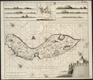
Nieuwe Afteekening van het Eyland Curacao vertoonende alle desselfs geleegentheeden mitsgaders de haven van St. Anna en't Fort...
24.
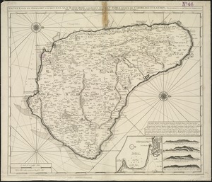
Nieuwe land en zeekaart van het eyland Barbados geleegen in West India onder de Caribesse Eylanden : afgeteekent na de nieuste...
25.
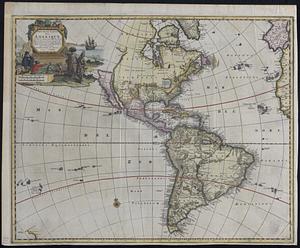
Nouvelle carte de l'Amerique : avec tous ses royaumes, etats, iles, ports, bayes et rivieres, dressée suivant les plus...
26.
Nouvelle Hollande (à présent Nouvelle-York), Nouvelle-Angleterre, et une partie de la Virginie
27.
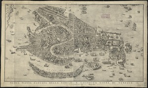
Nuoua pianta eleuata della nobile e cospicua citta di Venezia
28.
Part of modern Orange County
29.
Plan du fort de Chouéghen de la Riviere Et de terrain aux Environs au Sud du Lac Ontario
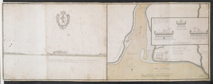
30.
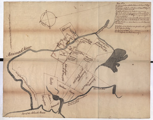
Plan No: 1 : [Eastern New Hampshire and Massachusetts]
31.
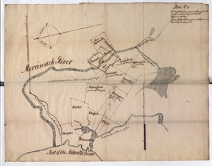
Plan No: 2 : [Eastern New Hampshire and Massachusetts]
32.
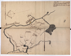
Plan No: 2 : [Eastern New Hampshire and Massachusetts]
33.
River valley with several foothills and swamp
34.
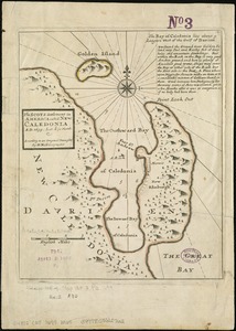
The Scots settlement in America called New Caledonia, A.D. 1699
35.
The seat of war on the Rhine being a new map of the course of that river from Basil to Bonn with the adjacent countries
36.
Shinsen zouho Kyo oezu
37.
Steden Wyser synde een perfecte en klare aenwysinge ... Leggen = L'echelle des villes montrant la distance ... l'autre
38.
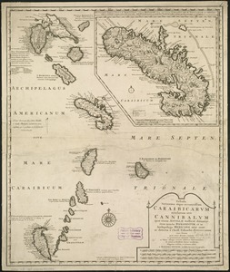
Tabula novissima atque accuratissima Caraibicarum insularum sive Cannibalum : quae etiam Antillae Gallicae dicuntur, item...
39.
Totius Americae descriptio nova
40.
The town of Boston in New England
‹ Prev
Next ›
1
2
3