Toggle navigation
LMEC Home
Exhibitions
Georeferencing
Tools for Teachers
Collections
My Favorites
Sign Up / Log In
Search
Search the map portal
Map Collection
Map Collection
Map Sets
Search
Search
Search for
Search In
All Fields
Creator
Title
Subject
Place
Search All Digital Collections
Advanced Search
21 Results
My Search
Start Over
"G1015 .C67 1697x"
Remove constraint "G1015 .C67 1697x"
Filter your Search
Place
North and Central America
9
Europe
3
South America
3
Africa
2
Asia
2
Canada
2
Cuba
2
Mesoamerica
2
more
Place
»
Topic
Planispheres--Maps--Early works to 1800
3
Stars--Maps--Early works to 1800
3
Astronomy, Ancient--Early works to 1800
2
Cuba--Maps--Early works to 1800
2
Eastern Hemisphere--Maps--Early works to 1800
2
Amazon River Valley--Maps--Early works to 1800
1
Arctic regions--Maps--Early works to 1800
1
Astronomy--Charts, diagrams, etc--Early works to 1800
1
more
Topic
»
Date
Date range begin
–
Date range end
Current results range from
1691
to
1697
View distribution
Creator
Coronelli, Vincenzo, 1650-1718
21
Format
Maps/Atlases
21
Georeferenced
Yes
2
No
19
Collection
Norman B. Leventhal Map & Education Center Collection
21
Maritime Charts and Atlases
3
Available to use
No known restrictions
21
Search Constraints
Sort by relevance
relevance
title
date (asc)
date (desc)
Number of results to display per page
20 per page
10
per page
20
per page
50
per page
100
per page
View results as:
grid view
map view
Search Results
21.
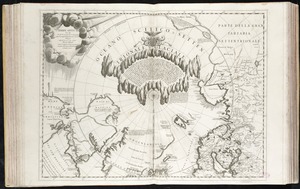
Terre Artiche
‹ Prev
Next ›
1
2