Toggle navigation
LMEC Home
Exhibitions
Georeferencing
Tools for Teachers
Collections
My Favorites
Sign Up / Log In
Search
Search the map portal
Map Collection
Map Collection
Map Sets
Search
Search
Search for
Search In
All Fields
Creator
Title
Subject
Place
Search All Digital Collections
Advanced Search
241 Results
My Search
Start Over
1870
Remove constraint 1870
Filter your Search
Place
North and Central America
134
United States
119
Europe
85
Massachusetts
60
Boston
39
Germany
39
Suffolk (county)
39
France
34
more
Place
»
Topic
Franco-Prussian War, 1870-1871--Maps
33
Germany--Maps
25
Boston (Mass.)--Maps
21
Europe--Maps
17
France--Maps
17
Real property--Massachusetts--Boston--Maps
11
Land tenure--Massachusetts--Boston--Maps
8
Franco-Prussian War, 1870-1871--Aerial views
7
more
Topic
»
Date
Date range begin
–
Date range end
Current results range from
1783
to
1952
View distribution
Creator
Beers, F. W. (Frederick W.)
13
United States. Hydrographic Office
13
Hellfarth, C.
9
Justus Perthes (Firm : Gotha, Germany)
9
Petermann, A. (August), 1822-1878
8
Shurcliff, Arthur A. (Arthur Asahel), 1870-1957
8
G.W. Bacon & Co.
7
Anderson, Alexander, 1775-1870
6
more
Creator
»
Format
Maps/Atlases
237
Books
3
Manuscripts
3
Prints
2
Documents
1
Objects/Artifacts
1
Georeferenced
Yes
19
No
222
Collection
Norman B. Leventhal Map & Education Center Collection
226
Urban Maps
68
Boston and New England Maps
59
Maritime Charts and Atlases
21
American Revolutionary War-Era Maps
8
Maps from AAS
5
Mapping Boston Collection
4
Massachusetts Real Estate Atlases
3
more
Collection
»
Available to use
No known restrictions
223
Creative Commons license
5
Search Constraints
Sort by relevance
relevance
title
date (asc)
date (desc)
Number of results to display per page
20 per page
10
per page
20
per page
50
per page
100
per page
View results as:
grid view
map view
Search Results
241.
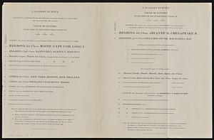
U.S. Coast Survey classification and rules for the miscellaneous lettering of names &c. on the map, not connected with title or...
‹ Prev
Next ›
1
2
…
9
10
11
12
13