Toggle navigation
LMEC Home
Exhibitions
Georeferencing
Tools for Teachers
Collections
My Favorites
Sign Up / Log In
Search
Search the map portal
Map Collection
Map Collection
Map Sets
Search
Search
Search for
Search In
All Fields
Creator
Title
Subject
Place
Search All Digital Collections
Advanced Search
95 Results
My Search
Start Over
Date
1901
Remove constraint Date: <span class='single'>1901</span>
Filter your Search
Place
North and Central America
72
United States
58
Massachusetts
18
Boston
12
Suffolk (county)
12
New York
9
Hawaii
8
Europe
7
more
Place
»
Topic
Boston (Mass.)--Maps
6
Havana (Cuba)--Maps
5
Gold mines and mining--Nova Scotia--Maps
4
Real property--Massachusetts--Boston--Maps
4
Roads--Cuba--Havana--Maps
4
Streets--Cuba--Havana--Maps
4
Geology--Nova Scotia--Halifax (County)--Maps
3
Halifax (N.S. : County)--Maps
3
more
Topic
»
Date
1901
[remove]
95
Date range begin
–
Date range end
Current results range from
1770
to
1999
1901
to
1901
95
Creator
United States. Congress (56th, 2nd session : 1900-1901). Senate
10
United States. Congress. Senate. Committee on Foreign Relations
10
United States. War Department
5
Alexander, W. D. (William De Witt), 1833-1913
4
Barden, W. J. (William Jones), 1870-
4
Geological Survey (U.S.)
4
Geological Survey of Canada
4
United States. Army. Corps of Engineers
4
more
Creator
»
Format
Maps/Atlases
91
Prints
2
Documents
1
Photographs
1
Georeferenced
Yes
10
No
85
Collection
Norman B. Leventhal Map & Education Center Collection
86
Urban Maps
9
Boston and New England Maps
5
Robert E. Diefenbach Map Collection at Phillips Academy
4
Massachusetts Real Estate Atlases
2
Ralph Finos Map Collection at Phillips Academy
2
American Revolutionary War-Era Maps
1
Sidney R. Knafel Map Collection at Phillips Academy
1
Available to use
No known restrictions
92
Search Constraints
Sort by relevance
relevance
title
date (asc)
date (desc)
Number of results to display per page
20 per page
10
per page
20
per page
50
per page
100
per page
View results as:
grid view
map view
Search Results
1.
Atlas of the city of Boston : East Boston
2.
Atlas of the city of Boston : Charlestown : from actual surveys and official plans
3.
Atlas of the city of Boston : East Boston : from actual surveys and official plans
4.
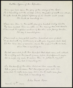
Battle hymn of the republic
5.
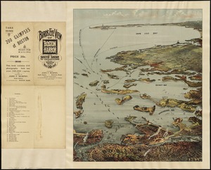
Bird's eye view of Boston Harbor and south shore to Provincetown showing steamboat routes
6.
Boston Harbor, Massachusetts
7.
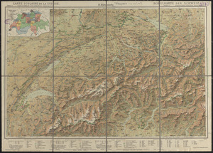
Carte scolaire de la Suisse
8.
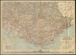
Cartes-guides Campbell Provence
9.
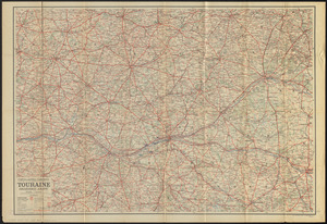
Cartes-guides Campbell Touraine, Orléanais, Anjou
10.
A chart of the gulf stream
11.
[Chiapas]
12.
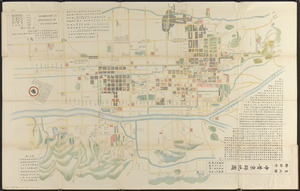
Chūseki keishi chizu
13.
Copia del Rio de Sn. Andres
14.
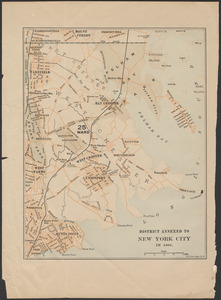
District annexed to New York City in 1895
15.
A draught of St. John's harbour : with the soundings
16.
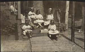
Family of Mrs. Donovan, Roxbury
17.
Fishing grounds on the Atlantic coast of North America
18.
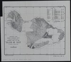
General map of the island of Maui : as surveyed to March 1st 1880
19.
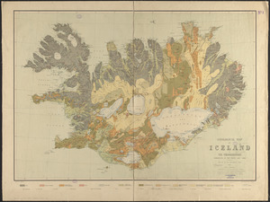
Geological map of Iceland
20.
Guide map of Boston
‹ Prev
Next ›
1
2
3
4
5


![[Chiapas]](https://bpldcassets.blob.core.windows.net/derivatives/images/commonwealth:4m90fj278/image_thumbnail_300.jpg)