Toggle navigation
LMEC Home
Exhibitions
Georeferencing
Tools for Teachers
Collections
My Favorites
Sign Up / Log In
Search
Search the map portal
Map Collection
Map Collection
Map Sets
Search
Search
Search for
Search In
All Fields
Creator
Title
Subject
Place
Search All Digital Collections
Advanced Search
37 Results
My Search
Start Over
Date
1700
Remove constraint Date: <span class='single'>1700</span>
Filter your Search
Place
North and Central America
15
Europe
8
United States
8
New York
6
North America
5
France
4
Africa
3
South America
3
more
Place
»
Topic
North America--Maps--Early works to 1800
3
America--Maps--Early works to 1800
2
Manuscript maps--Early works to 1800
2
World maps--Early works to 1800
2
1700
1
Africa, North--Historical geography--Maps--Early works to 1800
1
Africa, West--Maps--Early works to 1800
1
Africa--Maps--Early works to 1800
1
more
Topic
»
Date
1700
[remove]
37
Date range begin
–
Date range end
Current results range from
1668
to
1800
1700
to
1700
37
Creator
Burghers, M.
3
Wells, Edward, 1667-1727
3
George, III, King of Great Britain, 1738-1820
2
George, IV, King of Great Britain, 1762-1830
2
Lea, Philip, fl. 1683-1700
2
Nolin, Jean Baptiste, 1686-1762
2
Romer, Wolfgang William, 1640-1713
2
Godsoe, Wm. (William)
1
more
Creator
»
Format
Maps/Atlases
37
Manuscripts
9
Georeferenced
No
37
Collection
Norman B. Leventhal Map & Education Center Collection
26
American Revolutionary War-Era Maps
8
William L. Clements Library Collection
7
Boston and New England Maps
2
British Library Collection
2
Maritime Charts and Atlases
2
Library of Congress Collection
1
MacLean Collection Map Library
1
Available to use
No known restrictions
26
Creative Commons license
3
Search Constraints
Sort by relevance
relevance
title
date (asc)
date (desc)
Number of results to display per page
20 per page
10
per page
20
per page
50
per page
100
per page
View results as:
grid view
map view
Search Results
1.
Americae tam septentrionalis quam meridionalis in mappa geographica delineatio
2.
[Amerique septentrionale]
3.
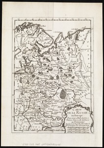
Carte de la Russie en Europe : pour servir al'Introduction a l'histoire universelle du Baron de Pufendorf
4.
Carte du diocèse d'Uzès
5.
Contents of composite atlas
6.
Contents of composite atlas verso
7.
Contents of composite atlas volume 2
8.
Contents of composite atlas volume 2 verso
9.
Cuba, ciudad capittal de la ysla del mismo nombre y su famoso puerto sittuado en la costa del sur de gra. ysla, los 20 grados y...
10.
Diocèse de Castres, dédié à Messire Augustin de Maupeou, Conseiller du Roy en ses Conseils Evêque de Castres
11.
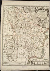
Le Diocese de Limoges : divisé en ses dix huict Archipretré et les Gouvernemens de la Marche et du Limosin dans les quels il...
12.
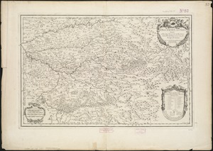
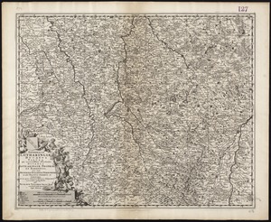
Generalis Lotharingiae Ducatus Tabula, qua accuratissime oftenduntur Ducatus Lotharingiae Propriae et Barrensis nec non...
13.
The Gulf coast from the Mississippi Delta to the Bay of St. Joseph
14.
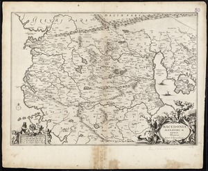
Macedonia Alexandri M. Patria Illustris
15.
Manuscript survey of a property in Kittery, Maine
16.
A map of lot no 1 in the Hardenbergh Patent
17.
A map of lot no 4 in the [Ha]rdenbergh Patent
18.
A map of part of the Isthmus of Darien : shewing the communication with Panama, from Portobello & Chagre both by land, and by...
19.
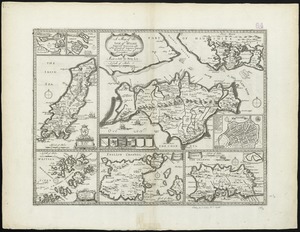
A map of the Isle of Wight Portsea Halinge, also the islands of Iarsey & Garnsey which are part of Hampshire
20.
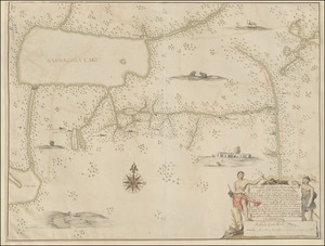
A Mappe of Colonel Römers Voyage to ye: 5 Indian nations going from New Yorck to Albany thence west to ye 3 Macquas Castle and...
‹ Prev
Next ›
1
2

![[Amerique septentrionale]](https://bpldcassets.blob.core.windows.net/derivatives/images/commonwealth:8336h2955/image_thumbnail_300.jpg)


![A map of lot no 4 in the [Ha]rdenbergh Patent](https://bpldcassets.blob.core.windows.net/derivatives/metadata/commonwealth-oai:zs262628v/image_thumbnail_300.jpg)