Toggle navigation
LMEC Home
Exhibitions
Georeferencing
Tools for Teachers
Collections
My Favorites
Sign Up / Log In
Search
Search the map portal
Map Collection
Map Collection
Map Sets
Search
Search
Search for
Search In
All Fields
Creator
Title
Subject
Place
Search All Digital Collections
Advanced Search
1652 Results
My Search
Start Over
More Like
commonwealth-oai:hm50zr247
Remove constraint More Like: commonwealth-oai:hm50zr247
Filter your Search
Place
North and Central America
1,625
United States
1,363
Suffolk (county)
755
Boston
748
Massachusetts
664
Canada
205
New York
195
Quebec
111
more
Place
»
Topic
Boston (Mass.)--Maps
752
United States--History--Revolution, 1775-1783--Maps
307
United States--History--French and Indian War, 1754-1763--Maps
149
City planning--Massachusetts--Boston--Maps
104
Real property--Massachusetts--Boston--Maps
99
Landowners--Massachusetts--Boston--Maps
74
Urban renewal--Massachusetts--Boston--Maps
63
Massachusetts--Maps
54
more
Topic
»
Date
Date range begin
–
Date range end
Current results range from
1700
to
2023
View distribution
Creator
Boston Redevelopment Authority
114
Rocque, Mary Ann
29
Geo. H. Walker & Co
27
Holland, Samuel, 1728-1801
25
Montrésor, John, 1736-1799
25
Bellin, Jacques Nicolas, 1703-1772
24
Jefferys, Thomas, -1771
24
Boynton, George W., d. 1884
21
more
Creator
»
Format
Maps/Atlases
1,636
Drawings/Illustrations
11
Manuscripts
9
Documents
5
Prints
1
Georeferenced
Yes
96
No
1,556
Collection
American Revolutionary War-Era Maps
924
William L. Clements Library Collection
909
Norman B. Leventhal Map & Education Center Collection
615
Boston and New England Maps
579
Urban Maps
490
Boston Redevelopment Authority Collection
120
Mapping Boston Collection
20
Massachusetts Real Estate Atlases
12
more
Collection
»
Available to use
No known restrictions
686
Creative Commons license
34
Search Constraints
Sort by relevance
relevance
title
date (asc)
date (desc)
Number of results to display per page
20 per page
10
per page
20
per page
50
per page
100
per page
View results as:
grid view
map view
Search Results
641.
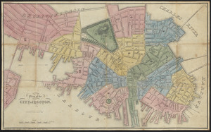
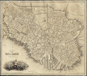
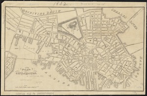
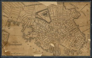
Plan of the city of Boston
642.
Plan of the city of Boston
643.
Plan of the city of Boston
644.
Plan of the city of Boston
645.
Plan of the city of Boston
646.
Plan of the city of Boston
647.
Plan of the city of Boston
648.
Plan of the city of Boston
649.
Plan of the city of Boston
650.
Plan of the Coffin Estate, corner of Summer and Chauncy Streets : to be sold by public auction on Wednesday April 26th 1856 at...
651.
Plan of the estate of late Doct. John W. Warren, No. 89 Harrison Avenue, cor. of Kneeland St. & Plymouth Pl. to be sold at...
652.
Plan of the estate of the late Warren White : to be sold at public auction on Wednesday March 27th 1872 at 12 o'clock m. on the...
653.
Plan of the estate on the southerly corner of Washington and Franklin Streets : to be sold by public auction on Saturday June...
654.
Plan of the estates nos. 246 to 252 Congress corner of Purchase Street and nos. 59 to 69 Purchase Street : to be sold by public...
655.
Plan of the Federal St. Meeting House estate : to be sold by public auction, on Thursday February 24th 1859, at 12 o'clock noon...
656.
[Plan of the Gore Estate at the corner of Pitts and Green streets]
657.
Plan of the harbour of Boston, from surveys made under the direction of commissioners appointed by a resolve of the...
658.
Plan of the Hutchinson Estate on the corner of Hanover & Clark Streets : to be sold by public auction on Monday Feby. 20th 1871...
659.
Plan of the old Julien estate : compriseing [sic] two stores on Milk and Congress Streets : belonging to the estate of the late...
660.
Plan of the parkway between Muddy River gate house and Jamaica Park 1892
‹ Prev
Next ›
1
2
…
29
30
31
32
33
34
35
36
37
…
82
83


![[Plan of the Gore Estate at the corner of Pitts and Green streets]](https://bpldcassets.blob.core.windows.net/derivatives/images/commonwealth:9s161h402/image_thumbnail_300.jpg)


