Toggle navigation
LMEC Home
Exhibitions
Georeferencing
Tools for Teachers
Collections
My Favorites
Sign Up / Log In
Search
Search the map portal
Map Collection
Map Collection
Map Sets
Search
Search
Search for
Search In
All Fields
Creator
Title
Subject
Place
Search All Digital Collections
Advanced Search
1291 Results
My Search
Start Over
More Like
commonwealth-oai:5m60vq35s
Remove constraint More Like: commonwealth-oai:5m60vq35s
Filter your Search
Place
North and Central America
1,251
United States
940
Canada
229
New York
193
Quebec
111
North America
86
Pennsylvania
61
New Jersey
54
more
Place
»
Topic
United States--Maps
330
United States--History--Revolution, 1775-1783--Maps
306
United States--History--French and Indian War, 1754-1763--Maps
151
North America--Maps
85
Saint Lawrence River--Maps
47
Elections--United States--Maps
36
Railroads--United States--Maps
34
Canada--Maps
31
more
Topic
»
Date
Date range begin
–
Date range end
Current results range from
1700
to
2023
View distribution
Creator
Paullin, Charles Oscar, 1868 or 1869-1944
70
Wright, John Kirtland, 1891-1969
70
Rocque, Mary Ann
29
Bellin, Jacques Nicolas, 1703-1772
27
Holland, Samuel, 1728-1801
25
Jefferys, Thomas, -1771
25
Montrésor, John, 1736-1799
25
Clinton, Henry, Sir, 1738?-1795
19
more
Creator
»
Format
Maps/Atlases
1,273
Drawings/Illustrations
11
Documents
5
Prints
3
Books
1
Manuscripts
1
Objects/Artifacts
1
Posters
1
Georeferenced
Yes
73
No
1,218
Collection
American Revolutionary War-Era Maps
972
William L. Clements Library Collection
909
Norman B. Leventhal Map & Education Center Collection
319
Maps from AAS
37
MacLean Collection Map Library
15
New York Public Library Collection
10
David Judkins Weaver Papers
2
Mapping Boston Collection
2
more
Collection
»
Available to use
No known restrictions
244
Creative Commons license
16
Search Constraints
Sort by relevance
relevance
title
date (asc)
date (desc)
Number of results to display per page
20 per page
10
per page
20
per page
50
per page
100
per page
View results as:
grid view
map view
Search Results
741.
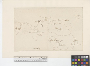
Northeastern end of Long Island
742.
Northern New Jersey
743.
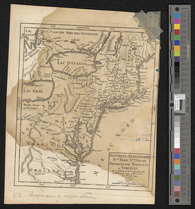
Nouvelle Angleterre, Nlle. York, Nlle. Jeersey, Pensilvanie, Mariland et Virginie
744.
La Nouvelle France ou Canada
745.
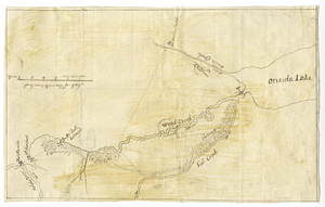
Oneida Lake to the Mohawk River
746.
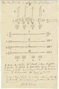
The order of battle in crossing Lake Champlane
747.
Original plan of Brentons Neck; and all the ground to the southward of the town of New-port Rhode Island, 1779
748.
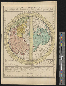
The panorganon for solving the common problems of the terrestrial globe : Northern Hemisphere
749.
Parish of Batiscant. Parish of St. Pierre Becquet. Parish of Champlain. Parish of Gentilly
750.
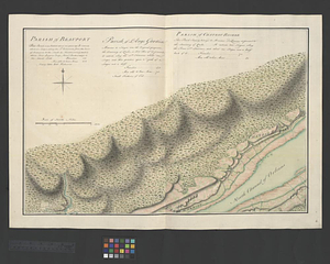
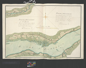
Parish of Beauport. Parish of L'Ange Gardien. Parish of Chateau Richer
751.
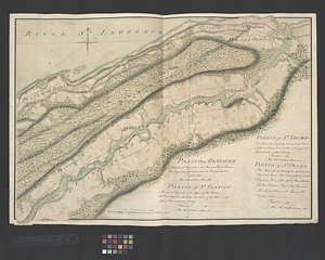
Parish of Berthier. Parish of St. François. Parish of St. Thomas
752.
Parish of Bertier. Isle du Pas
753.
Parish of Boucherville. Parish de la Magdelaine. Parish of La Prairie
754.
Parish of Chambly & Ste. Therese
755.
Parish of Charlebourgh
756.
Parish of Chateau Gay
757.
Parish of Dechaillon or St. Jean. Parish of Grondines
758.
Parish of Dechambeaux. Parish of Cape Sante. Parish of Lotbinière. Parish of St. Croix
759.
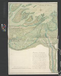
Parish of Iamaska
760.
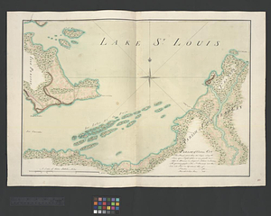
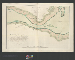
Parish of La Chine. Parish of the Saut of St. Louis. Cocnawaga or St. Louis Indian Castle
‹ Prev
Next ›
1
2
…
34
35
36
37
38
39
40
41
42
…
64
65