Toggle navigation
LMEC Home
Exhibitions
Georeferencing
Tools for Teachers
Collections
My Favorites
Sign Up / Log In
Search
Search the map portal
Map Collection
Map Collection
Map Sets
Search
Search
Search for
Search In
All Fields
Creator
Title
Subject
Place
Search All Digital Collections
Advanced Search
170 Results
My Search
Start Over
More Like
commonwealth:zw131t38b
Remove constraint More Like: commonwealth:zw131t38b
Filter your Search
Place
North and Central America
170
United States
167
Middlesex (county)
52
Suffolk (county)
40
Boston
38
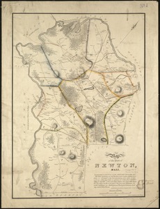
Newton
30
Essex (county)
28
Norfolk (county)
14
more
Place
»
Topic
Landowners--Massachusetts--Boston--Maps
35
Real property--Massachusetts--Boston--Maps
35
Buildings--Massachusetts--Boston--Maps
34
Newton (Mass.)--Maps
29
Real property--Massachusetts--Newton--Maps
21
Landowners--Massachusetts--Newton--Maps
20
Boston (Mass.)--Maps
12
Buildings--Massachusetts--Brookline--Maps
9
more
Topic
»
Date
Date range begin
–
Date range end
Current results range from
1830
to
1987
View distribution
Creator
Bromley, George Washington
38
Bromley, Walter Scott
38
G.W. Bromley & Co.
38
Geo. H. Walker & Co.
24
Hopkins, Griffith Morgan, Jr.
20
L.J. Richards & Co.
15
Richards Map Company
7
Walker Lith. & Pub. Co.
7
more
Creator
»
Format
Maps/Atlases
170
Manuscripts
1
Georeferenced
Yes
1
No
169
Collection
Massachusetts Real Estate Atlases
143
Norman B. Leventhal Map Center Collection
26
Boston and New England Maps
24
Urban Maps
24
Boston Redevelopment Authority Collection
1
Available to use
No known restrictions
27
Search Constraints
Sort by relevance
relevance
title
date (asc)
date (desc)
Number of results to display per page
100 per page
10
per page
20
per page
50
per page
100
per page
View results as:
grid view
map view
Search Results
1.
Atlas of the city of Newton, Massachusetts
2.
Atlas of the city of Newton, Massachusetts
3.
Atlas of the city of Newton, Massachusetts
4.
Atlas of the city of Newton, Massachusetts : from actual surveys and official plans
5.
Atlas of the city of Newton, Massachusetts : from actual surveys and official plans
6.
Atlas of the city of Newton, Massachusetts
7.
Atlas of the city of Newton, Massachusetts : compiled from actual surveys and records
8.
Atlas of the city of Newton, Middlesex Co., Massachusetts : from actual survey, official records & private plans
9.
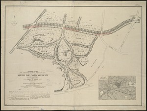
General plan for subdividing into roads and building lots, the property of the Newton Boulevard Syndicate, blocks 1, 2, 3, 4,...
10.
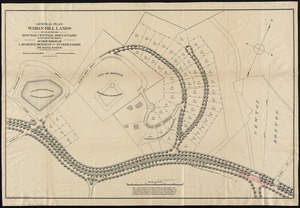
General plan Waban Hill lands on and near Newton Central Boulevard (eastern division) : subdivision of Lawrence, Bennett and...
11.
Map of the town of Newton, Mass
12.
Plan of Briggs Place, in Newton
13.
Plan of house lots at Newton Corner near the residence of Dr. Hitchcock, lately belonging to W.S. Tuckerman
14.
Plan of house lots in West Newton, belonging to Chester Judson, to be sold by public auction, on Thursday August 12th at 4...
15.
Plan of land belonging to William Kenrick : near the depot of Newton Corner
16.
Plan of Woodland Vale, in Newton, belonging to Wm. Kenrick
17.
Plan of land in Newton, 6th ward : being a portion of the estate of J. Willey [sic]Edmands, decd. ... to be sold by...
18.
Plan of lots in North Auburn Dale, Newton, Mass
19.
Plan of lots to be sold at auction in West New[ton] on Friday, September 23d, 1853, at 3 o'clock, p.m : by the foot & by the acre
20.
Map of the town of Newton, Middlesex County, Mass.
21.
Atlas of the city of Newton Massachusetts : assessors block system
22.
Plan of Newton Terraces, Newton, Mass
23.
Atlas of Massachusetts
24.
Atlas of Middlesex County. Vol. 1. Cambridge, Somerville, Arlington, Belmont, Watertown, Everett, Malden, Medford, Newton,...
25.
Hancock Woods EGA
26.
Map of Commonwealth Avenue Street Railway Company, and connecting lines : showing route to Norumbega Park
27.
Map of Newton Mass
28.
Map of the city of Newton, and surroundings, Mass
29.
Map of the city of Newton Massachusetts
30.
Map of the town of Newton
31.
Plan of Chestnut Hill, in Brookline & Newton : August 1856
32.
Plan of Newton & Needham
33.
Atlas, city of Everett, Middlesex County, Massachusetts
34.
Atlas of Attleboro town, Massachusetts
35.
Atlas of Barnstable County, Massachusetts : towns of Bourne, Mashpee, Falmouth, Sandwich, Barnstable, Yarmouth, Dennis,...
36.
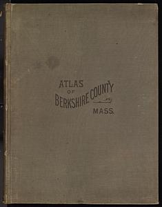
Atlas of Berkshire County, Massachusetts
37.
Atlas of Brookfield, West Brookfield and North Brookfield towns, Massachusetts
38.
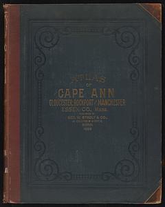
Atlas of Cape Ann, Gloucester, Rockport and Manchester, Essex County, Mass
39.
Atlas of Dorchester, West Roxbury, and Brighton, City of Boston
40.
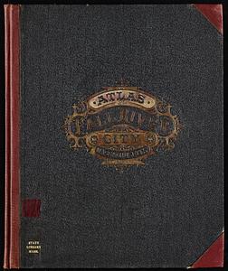
Atlas of Fall River City, Massachusetts
41.
Atlas of Franklin Co., Massachusetts : from actual surveys
42.
Atlas of Gardner town, Massachusetts
43.
Atlas of Greenfield town, Massachusetts
44.
Atlas of Haverhill and Bradford, Massachusetts
45.
Atlas of Holyoke City, Massachusetts
46.
Atlas of Marblehead, Massachusetts : from official records, private plans and actual surveys
47.
Atlas of Massachusetts
48.
Atlas of Middlesex County. Vol. 2. Cities of Melrose & Woburn, towns of Bedford, Burlington, Concord, North Reading, Reading,...
49.
Atlas of Plymouth county, Massachusetts : compiled from recent and actual surveys and records under the direction of the...
50.
Atlas of Spencer town, Massachusetts
51.
Atlas of Springfield city, Massachusetts
52.
Atlas of the city of Beverly, Essex County, Massachusetts
53.
Atlas of the city of Beverly, Essex County, Massachusetts
54.
Atlas of the city of Boston : West Roxbury
55.
Atlas of the city of Boston : Dorchester
56.
Atlas of the city of Boston : Boston proper and Back Bay
57.
Atlas of the city of Boston : Dorchester
58.
Atlas of the city of Boston : Boston proper and Back Bay
59.
Atlas of the city of Boston : Dorchester, Mass., vol. 5
60.
Atlas of the city of Boston : South Boston
61.
Atlas of the city of Boston : volume 7, Brighton
62.
Atlas of the city of Boston : vol. 5, West Roxbury
63.
Atlas of the city of Boston : Boston proper and Roxbury
64.
Atlas of the city of Boston : Boston proper
65.
Atlas of the city of Boston : Dorchester, Massachusetts, vol. 5
66.
Atlas of the city of Boston : volume 6, West Roxbury
67.
Atlas of the city of Boston : vol. 5, Dorchester, Mass.
68.
Atlas of the city of Boston : East Boston
69.
Atlas of the city of Boston : Roxbury
70.
Atlas of the city of Boston : ward 25 Brighton
71.
Atlas of the city of Boston : Boston proper and Back Bay
72.
Atlas of the city of Boston : West Roxbury
73.
Atlas of the city of Boston : South Boston
74.
Atlas of the city of Boston : ward 26 Hyde Park
75.
Atlas of the city of Boston : Dorchester
76.
Atlas of the city of Boston : Roxbury
77.
Atlas of the city of Boston : wards 25 and 26, Brighton
78.
Atlas of the city of Boston : Boston proper and Back Bay
79.
Atlas of the city of Boston : Boston proper and Back Bay
80.
Atlas of the city of Brockton, Mass.
81.
Atlas of the city of Cambridge, Massachusetts
82.
Atlas of the city of Cambridge, Massachusetts
83.
Atlas of the city of Cambridge, Massachusetts
84.
Atlas of the city of Cambridge, Massachusetts
85.
Atlas of the city of Cambridge, Middlesex Co., Massachusetts
86.
Atlas of the city of Chelsea and the towns of Revere & Winthrop, Massachusetts
87.
Atlas of the city of Chelsea and the towns of Revere and Winthrop, Massachusetts
88.
Atlas of the city of Everett, Mass.
89.
Atlas of the city of Fitchburg, Worcester County, Massachusetts : from official records and surveys
90.
Atlas of the city of Gloucester and town of Rockport, Massachusetts : from official records, private plans and actual surveys
91.
Atlas of the city of Lawrence and the towns of Methuen, Andover and North Andover, Massachusetts
92.
Atlas of the city of Lawrence and the towns of Methuen, Andover and North Andover, Massachusetts
93.
Atlas of the city of Lawrence, Massachusetts : including also the town of Methuen
94.
Atlas of the city of Lowell, Massachusetts
95.
Atlas of the city of Lowell, Massachusetts
96.
Atlas of the City of Lynn, Massachusetts, including also, the towns of Swampscott and Saugus
97.
Atlas of the City of Lynn, Massachusetts, including also, the towns of Swampscott and Saugus
98.
Atlas of the city of Malden, Massachusetts
99.
Atlas of the city of Pittsfield, Berkshire County, Massachusetts
100.
Atlas of the city of Quincy, Norfolk County, Massachusetts : compiled from the latest plans and original surveys
‹ Prev
Next ›
1
2


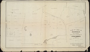

![Plan of lots to be sold at auction in West New[ton] on Friday, September 23d, 1853, at 3 o'clock, p.m](https://bpldcassets.blob.core.windows.net/derivatives/images/commonwealth:x059c971d/image_thumbnail_300.jpg)