Toggle navigation
LMEC Home
Exhibitions
Georeferencing
Tools for Teachers
Collections
My Favorites
Sign Up / Log In
Search
Search the map portal
Map Collection
Map Collection
Map Sets
Search
Search
Search for
Search In
All Fields
Creator
Title
Subject
Place
Search All Digital Collections
Advanced Search
230 Results
My Search
Start Over
More Like
commonwealth:z603vn753
Remove constraint More Like: commonwealth:z603vn753
Filter your Search
Place
North and Central America
206
United States
158
New England
88
Canada
26
Middle Atlantic
21
New York
13
Massachusetts
12
Boston Harbor
11
more
Place
»
Topic
Manuscript maps--Early works to 1800
138
New England--Maps--Early works to 1800
91
Middle Atlantic States--Maps--Early works to 1800
21
Northeastern States--Maps--Early works to 1800
10
New York (State)--Maps--Early works to 1800
8
North America--Maps--Early works to 1800
7
Añasco (P.R.)--Maps--Early works to 1800
6
Boston (Mass.)--Maps--Early works to 1800
6
more
Topic
»
Date
Date range begin
–
Date range end
Current results range from
1617
to
1999
View distribution
Creator
Dumont de Montigny
14
Adlum, John, 1759-1836
9
Bingham, William, 1752-1804
9
Jefferys, Thomas, d. 1771
9
Bellin, Jacques Nicolas, 1703-1772
4
De Brahm, John Gerar William, 1717-approximately 1799
4
Green, John, d. 1757
4
Jefferys, Thomas, -1771
4
more
Creator
»
Format
Maps/Atlases
230
Manuscripts
139
Georeferenced
Yes
10
No
220
Collection
American Revolutionary War-Era Maps
180
Library of Congress Collection
97
Norman B. Leventhal Map Center Collection
65
Newberry Library Collection
39
Boston and New England Maps
32
Maritime Charts and Atlases
27
Mapping Boston Collection
23
Sidney R. Knafel Map Collection at Phillips Academy
15
more
Collection
»
Available to use
Creative Commons license
132
No known restrictions
43
Search Constraints
Sort by date (desc)
relevance
title
date (asc)
date (desc)
Number of results to display per page
10 per page
10
per page
20
per page
50
per page
100
per page
View results as:
grid view
map view
Search Results
1.
A mapp of New England
2.
Copy of a map presented to the Congres [sic]
3.
Cours de l'Ohio depuis sa source jusqu'a sa jonction avec la Riviere d'Ouabache et les pais voisons
4.
Carte réduite du nord des Etat-Unis avec l'intérieur du pays : pour servir à l'intelligence de cette histoire ; copieé par...
5.
A chart of the coast of New England from the South Shoal to Cape Sable including Georges Bay from Holland & actual surveys
6.
1. Prise de Newport par d'Estaing, 1778 : 2. Embossage de Ternay à Newport, 1780
7.
Costa desde la Mobila asta la Bahía de Sn. Josef
8.
[Plan de defense de New-Port] : [dans l'Isle Rhode (Amerique Septentrionalle) par l'escadre du Roy aux ordres de Monsieur le...
9.
A chart of the coast of New England from the South Shoal to Cape Sable including Georges Bay from Holland & actual surveys
10.
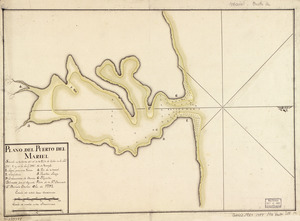
Plano del Puerto del Mariel situado en la costa del N. de la ysla de Cuba en la latd. 23⁰5ʹ y en la longd. 293⁰16ʹ de Tenerife
‹ Prev
Next ›
1
2
3
4
5
…
22
23

![Copy of a map presented to the Congres [sic]](https://bpldcassets.blob.core.windows.net/derivatives/images/commonwealth:z603vn16x/image_thumbnail_300.jpg)


![[Plan de defense de New-Port]](https://bpldcassets.blob.core.windows.net/derivatives/images/commonwealth:z603vn044/image_thumbnail_300.jpg)