Toggle navigation
LMEC Home
Exhibitions
Georeferencing
Tools for Teachers
Collections
My Favorites
Sign Up / Log In
Search
Search the map portal
Map Collection
Map Collection
Map Sets
Search
Search
Search for
Search In
All Fields
Creator
Title
Subject
Place
Search All Digital Collections
Advanced Search
140 Results
My Search
Start Over
More Like
commonwealth:z603vm188
Remove constraint More Like: commonwealth:z603vm188
Filter your Search
Place
North and Central America
101
Canada
64
United States
56
Suffolk (county)
33
Boston
32
Nova Scotia
21
Minas Basin
9
Chignecto Bay
8
more
Place
»
Topic
Coasts--Nova Scotia--Maps
64
Boston (Mass.)--Buildings, structures, etc--Maps, Manuscript--Early works to 1800
17
Fortification--Massachusetts--Boston--Maps, Manuscript--Early works to 1800
11
Coasts--Nova Scotia--Pictorial works
10
Atlantic Coast (Middle Atlantic States)--Maps
8
Atlantic Coast (N.S.)--Maps
8
Atlantic Coast (New England)--Maps
8
Boston (Mass.)--History--Siege, 1775-1776--Maps, Manuscript--Early works to 1800
8
more
Topic
»
Date
Date range begin
–
Date range end
Current results range from
1758
to
1889
View distribution
Creator
Des Barres, Joseph F. W. (Joseph Frederick Wallet), 1722-1824
94
Montrésor, John, 1736-1799
5
Page, Thomas Hyde, Sir, 1746-1821
4
Browne, William, Captain
2
De Berniere, Henry
2
Holland, Samuel, 1728-1801
2
United States. Hydrographic Office
2
Aitken, Robert, 1735-1802
1
more
Creator
»
Format
Maps/Atlases
139
Manuscripts
35
Prints
1
Georeferenced
Yes
2
No
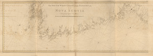
138
Collection
American Revolutionary War-Era Maps
136
Library of Congress Collection
136
Norman B. Leventhal Map & Education Center Collection
4
Maritime Charts and Atlases
2
Boston and New England Maps
1
Available to use
Creative Commons license
136
No known restrictions
4
Search Constraints
Sort by relevance
relevance
title
date (asc)
date (desc)
Number of results to display per page
20 per page
10
per page
20
per page
50
per page
100
per page
View results as:
grid view
map view
Search Results
101.
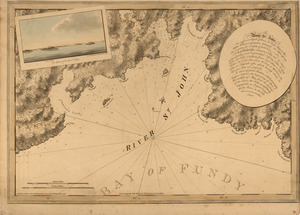
[River St. John]
102.
The river St. John
103.
[Rough draft of Charlestown, in water colour]
104.
[Rough draught of Boston and harbour]
105.
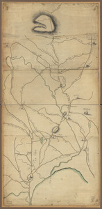
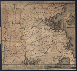
Roxbury to Concord : Roads & distances, &c
106.
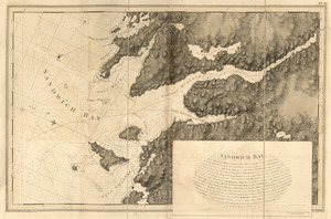
Sandwich Bay
107.
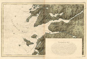
Sandwich Bay
108.
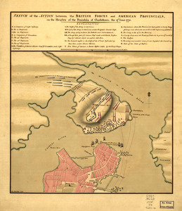
Sketch of the action between the British forces and American provincials, on the heights of the peninsula of Charlestown : the...
109.
The south east coast of Nova Scotia
110.
South entrance of Grand Passage ; Cape St. Mary n.e. one mile ; St. Marys Bay
111.
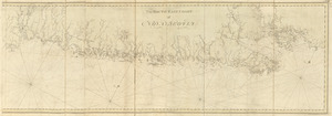
The south west coast of the peninsula of Nova Scotia
112.
The south west coast of the peninsula of Nova Scotia
113.
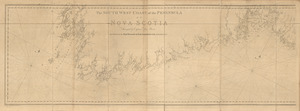
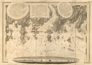
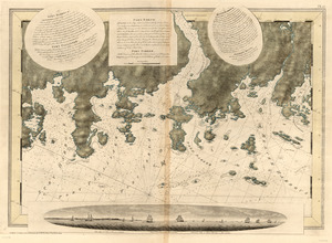
[Southwest coast of Nova Scotia from Cape Sable to Cape St. Mary]
114.
[Southwest coast of Nova Scotia from Cape Sable to Cape St. Mary]
115.
Spry Harbour ; Port Pallisser ; Port North ; Port Parker ; Beaver Harbour ; Fleming River
116.
Spry Harbour ; Port Pallisser ; Port North ; Port Parker ; Beaver Harbour ; Fleming River
117.
A Temporary project for a star redout [sic] to contain 150 men
118.
To the Hone. Jno. Hancock, Esqre. president of ye Continental Congress, this map of the seat of civil war in America, is...
119.
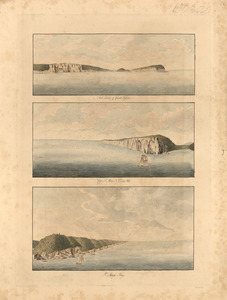
[Torbay]
120.
[Torbay]
‹ Prev
Next ›
1
2
3
4
5
6
7
![[River St. John]](https://bpldcassets.blob.core.windows.net/derivatives/images/commonwealth:dz010t93f/image_thumbnail_300.jpg)
![[Rough draft of Charlestown, in water colour]](https://bpldcassets.blob.core.windows.net/derivatives/images/commonwealth:z603vj49v/image_thumbnail_300.jpg)
![[Rough draught of Boston and harbour]](https://bpldcassets.blob.core.windows.net/derivatives/images/commonwealth:z603vj39m/image_thumbnail_300.jpg)
![[Southwest coast of Nova Scotia from Cape Sable to Cape St. Mary]](https://bpldcassets.blob.core.windows.net/derivatives/images/commonwealth:t722hs70t/image_thumbnail_300.jpg)
![[Southwest coast of Nova Scotia from Cape Sable to Cape St. Mary]](https://bpldcassets.blob.core.windows.net/derivatives/images/commonwealth:t722hs72c/image_thumbnail_300.jpg)
![A Temporary project for a star redout [sic] to contain 150 men](https://bpldcassets.blob.core.windows.net/derivatives/images/commonwealth:z603vj703/image_thumbnail_300.jpg)
![[Torbay]](https://bpldcassets.blob.core.windows.net/derivatives/images/commonwealth:z603vj95z/image_thumbnail_300.jpg)
![[Torbay]](https://bpldcassets.blob.core.windows.net/derivatives/images/commonwealth:z603vj992/image_thumbnail_300.jpg)