Toggle navigation
LMEC Home
Exhibitions
Georeferencing
Tools for Teachers
Collections
My Favorites
Sign Up / Log In
Search
Search the map portal
Map Collection
Map Collection
Map Sets
Search
Search
Search for
Search In
All Fields
Creator
Title
Subject
Place
Search All Digital Collections
Advanced Search
161 Results
My Search
Start Over
More Like
commonwealth:z603vj38b
Remove constraint More Like: commonwealth:z603vj38b
Filter your Search
Place
North and Central America
122
United States
78
Canada
62
Suffolk (county)
55
Boston
54
Nova Scotia
22
Massachusetts
18
Boston Harbor
13
more
Place
»
Topic
Coasts--Nova Scotia--Maps
62
Fortification--Massachusetts--Boston--Maps--Early works to 1800
30
Boston (Mass.)--History--Revolution, 1775-1783--Maps--Early works to 1800
22
Boston (Mass.)--Buildings, structures, etc--Maps, Manuscript--Early works to 1800
16
Fortification--Massachusetts--Boston--Maps, Manuscript--Early works to 1800
11
Coasts--Nova Scotia--Pictorial works
10
Atlantic Coast (N.S.)--Maps
8
Boston Harbor (Mass.)--Maps--Early works to 1800
8
more
Topic
»
Date
Date range begin
–
Date range end
Current results range from
1747
to
1782
View distribution
Creator
Des Barres, Joseph F. W. (Joseph Frederick Wallet), 1722-1824
95
Page, Thomas Hyde, Sir, 1746-1821
9
Aitken, Robert, 1735-1802
7
Montrésor, John, 1736-1799
6
Beaurain, Jean de, 1696-1771
5
Faden, William, 1749-1836
3
Gage, Thomas, 1721-1787
3
Pelham, Henry, 1749-1806
3
more
Creator
»
Format
Maps/Atlases
160
Manuscripts
34
Prints
1
Georeferenced
Yes
7
No
154
Collection
American Revolutionary War-Era Maps
160
Library of Congress Collection
136
Norman B. Leventhal Map & Education Center Collection
16
Boston and New England Maps
15
Mapping Boston Collection
10
Richard H. Brown Revolutionary War Map Collection at Mount Vernon
6
Urban Maps
5
Harvard Map Collection
2
more
Collection
»
Available to use
Creative Commons license
154
No known restrictions
7
Search Constraints
Sort by relevance
relevance
title
date (asc)
date (desc)
Number of results to display per page
20 per page
10
per page
20
per page
50
per page
100
per page
View results as:
grid view
map view
Search Results
81.
The environs of Fort Cumberland in the Bay of Fundy
82.
A general & particular plan of the island of Castle William near Boston : shewing the works in their original & present state,...
83.
Grundriss von der Stadt Boston und ihren Gegenden
84.
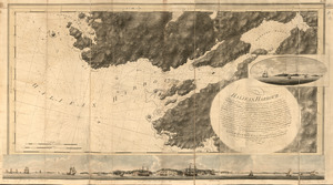
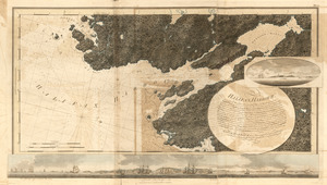
Halifax Harbour ... Catch Harbour ...
85.
Halifax Harbour ... Catch Harbour ...
86.
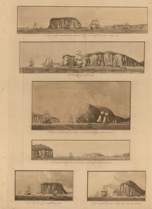
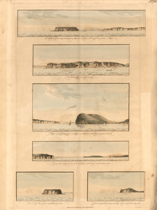
The isle Haut ...; and Cape Chignecto ... ; The western cliffs of Cape Dore ; A view of Cape Baptist in the entrance into the...
87.
The isle Haut ...; and Cape Chignecto ... ; The western cliffs of Cape Dore ; A view of Cape Baptist in the entrance into the...
88.
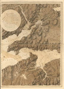
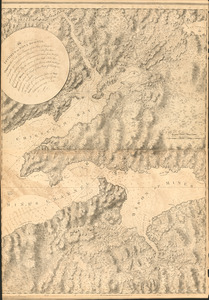
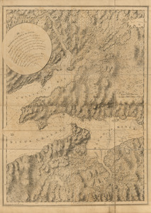
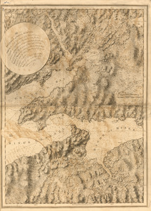
The isthmus of Nova Scotia
89.
The isthmus of Nova Scotia
90.
The isthmus of Nova Scotia
91.
The isthmus of Nova Scotia
92.
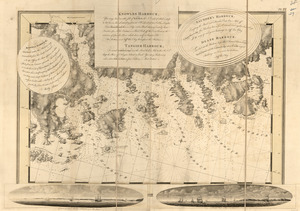
Keppell Harbour ; Knowles Harbour ; Tangier Harbour ; Saunder's Harbour ; Deane Harbour
93.
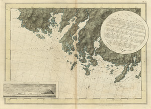
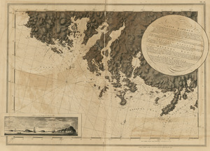
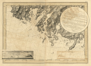
Leith Harbour ; Prospect Harbour ; Bristol Bay ; Sambro Harbour
94.
Leith Harbour ; Prospect Harbour ; Bristol Bay ; Sambro Harbour
95.
Leith Harbour ; Prospect Harbour ; Bristol Bay ; Sambro Harbour
96.
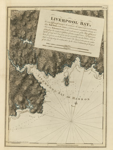
Liverpool Bay
97.
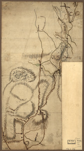
Map of the environs of Roxbury showing roads to Jamaica, Cambridge, Dorchester, Milton, etc
98.
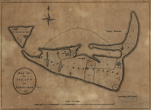
Map of the island of Nantucket
99.
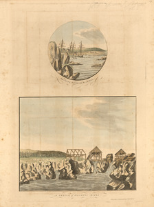
Mechios River near the mills ; A sketch of Mechios mills
100.
Mechios River near the mills ; A sketch of Mechios mills
‹ Prev
Next ›
1
2
3
4
5
6
7
8
9