Toggle navigation
LMEC Home
Exhibitions
Georeferencing
Tools for Teachers
Collections
My Favorites
Sign Up / Log In
Search
Search the map portal
Map Collection
Map Collection
Map Sets
Search
Search
Search for
Search In
All Fields
Creator
Title
Subject
Place
Search All Digital Collections
Advanced Search
464 Results
My Search
Start Over
More Like
commonwealth:z603vh049
Remove constraint More Like: commonwealth:z603vh049
Filter your Search
Place
United States
341
North and Central America
173
Canada
63
North America
31
West Indies
23
New York
16
New England
15
Boston
11
more
Place
»
Topic
United States--Maps
314
Canada--Maps
54
Elections--United States--Maps
36
Railroads--United States--Maps
34
North America--Maps
30
West Indies--Maps
24
New England--Maps
15
Population density--United States--Maps
14
more
Topic
»
Date
Date range begin
–
Date range end
Current results range from
1750
to
2020
View distribution
Creator
Paullin, Charles Oscar, 1868 or 1869-1944
70
Wright, John Kirtland, 1891-1969
70
Geological Survey (U.S.)
15
Reid, John, 1764?-1828
11
Bellin, Jacques Nicolas, 1703-1772
10
Carleton, Osgood, 1742-1816
9
Farwell, John Whittemore, 1843-1929
9
Kitchin, Thomas, 1718-1784
8
more
Creator
»
Format
Maps/Atlases
462
Manuscripts
13
Prints
2
Books
1
Objects/Artifacts
1
Posters
1
Georeferenced
Yes
77
No
387
Collection
Norman B. Leventhal Map Center Collection
301
American Revolutionary War-Era Maps
162
American Antiquarian Society Collection
138
William L. Clements Library Collection
21
Boston and New England Maps
3
MacLean Collection Map Library
3
David Judkins Weaver Papers
2
Mapping Boston Collection
2
more
Collection
»
Available to use
No known restrictions
227
Creative Commons license
5
Search Constraints
Sort by relevance
relevance
title
date (asc)
date (desc)
Number of results to display per page
10 per page
10
per page
20
per page
50
per page
100
per page
View results as:
grid view
map view
Search Results
41.
British possessions in North America
42.
The British possessions in North America from the best authorities
43.
The British possessions in North America from the best authorities
44.
Canada
45.
Canada and Nova Scotia
46.
Canada and Nova Scotia
47.
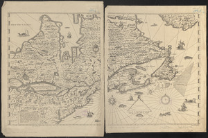
Carte de la Nouvelle-France, augmentée depuis la derniere, servant a la navigation faicte en son vray Meridien par le Sr. de...
48.
Carte du Golphe de St. Laurent et pays voisins pour servir à l'histoire générale des voyages
49.
Coal areas of Canada
50.
Dawson's map of the Dominion of Canada
‹ Prev
Next ›
1
2
3
4
5
6
7
8
9
…
46
47