Toggle navigation
LMEC Home
Exhibitions
Georeferencing
Tools for Teachers
Collections
My Favorites
Sign Up / Log In
Search
Search the map portal
Map Collection
Map Collection
Map Sets
Search
Search
Search for
Search In
All Fields
Creator
Title
Subject
Place
Search All Digital Collections
Advanced Search
882 Results
My Search
Start Over
More Like
commonwealth:z603vg07x
Remove constraint More Like: commonwealth:z603vg07x
Filter your Search
Place
North and Central America
868
United States
839
Boston
742
Suffolk (county)
742
Massachusetts
647
Downtown Boston
35
Boston Harbor
23
Canada
22
more
Place
»
Topic
Boston (Mass.)--Maps
752
City planning--Massachusetts--Boston--Maps
104
Real property--Massachusetts--Boston--Maps
99
Landowners--Massachusetts--Boston--Maps
74
Urban renewal--Massachusetts--Boston--Maps
63
Massachusetts--Maps
50
Local transit--Massachusetts--Boston--Maps
47
Land use--Massachusetts--Boston--Maps
35
more
Topic
»
Date
Date range begin
–
Date range end
Current results range from
1743
to
2023
View distribution
Creator
Boston Redevelopment Authority
114
Geo. H. Walker & Co
27
Boynton, George W., d. 1884
21
Sampson, Davenport & Co
21
Sampson, Murdock & Co
20
Bromley, George Washington
18
Bromley, Walter Scott
17
Lufkin, Richard F. (Richard Friend)
17
more
Creator
»
Format
Maps/Atlases
882
Manuscripts
21
Georeferenced
Yes
104
No
778
Collection
Norman B. Leventhal Map & Education Center Collection
615
Boston and New England Maps
580
Urban Maps
490
American Revolutionary War-Era Maps
153
Maps from AAS
138
Boston Redevelopment Authority Collection
120
Mapping Boston Collection
20
Massachusetts Real Estate Atlases
12
more
Collection
»
Available to use
No known restrictions
686
Creative Commons license
35
Search Constraints
Sort by relevance
relevance
title
date (asc)
date (desc)
Number of results to display per page
20 per page
10
per page
20
per page
50
per page
100
per page
View results as:
grid view
map view
Search Results
781.
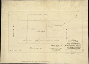
Plan of the estate of late Doct. John W. Warren, No. 89 Harrison Avenue, cor. of Kneeland St. & Plymouth Pl. to be sold at...
782.
Plan of the estate of the late Warren White : to be sold at public auction on Wednesday March 27th 1872 at 12 o'clock m. on the...
783.
Plan of the estate on the southerly corner of Washington and Franklin Streets : to be sold by public auction on Saturday June...
784.
Plan of the estates nos. 246 to 252 Congress corner of Purchase Street and nos. 59 to 69 Purchase Street : to be sold by public...
785.
Plan of the Federal St. Meeting House estate : to be sold by public auction, on Thursday February 24th 1859, at 12 o'clock noon...
786.
[Plan of the Gore Estate at the corner of Pitts and Green streets]
787.
Plan of the harbour of Boston, from surveys made under the direction of commissioners appointed by a resolve of the...
788.
Plan of the Hutchinson Estate on the corner of Hanover & Clark Streets : to be sold by public auction on Monday Feby. 20th 1871...
789.
Plan of the old Julien estate : compriseing [sic] two stores on Milk and Congress Streets : belonging to the estate of the late...
790.
Plan of the parkway between Muddy River gate house and Jamaica Park 1892
791.
Plan of the Pratt estate, corner of Summer & Hawley Streets : to be sold by pulic auction on Thursday April 10th 1855 at 12...
792.
Plan of the receiving basin showing certain avenues and lines of release
793.
Plan of the route of pipes from Jamaica Pond, in Roxbury to the reservoir, in Boston
794.
Plan of the South Cove
795.
[Plan of the State House grounds and the adjacent district]
796.
A plan of the town and chart of the harbour of Boston exhibiting a view of the islands castle forts and entrances into the said...
797.
A plan of the town and harbour of Boston and the country adjacent with the road from Boston to Concord shewing the place of the...
798.
Plan of the town of Boston
799.
Plan of the town of Boston
800.
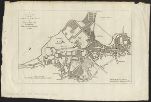
A plan of the town of Boston, in New-England, distinguishing that part which was burnt in 1760
‹ Prev
Next ›
1
2
…
36
37
38
39
40
41
42
43
44
45


![[Plan of the Gore Estate at the corner of Pitts and Green streets]](https://bpldcassets.blob.core.windows.net/derivatives/images/commonwealth:9s161h402/image_thumbnail_300.jpg)


![[Plan of the State House grounds and the adjacent district]](https://bpldcassets.blob.core.windows.net/derivatives/images/commonwealth:js956k629/image_thumbnail_300.jpg)