Toggle navigation
LMEC Home
Exhibitions
Georeferencing
Tools for Teachers
Collections
My Favorites
Sign Up / Log In
Search
Search the map portal
Map Collection
Map Collection
Map Sets
Search
Search
Search for
Search In
All Fields
Creator
Title
Subject
Place
Search All Digital Collections
Advanced Search
8912 Results
My Search
Start Over
More Like
commonwealth:x059cd380
Remove constraint More Like: commonwealth:x059cd380
Filter your Search
Place
North and Central America
6,082
United States
4,898
Massachusetts
2,080
Europe
1,396
Suffolk (county)
1,046
Boston
1,019
Canada
503
Asia
441
more
Place
»
Topic
Boston (Mass.)--Maps
586
United States--Maps
282
North America--Maps--Early works to 1800
240
Real property--Massachusetts--Boston--Maps
175
Massachusetts--Maps
162
Landowners--Massachusetts--Boston--Maps
133
New England--Maps
102
Canada--Maps--Early works to 1800
79
more
Topic
»
Date
Date range begin
–
Date range end
Current results range from
1482
to
2023
View distribution
Creator
United States. Hydrographic Office
595
O.H. Bailey & Co
148
Des Barres, Joseph F. W. (Joseph Frederick Wallet), 1722-1824
123
United States. Post Office Dept
120
Ptolemy, 2nd cent
100
Jefferys, Thomas, -1771
94
Walling, Henry Francis, 1825-1888
94
Sayer, Robert, 1725-1794
87
more
Creator
»
Format
Maps/Atlases
8,852
Manuscripts
219
Prints
56
Books
36
Objects/Artifacts
10
Drawings/Illustrations
8
Posters
5
Georeferenced
Yes
872
No
8,040
Collection
Norman B. Leventhal Map & Education Center Collection
8,711
Boston and New England Maps
2,234
Urban Maps
2,023
Maritime Charts and Atlases
1,086
American Revolutionary War-Era Maps
811
MacLean Collection Map Library
101
Boston Redevelopment Authority Collection
87
New York Public Library Collection
44
more
Collection
»
Available to use
No known restrictions
8,558
Creative Commons license
136
Search Constraints
Sort by relevance
relevance
title
date (asc)
date (desc)
Number of results to display per page
20 per page
10
per page
20
per page
50
per page
100
per page
View results as:
grid view
map view
Search Results
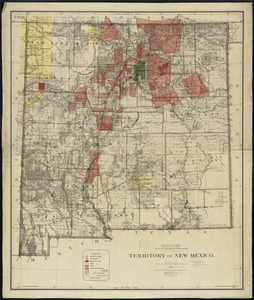
8121.
Territory of New Mexico
8122.
Territory of New Mexico
8123.
Territory of Utah
8124.
Territory of Utah
8125.
Territory of Wyoming
8126.
The territory over possession of which France and England are disputing
8127.
Tertia Affrice tabula continet Cyrenainaycam & Egyptum cum adiacentibus insulis
8128.
Tertia Africae tabula
8129.
Tertia Asiae tabula
8130.
Tertia Asie tabula continet Colchide, Iberia, Albania :& maiorem Armenia
8131.
Tertia Europae tabula
8132.
Teton National Forest, Wyoming
8133.
Tetrachia Ducatus Geldriae Neomagensis
8134.
Tetrachia ducatus Geldriae Ruremondana sive Hispanica
8135.
A Texan's map of the United States [of Texas]
8136.
Texas and Pacific Rail Way
8137.
Texas New Yorker travelers' railroad map of the State of Texas
8138.
Texas New Yorker's railroad map of Texas : showing all completed and proposed routes, with principal rivers, county boundaries...
8139.
Tezanos Pinto (Entre Rios)
8140.
[The natural shape of England with the names of rivers, seaports, sands, hills, moors, forrests, and many other remarks which...
‹ Prev
Next ›
1
2
…
403
404
405
406
407
408
409
410
411
…
445
446