Toggle navigation
LMEC Home
Exhibitions
Georeferencing
Tools for Teachers
Collections
My Favorites
Sign Up / Log In
Search
Search the map portal
Map Collection
Map Collection
Map Sets
Search
Search
Search for
Search In
All Fields
Creator
Title
Subject
Place
Search All Digital Collections
Advanced Search
8878 Results
My Search
Start Over
More Like
commonwealth:wd376217m
Remove constraint More Like: commonwealth:wd376217m
Filter your Search
Place
North and Central America
6,109
United States
5,025
Massachusetts
2,147
Europe
1,396
Suffolk (county)
1,214
Boston
1,187
Canada
449
Asia
438
more
Place
»
Topic
Boston (Mass.)--Maps
752
United States--Maps
282
Real property--Massachusetts--Boston--Maps
195
Massachusetts--Maps
166
City planning--Massachusetts--Boston--Maps
160
Landowners--Massachusetts--Boston--Maps
142
New England--Maps
104
North America--Maps--Early works to 1800
103
more
Topic
»
Date
Date range begin
–
Date range end
Current results range from
1482
to
2023
View distribution
Creator
United States. Hydrographic Office
595
Boston Redevelopment Authority
164
O.H. Bailey & Co
148
Des Barres, Joseph F. W. (Joseph Frederick Wallet), 1722-1824
124
United States. Post Office Dept
120
Ptolemy, 2nd cent
100
Walling, Henry Francis, 1825-1888
94
Geological Survey (U.S.)
87
more
Creator
»
Format
Maps/Atlases
8,818
Manuscripts
215
Prints
56
Books
36
Objects/Artifacts
10
Drawings/Illustrations
8
Posters
6
Georeferenced
Yes
885
No
7,993
Collection
Norman B. Leventhal Map & Education Center Collection
8,731
Boston and New England Maps
2,368
Urban Maps
2,144
Maritime Charts and Atlases
1,087
American Revolutionary War-Era Maps
644
Boston Redevelopment Authority Collection
194
Mapping Boston Collection
27
William L. Clements Library Collection
15
more
Collection
»
Available to use
No known restrictions
8,668
Creative Commons license
78
Search Constraints
Sort by relevance
relevance
title
date (asc)
date (desc)
Number of results to display per page
20 per page
10
per page
20
per page
50
per page
100
per page
View results as:
grid view
map view
Search Results
461.
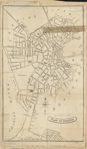
Plan of Boston
462.
Plan of Boston & Maine Railroad terminal division Boston, Cambridge, Somerville, Everett and Medford
463.
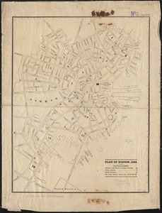
Plan of Boston 1828
464.
Plan of Boston and its vicinity
465.
Plan of Boston and its vicinity showing the connection of the Grand Junction Rail Road with the Harbor and other Rail-roads
466.
Plan of Boston and its vicinity, showing the drainage area of Stony Brook which empties into the full basin of the Back Bay
467.
Plan of Boston and its vicinity, showing the drainage area of Stony Brook which empties into the full basin of the Back Bay
468.
Plan of Boston and Roxbury
469.
Plan of Boston comprising a part of Charlestown and Cambridge
470.
Plan of Boston comprising a part of Charlestown and Cambridge
471.
Plan of Boston comprising a part of Charlestown and Cambridge
472.
Plan of Boston comprising a part of Charlestown and Cambridge
473.
Plan of Boston comprising a part of Charlestown and Cambridge
474.
Plan of Boston comprising a part of Charlestown and Cambridge
475.
Plan of Boston comprising a part of Charlestown and Cambridge
476.
Plan of Boston comprising a part of Charlestown and Cambridge
477.
A plan of Boston, from actual survey by Osgood Carleton
478.
Plan of Boston showing existing ways and owners on December 25, 1630
479.
Plan of Boston showing existing ways and owners on December 25, 1631
480.
Plan of Boston showing existing ways and owners on December 25, 1632
‹ Prev
Next ›
1
2
…
20
21
22
23
24
25
26
27
28
…
443
444