Toggle navigation
LMEC Home
Exhibitions
Georeferencing
Tools for Teachers
Collections
My Favorites
Sign Up / Log In
Search
Search the map portal
Map Collection
Map Collection
Map Sets
Search
Search
Search for
Search In
All Fields
Creator
Title
Subject
Place
Search All Digital Collections
Advanced Search
8800 Results
My Search
Start Over
More Like
commonwealth:tt44pv58g
Remove constraint More Like: commonwealth:tt44pv58g
Filter your Search
Place
North and Central America
6,039
United States
4,958
Massachusetts
2,079
Europe
1,392
Suffolk (county)
1,194
Boston
1,167
Canada
449
Asia
437
more
Place
»
Topic
Boston (Mass.)--Maps
603
United States--Maps
279
Real property--Massachusetts--Boston--Maps
253
City planning--Massachusetts--Boston--Maps
172
Landowners--Massachusetts--Boston--Maps
169
Massachusetts--Maps
161
North America--Maps--Early works to 1800
103
New England--Maps
101
more
Topic
»
Date
Date range begin
–
Date range end
Current results range from
1482
to
2023
View distribution
Creator
United States. Hydrographic Office
595
Boston Redevelopment Authority
174
O.H. Bailey & Co
148
Des Barres, Joseph F. W. (Joseph Frederick Wallet), 1722-1824
123
United States. Post Office Dept
120
Ptolemy, 2nd cent
100
Walling, Henry Francis, 1825-1888
94
Geological Survey (U.S.)
86
more
Creator
»
Format
Maps/Atlases
8,740
Manuscripts
215
Prints
56
Books
36
Objects/Artifacts
10
Drawings/Illustrations
8
Posters
5
Georeferenced
Yes
871
No
7,929
Collection
Norman B. Leventhal Map & Education Center Collection
8,649
Boston and New England Maps
2,339
Urban Maps
2,109
Maritime Charts and Atlases
1,083
American Revolutionary War-Era Maps
615
Boston Redevelopment Authority Collection
203
Massachusetts Real Estate Atlases
35
Applied Geographics, Inc. Records
2
more
Collection
»
Available to use
No known restrictions
8,622
Creative Commons license
48
Search Constraints
Sort by relevance
relevance
title
date (asc)
date (desc)
Number of results to display per page
20 per page
10
per page
20
per page
50
per page
100
per page
View results as:
grid view
map view
Search Results
141.
Jamaica Plain view of the world
142.
Jamaica Pond master plan
143.
Map of Arnold Arboretum showing location of the trees and shrubs
144.
Map of Arnold Arboretum showing location of the trees and shrubs
145.
Map of proposed arboretum, showing its outlines and local connections, with a study for public drive passing through it
146.
Olmsted Park master plan
147.
Plan of the Arnold Arboretum Jamaica Plain Mass
148.
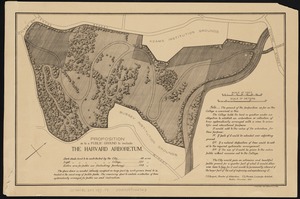
Proposition as to a public ground to include the Harvard Arboretum
149.
Atlas of Dorchester, West Roxbury, and Brighton, City of Boston
150.
Atlas of the city of Boston : West Roxbury
151.
Atlas of the city of Boston : Dorchester
152.
Atlas of the city of Boston : Boston proper and Back Bay
153.
Atlas of the city of Boston : Dorchester
154.
Atlas of the city of Boston : Boston proper and Back Bay
155.
Atlas of the city of Boston : Dorchester, Mass., vol. 5
156.
Atlas of the city of Boston : South Boston
157.
Atlas of the city of Boston : volume 7, Brighton
158.
Atlas of the city of Boston : vol. 5, West Roxbury
159.
Atlas of the city of Boston : Boston proper
160.
Atlas of the city of Boston : Dorchester, Massachusetts, vol. 5
‹ Prev
Next ›
1
2
…
4
5
6
7
8
9
10
11
12
…
439
440