Toggle navigation
LMEC Home
Exhibitions
Georeferencing
Tools for Teachers
Collections
My Favorites
Sign Up / Log In
Search
Search the map portal
Map Collection
Map Collection
Map Sets
Search
Search
Search for
Search In
All Fields
Creator
Title
Subject
Place
Search All Digital Collections
Advanced Search
294 Results
My Search
Start Over
More Like
commonwealth:t722hs68s
Remove constraint More Like: commonwealth:t722hs68s
Filter your Search
Place
North and Central America
234
United States
140
Canada
74
Suffolk (county)
45
Boston
44
Boston Harbor
25
Nova Scotia
23
Massachusetts
20
more
Place
»
Topic
Manuscript maps--Early works to 1800
138
Coasts--Nova Scotia--Maps
62
Boston (Mass.)--Buildings, structures, etc--Maps, Manuscript--Early works to 1800
17
Nautical charts--Massachusetts--Boston Harbor--Early works to 1800
16
Boston Harbor (Mass.)--Maps--Early works to 1800
13
Fortification--Massachusetts--Boston--Maps, Manuscript--Early works to 1800
13
Coasts--Nova Scotia--Pictorial works
10
Boston (Mass.)--Maps, Manuscript--Early works to 1800
9
more
Topic
»
Date
Date range begin
–
Date range end
Current results range from
1688
to
1899
View distribution
Creator
Des Barres, Joseph F. W. (Joseph Frederick Wallet), 1722-1824
101
Dumont de Montigny
14
Adlum, John, 1759-1836
9
Bingham, William, 1752-1804
9
Montrésor, John, 1736-1799
7
De Brahm, John Gerar William, 1717-approximately 1799
4
Page, Thomas Hyde, Sir, 1746-1821
4
Real Escuela de Navegación (Cádiz, Spain)
4
more
Creator
»
Format
Maps/Atlases
293
Manuscripts
174
Prints
1
Georeferenced
Yes
7
No
287
Collection
American Revolutionary War-Era Maps
281
Library of Congress Collection
229
Newberry Library Collection
39
Maritime Charts and Atlases
32
Boston and New England Maps
22
Norman B. Leventhal Map & Education Center Collection
20
Urban Maps
11
Mapping Boston Collection
7
more
Collection
»
Available to use
Creative Commons license
242
No known restrictions
13
Search Constraints
Sort by relevance
relevance
title
date (asc)
date (desc)
Number of results to display per page
20 per page
10
per page
20
per page
50
per page
100
per page
View results as:
grid view
map view
Search Results
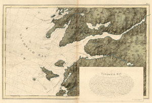
261.
Sandwich Bay
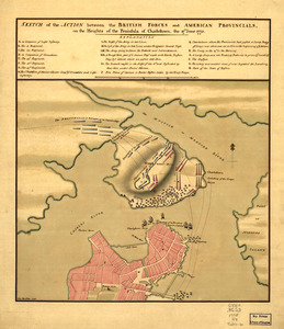
262.
Sketch of the action between the British forces and American provincials, on the heights of the peninsula of Charlestown : the...
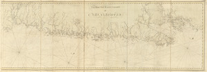
263.
The south east coast of Nova Scotia
264.
South entrance of Grand Passage ; Cape St. Mary n.e. one mile ; St. Marys Bay
265.
The south west coast of the peninsula of Nova Scotia
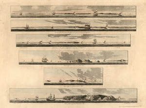
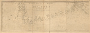
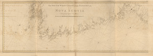
266.
The south west coast of the peninsula of Nova Scotia
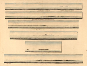
267.
[Southwest coast of Nova Scotia from Cape Sable to Cape St. Mary]
268.
[Southwest coast of Nova Scotia from Cape Sable to Cape St. Mary]
269.
Spry Harbour ; Port Pallisser ; Port North ; Port Parker ; Beaver Harbour ; Fleming River
270.
Spry Harbour ; Port Pallisser ; Port North ; Port Parker ; Beaver Harbour ; Fleming River
271.
A Temporary project for a star redout [sic] to contain 150 men
272.
To the Hone. Jno. Hancock, Esqre. president of ye Continental Congress, this map of the seat of civil war in America, is...
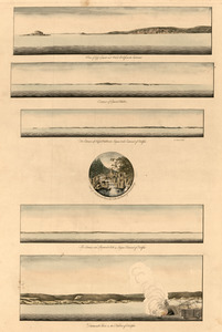
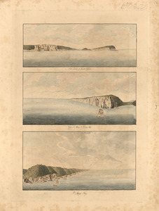
273.
[Torbay]
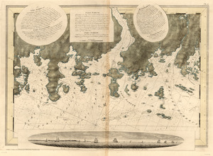
274.
[Torbay]
275.
[Torbay]
276.
[Torbay]
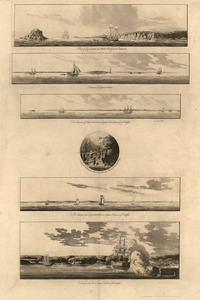
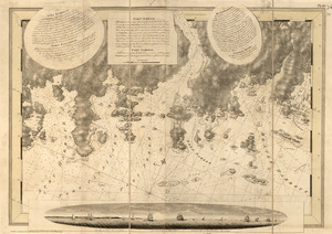
277.
A view from the south eastward of Halifax Harbor ; Appearance of the shore at three miles off four or five leagues to the...
278.
A view from the south eastward of Halifax Harbor ; Appearance of the shore at three miles off four or five leagues to the...
279.
View of Cape Egmont and Winter Rock from the eastward ; Entrance of Egmont Harbor ; The entrance of Keppel Harbor ... ; Falls...
280.
View of Cape Egmont and Winter Rock from the eastward ; Entrance of Egmont Harbor ; The entrance of Keppel Harbor ... ; Falls...
‹ Prev
Next ›
1
2
…
10
11
12
13
14
15
![[Southwest coast of Nova Scotia from Cape Sable to Cape St. Mary]](https://bpldcassets.blob.core.windows.net/derivatives/images/commonwealth:t722hs70t/image_thumbnail_300.jpg)
![[Southwest coast of Nova Scotia from Cape Sable to Cape St. Mary]](https://bpldcassets.blob.core.windows.net/derivatives/images/commonwealth:t722hs72c/image_thumbnail_300.jpg)
![A Temporary project for a star redout [sic] to contain 150 men](https://bpldcassets.blob.core.windows.net/derivatives/images/commonwealth:z603vj703/image_thumbnail_300.jpg)
![[Torbay]](https://bpldcassets.blob.core.windows.net/derivatives/images/commonwealth:z603vj95z/image_thumbnail_300.jpg)
![[Torbay]](https://bpldcassets.blob.core.windows.net/derivatives/images/commonwealth:z603vj992/image_thumbnail_300.jpg)
![[Torbay]](https://bpldcassets.blob.core.windows.net/derivatives/images/commonwealth:z603vk01w/image_thumbnail_300.jpg)
![[Torbay]](https://bpldcassets.blob.core.windows.net/derivatives/images/commonwealth:z603vj97h/image_thumbnail_300.jpg)