Toggle navigation
LMEC Home
Exhibitions
Georeferencing
Tools for Teachers
Collections
My Favorites
Sign Up / Log In
Search
Search the map portal
Map Collection
Map Collection
Map Sets
Search
Search
Search for
Search In
All Fields
Creator
Title
Subject
Place
Search All Digital Collections
Advanced Search
8768 Results
My Search
Start Over
More Like
commonwealth:st74cw14b
Remove constraint More Like: commonwealth:st74cw14b
Filter your Search
Place
North and Central America
5,999
United States
4,901
Massachusetts
2,149
Europe
1,396
Suffolk (county)
1,047
Boston
1,020
Canada
450
Asia
438
more
Place
»
Topic
Boston (Mass.)--Maps
590
United States--Maps
282
Massachusetts--Maps
235
Real property--Massachusetts--Boston--Maps
175
Landowners--Massachusetts--Boston--Maps
133
New England--Maps
104
North America--Maps--Early works to 1800
103
Europe--Maps
79
more
Topic
»
Date
Date range begin
–
Date range end
Current results range from
1482
to
2023
View distribution
Creator
United States. Hydrographic Office
595
O.H. Bailey & Co
148
Des Barres, Joseph F. W. (Joseph Frederick Wallet), 1722-1824
123
United States. Post Office Dept
120
Ptolemy, 2nd cent
100
Walling, Henry Francis, 1825-1888
95
Geological Survey (U.S.)
92
Jefferys, Thomas, -1771
85
more
Creator
»
Format
Maps/Atlases
8,707
Manuscripts
217
Prints
56
Books
36
Objects/Artifacts
10
Drawings/Illustrations
8
Posters
5
Ephemera
1
Georeferenced
Yes
878
No
7,890
Collection
Norman B. Leventhal Map & Education Center Collection
8,737
Boston and New England Maps
2,280
Urban Maps
2,024
Maritime Charts and Atlases
1,083
American Revolutionary War-Era Maps
635
Boston Redevelopment Authority Collection
90
Applied Geographics, Inc. Records
20
David Judkins Weaver Papers
18
more
Collection
»
Available to use
No known restrictions
8,595
Creative Commons license
51
Search Constraints
Sort by relevance
relevance
title
date (asc)
date (desc)
Number of results to display per page
20 per page
10
per page
20
per page
50
per page
100
per page
View results as:
grid view
map view
Search Results
2461.
Fangaloa Bay, north side of Upolu
2462.
Fault map of the state of California
2463.
Fayal Id., Horta and Pim Bays ; Azores, Fayal Channel
2464.
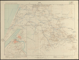
Fes
2465.
Fezzae et Marocchi regna Africae celeberrima
2466.
Field of operations of the Army of the Potomac
2467.
The fifteenth section no. I. Lake Huron 1820 & 1822
2468.
The fifth column menaces America on a thousand fronts
2469.
Financial irrigation of the United States by funds appropriated for emergency use under the New Deal
2470.
Fire insurance district atlas : showing the fire insurance districts of the city of Boston : as established by the State...
2471.
The Firemen's guide : a map of the City of New-York, showing the fire districts, fire limits, hydrants, public cisterns,...
2472.
First Corps Cadets, Massachusetts Volunteer Militia : encampment at Hingham, July 13 to 18, 1885
2473.
Fishing & hunting resorts of Maine, northern New Hampshire, and part of Canada and the provinces, Rangeley & Moosehead Lakes as...
2474.
Fishing grounds on the Atlantic coast of North America
2475.
Fishing grounds out of Boston : NLSECO marine diesel oil engines ; built by New London Ship & Engine Co., Groton, Conn
2476.
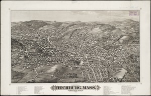
Fitchburg, Mass : population 14,000, 1882
2477.
Fitton Bay (Peel Id.) from the survey of Captain F.W. Beechey, R.N. 1827 ; Coffin Group by officers of the U.S. Ship Plymouth,...
2478.
Fitz globe
2479.
Flamm's new map of Baltimore and vicinity
2480.
Flandria
‹ Prev
Next ›
1
2
…
120
121
122
123
124
125
126
127
128
…
438
439