Toggle navigation
LMEC Home
Exhibitions
Georeferencing
Tools for Teachers
Collections
My Favorites
Sign Up / Log In
Search
Search the map portal
Map Collection
Map Collection
Map Sets
Search
Search
Search for
Search In
All Fields
Creator
Title
Subject
Place
Search All Digital Collections
Advanced Search
9085 Results
My Search
Start Over
More Like
commonwealth:rf562f58f
Remove constraint More Like: commonwealth:rf562f58f
Filter your Search
Place
North and Central America
6,316
United States
5,233
Massachusetts
2,152
Suffolk (county)
1,435
Boston
1,408
Europe
1,396
Canada
449
Asia
438
more
Place
»
Topic
Boston (Mass.)--Maps
686
City planning--Massachusetts--Boston--Maps
418
United States--Maps
282
Real property--Massachusetts--Boston--Maps
253
Urban renewal--Massachusetts--Boston--Maps
253
Landowners--Massachusetts--Boston--Maps
169
Massachusetts--Maps
163
Buildings--Massachusetts--Boston--Maps
124
more
Topic
»
Date
Date range begin
–
Date range end
Current results range from
1482
to
2023
View distribution
Creator
United States. Hydrographic Office
595
Boston Redevelopment Authority
392
O.H. Bailey & Co
148
Des Barres, Joseph F. W. (Joseph Frederick Wallet), 1722-1824
123
United States. Post Office Dept
120
Ptolemy, 2nd cent
100
Walling, Henry Francis, 1825-1888
94
Geological Survey (U.S.)
87
more
Creator
»
Format
Maps/Atlases
9,025
Manuscripts
215
Prints
56
Books
36
Objects/Artifacts
10
Drawings/Illustrations
8
Posters
5
Georeferenced
Yes
869
No
8,216
Collection
Norman B. Leventhal Map & Education Center Collection
8,695
Boston and New England Maps
2,587
Urban Maps
2,375
Maritime Charts and Atlases
1,083
American Revolutionary War-Era Maps
616
Boston Redevelopment Authority Collection
440
Massachusetts Real Estate Atlases
36
Applied Geographics, Inc. Records
1
Available to use
No known restrictions
8,907
Creative Commons license
47
Search Constraints
Sort by relevance
relevance
title
date (asc)
date (desc)
Number of results to display per page
20 per page
10
per page
20
per page
50
per page
100
per page
View results as:
grid view
map view
Search Results
821.
America the wonderland : a pictorial map of the United States
822.
America, with the European Settlements, and the conquests of Cortes and Pizarro
823.
America with those known parts in that unknowne worlde both people and manner of buildings
824.
America with those known parts in that unknowne worlde both people and manner of buildings
825.
Americae
826.
Americae
827.
Americae mappa generalis : secundum legitimas projectionis stereographicae regulas relationesque recentissimas et observationes...
828.
Americae nova descriptio
829.
Americae nova discriptio
830.
Americae nova tabula
831.
Americae nova tabula
832.
Americae pars meridionalis
833.
Americae pars meridionalis
834.
Americae pars meridionalis
835.
Americæ pars, nunc Virginia dicta, primum ab Anglis inuenta, sumtibus Dn. Walteri Raleigh, equestris ordinis Viri, Anno Dn̄i....
836.
Americae siue noui orbis, noua descriptio
837.
Americae sive Indiae Occidentalis : tabula generalis
838.
Americae tam septentrionalis quam meridionalis in mappa geographica delineatio
839.
American explorations in the West, 1803-1852
840.
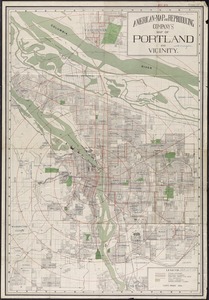
American Map and Reproducing Company's map of Portland and vicinity
‹ Prev
Next ›
1
2
…
38
39
40
41
42
43
44
45
46
…
454
455