Toggle navigation
LMEC Home
Exhibitions
Georeferencing
Tools for Teachers
Collections
My Favorites
Sign Up / Log In
Search
Search the map portal
Map Collection
Map Collection
Map Sets
Search
Search
Search for
Search In
All Fields
Creator
Title
Subject
Place
Search All Digital Collections
Advanced Search
8927 Results
My Search
Start Over
More Like
commonwealth:m900r861d
Remove constraint More Like: commonwealth:m900r861d
Filter your Search
Place
North and Central America
6,158
United States
5,074
Massachusetts
2,139
Europe
1,396
Suffolk (county)
1,273
Boston
1,246
Canada
449
Asia
438
more
Place
»
Topic
Boston (Mass.)--Maps
753
United States--Maps
282
Real property--Massachusetts--Boston--Maps
254
City planning--Massachusetts--Boston--Maps
192
Landowners--Massachusetts--Boston--Maps
170
Massachusetts--Maps
166
New England--Maps
104
North America--Maps--Early works to 1800
103
more
Topic
»
Date
Date range begin
–
Date range end
Current results range from
1482
to
2023
View distribution
Creator
United States. Hydrographic Office
595
Boston Redevelopment Authority
194
O.H. Bailey & Co
148
Des Barres, Joseph F. W. (Joseph Frederick Wallet), 1722-1824
124
United States. Post Office Dept
120
Ptolemy, 2nd cent
100
Walling, Henry Francis, 1825-1888
94
Geological Survey (U.S.)
87
more
Creator
»
Format
Maps/Atlases
8,867
Manuscripts
215
Prints
56
Books
36
Objects/Artifacts
10
Drawings/Illustrations
8
Posters
5
Georeferenced
Yes
885
No
8,042
Collection
Norman B. Leventhal Map & Education Center Collection
8,725
Boston and New England Maps
2,397
Urban Maps
2,181
Maritime Charts and Atlases
1,083
American Revolutionary War-Era Maps
637
Boston Redevelopment Authority Collection
229
Massachusetts Real Estate Atlases
38
Mapping Boston Collection
20
more
Collection
»
Available to use
No known restrictions
8,704
Creative Commons license
70
Search Constraints
Sort by relevance
relevance
title
date (asc)
date (desc)
Number of results to display per page
20 per page
10
per page
20
per page
50
per page
100
per page
View results as:
grid view
map view
Search Results
8521.
View of Chatham : New Brunswick
8522.
View of Cheshire, Connecticut : 1882
8523.
View of Chester, Connecticut : 1881
8524.
View of Clinton, Connecticut : 1881
8525.
View of College Point, L.I : 1876
8526.
View of Collinsville, Conn : 1878
8527.
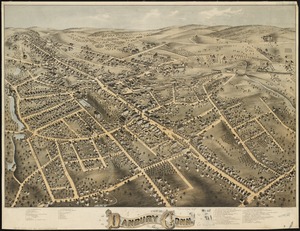
View of Danbury, Conn : 1875
8528.
View of Dedham, Mass. in 1876
8529.
View of East Boston, Mass : 1879
8530.
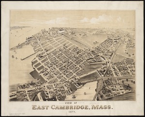
View of East Cambridge, Mass., 1879
8531.
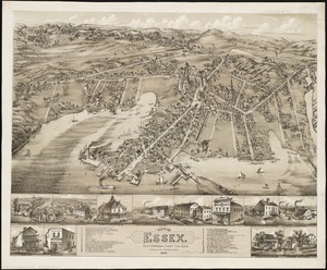
View of Essex, Centerbrook & Ivoryton, Conn : 1881
8532.
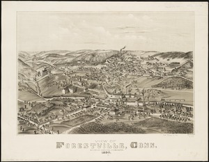
View of Forestville, Conn : 1880
8533.
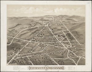
View of Franklin, Mass : 1879
8534.
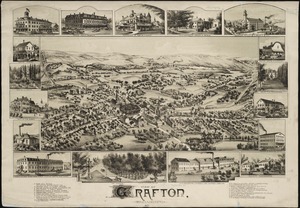
View of Grafton, Massachusetts : 1887
8535.
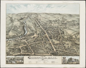
View of Greenfield, Mass
8536.
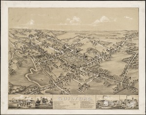
View of Guilford, Connecticut : 1881
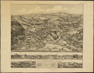
8537.
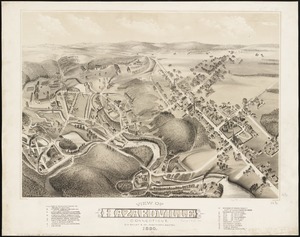
View of Hazardville, Connecticut
8538.
View of Higganum, Connecticut : 1881
8539.
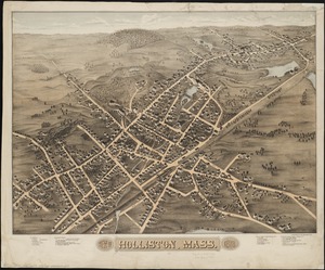
View of Holliston, Mass : 1878
8540.
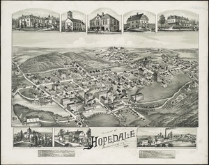
View of Hopedale, Massachusetts : 1888
‹ Prev
Next ›
1
2
…
423
424
425
426
427
428
429
430
431
…
446
447