Toggle navigation
LMEC Home
Exhibitions
Georeferencing
Tools for Teachers
Collections
My Favorites
Sign Up / Log In
Search
Search the map portal
Map Collection
Map Collection
Map Sets
Search
Search
Search for
Search In
All Fields
Creator
Title
Subject
Place
Search All Digital Collections
Advanced Search
8563 Results
My Search
Start Over
More Like
commonwealth:ht2500508
Remove constraint More Like: commonwealth:ht2500508
Filter your Search
Place
North and Central America
5,858
United States
4,782
Massachusetts
2,052
Europe
1,359
Suffolk (county)
1,047
Boston
1,020
Canada
448
Asia
422
more
Place
»
Topic
Boston (Mass.)--Maps
577
United States--Maps
273
Real property--Massachusetts--Boston--Maps
176
Massachusetts--Maps
160
Landowners--Massachusetts--Boston--Maps
134
North America--Maps--Early works to 1800
103
New England--Maps
99
Europe--Maps
78
more
Topic
»
Date
Date range begin
–
Date range end
Current results range from
1482
to
2023
View distribution
Creator
United States. Hydrographic Office
594
O.H. Bailey & Co
148
Des Barres, Joseph F. W. (Joseph Frederick Wallet), 1722-1824
123
United States. Post Office Dept
120
Ptolemy, 2nd cent
100
Walling, Henry Francis, 1825-1888
94
Geological Survey (U.S.)
86
Jefferys, Thomas, -1771
85
more
Creator
»
Format
Maps/Atlases
8,504
Manuscripts
215
Prints
56
Books
36
Objects/Artifacts
10
Drawings/Illustrations
8
Posters
4
Georeferenced
Yes
869
No
7,694
Collection
Norman B. Leventhal Map & Education Center Collection
8,550
Boston and New England Maps
2,215
Urban Maps
1,947
Maritime Charts and Atlases
1,081
American Revolutionary War-Era Maps
616
Boston Redevelopment Authority Collection
98
Massachusetts Real Estate Atlases
2
Available to use
No known restrictions
8,420
Creative Commons license
46
Search Constraints
Sort by relevance
relevance
title
date (asc)
date (desc)
Number of results to display per page
20 per page
10
per page
20
per page
50
per page
100
per page
View results as:
grid view
map view
Search Results
21.
Plan of sections of 1, 2 & 3, East Boston
22.
Preliminary plan for Wood Island Park, East Boston
23.
West Wood Island Park, East Boston district
24.
Fire insurance district atlas : showing the fire insurance districts of the city of Boston : as established by the State...
25.
Insurance map of Boston : volume 1
26.
Insurance map of Charlestown : portions of Roxbury (now annexed to Boston) and Cambridge : 1868 : corrected Nov. 1871
27.
Insurance map of Charlestown : portions of Roxbury (now annexed to Boston) and Cambridge
28.
Insurance maps of Boston volume 4 : comprising portions of Charlestown, East Cambridge, Cambridge Port, Old Cambridge & Somerville
29.
Insurance maps of Boston volume one
30.
Insurance maps of Boston volume two
31.
Atlas of the city of Boston : East Boston
32.
Atlas of the county of Suffolk, Massachusetts, vol. 4 : including East Boston, city of Chelsea, Revere and Winthrop
33.
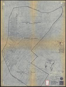
East Boston urban renewal area r-44 : existing & proposed public facilities
34.
East Boston urban renewal area r-44 : proposed circulation
35.
East Boston urban renewal area r-44 : existing circulation
36.
East Boston urban renewal area r-44 : proposed land use
37.
East Boston urban renewal area r-44 : existing land use
38.
East Boston urban renewal area r-44 : building conditions
39.
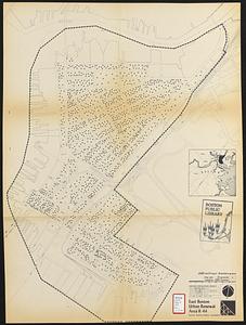
East Boston urban renewal area r-44 : existing population density
40.
East Boston urban renewal area r-44 : proposed treatment title I project
‹ Prev
Next ›
1
2
3
4
5
6
…
428
429