Toggle navigation
LMEC Home
Exhibitions
Georeferencing
Tools for Teachers
Collections
My Favorites
Sign Up / Log In
Search
Search the map portal
Map Collection
Map Collection
Map Sets
Search
Search
Search for
Search In
All Fields
Creator
Title
Subject
Place
Search All Digital Collections
Advanced Search
519 Results
My Search
Start Over
More Like
commonwealth:g445fx66s
Remove constraint More Like: commonwealth:g445fx66s
Filter your Search
Place
North and Central America
516
United States
513
Suffolk (county)
505
Boston
504
Massachusetts
201
Roxbury
88
South End
52
Fens
47
more
Place
»
Topic
City planning--Massachusetts--Boston--Maps
417
Urban renewal--Massachusetts--Boston--Maps
253
Boston (Mass.)--Maps
141
Land use--Massachusetts--Boston--Maps
100
Roxbury (Boston, Mass.)--Maps
87
Buildings--Massachusetts--Boston--Maps
85
Real property--Massachusetts--Boston--Maps
78
Fenway (Boston, Mass.)--Maps
48
more
Topic
»
Date
Date range begin
–
Date range end
Current results range from
1832
to
2014
View distribution
Creator
Boston Redevelopment Authority
370
Bromley, George Washington
17
Bromley, Walter Scott
17
G.W. Bromley & Co.
12
Downtown Waterfront Corporation
10
Victor Gruen Associates
10
Boston (Mass.). Parks and Recreation Department
8
Sasaki Associates
6
more
Creator
»
Format
Maps/Atlases
518
Drawings/Illustrations
3
Manuscripts
1
Prints
1
Georeferenced
Yes
7
No
512
Collection
Boston and New England Maps
505
Urban Maps
492
Boston Redevelopment Authority Collection
441
Norman B. Leventhal Map & Education Center Collection
128
Massachusetts Real Estate Atlases
5
Mapping Boston Collection
1
Available to use
No known restrictions
512
Creative Commons license
1
Search Constraints
Sort by relevance
relevance
title
date (asc)
date (desc)
Number of results to display per page
20 per page
10
per page
20
per page
50
per page
100
per page
View results as:
grid view
map view
Search Results
221.
Government Center urban renewal area r-35 parcel-7 : site section 2
222.
Illustrative site plan : Government Center
223.
Index to planning districts
224.
Jamaica Plain urban renewal area r-49 : building conditions
225.
Jamaica Plain urban renewal area r-49 : existing population density
226.
Jamaica Plain urban renewal area r-49 : existing and proposed community facilities
227.
Jamaica Plain urban renewal area r-49 : proposed treatment and title I projects
228.
Locality map
229.
Mattapan project : building deficiencies
230.
Mattapan project : property map
231.
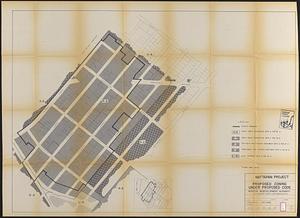
Mattapan project : proposed zoning under proposed code
232.
Mattapan project : right-of-way adjustment plan
233.
Mattapan project : existing zoning under proposed code
234.
Mattapan project : proposed zoning
235.
Midtown improvement area
236.
North Harvard project area : conditions in project area
237.
North Harvard project area : locality map
238.
Parcel 10 : Sears Crescent, Government Center
239.
Park Plaza : illustrative site plan
240.
Park Plaza : illustrative site plan showing alternate apartment building configuration
‹ Prev
Next ›
1
2
…
8
9
10
11
12
13
14
15
16
…
25
26