Toggle navigation
LMEC Home
Exhibitions
Georeferencing
Tools for Teachers
Collections
My Favorites
Sign Up / Log In
Search
Search the map portal
Map Collection
Map Collection
Map Sets
Search
Search
Search for
Search In
All Fields
Creator
Title
Subject
Place
Search All Digital Collections
Advanced Search
8756 Results
My Search
Start Over
More Like
commonwealth:db78x259p
Remove constraint More Like: commonwealth:db78x259p
Filter your Search
Place
North and Central America
5,956
United States
4,847
Massachusetts
2,079
Europe
1,396
Suffolk (county)
1,046
Boston
1,019
Canada
480
Asia
438
more
Place
»
Topic
Boston (Mass.)--Maps
586
United States--Maps
282
Real property--Massachusetts--Boston--Maps
175
Massachusetts--Maps
162
Landowners--Massachusetts--Boston--Maps
133
North America--Maps--Early works to 1800
103
New England--Maps
102
Europe--Maps
79
more
Topic
»
Date
Date range begin
–
Date range end
Current results range from
1482
to
2023
View distribution
Creator
United States. Hydrographic Office
594
Des Barres, Joseph F. W. (Joseph Frederick Wallet), 1722-1824
185
O.H. Bailey & Co
148
United States. Post Office Dept
120
Ptolemy, 2nd cent
100
Walling, Henry Francis, 1825-1888
94
Geological Survey (U.S.)
86
Jefferys, Thomas, -1771
85
more
Creator
»
Format
Maps/Atlases
8,696
Manuscripts
215
Prints
56
Books
36
Objects/Artifacts
10
Drawings/Illustrations
8
Posters
5
Georeferenced
Yes
869
No
7,887
Collection
Norman B. Leventhal Map & Education Center Collection
8,694
Boston and New England Maps
2,233
Urban Maps
2,023
Maritime Charts and Atlases
1,082
American Revolutionary War-Era Maps
678
Boston Redevelopment Authority Collection
87
Library of Congress Collection
62
Available to use
No known restrictions
8,552
Creative Commons license
109
Search Constraints
Sort by relevance
relevance
title
date (asc)
date (desc)
Number of results to display per page
20 per page
10
per page
20
per page
50
per page
100
per page
View results as:
grid view
map view
Search Results
41.
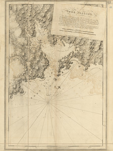
Port Jackson
42.
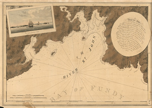
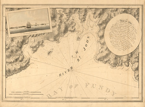
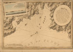
The river St. John
43.
The river St. John
44.
The river St. John
45.
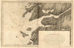
Sandwich Bay
46.
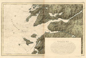
Sandwich Bay
47.
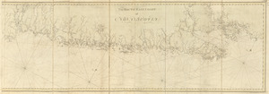
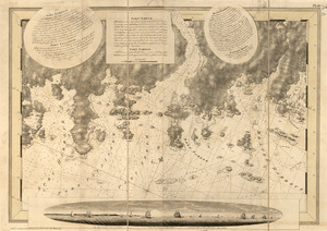
The south east coast of Nova Scotia
48.
South entrance of Grand Passage ; Cape St. Mary n.e. one mile ; St. Marys Bay
49.
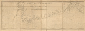
The south west coast of the peninsula of Nova Scotia
50.
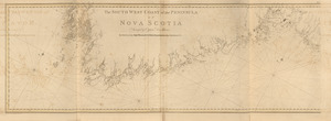
The south west coast of the peninsula of Nova Scotia
51.
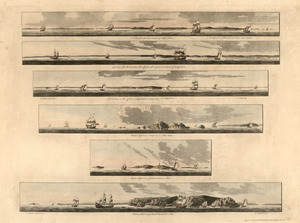
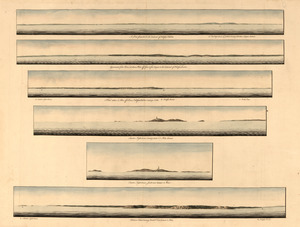
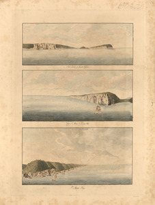
[Southwest coast of Nova Scotia from Cape Sable to Cape St. Mary]
52.
[Southwest coast of Nova Scotia from Cape Sable to Cape St. Mary]
53.
Spry Harbour ; Port Pallisser ; Port North ; Port Parker ; Beaver Harbour ; Fleming River
54.
Spry Harbour ; Port Pallisser ; Port North ; Port Parker ; Beaver Harbour ; Fleming River
55.
[Torbay]
56.
A view from the south eastward of Halifax Harbor ; Appearance of the shore at three miles off four or five leagues to the...
57.
A view from the south eastward of Halifax Harbor ; Appearance of the shore at three miles off four or five leagues to the...
58.
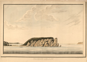
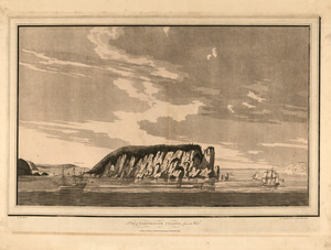
A view of Partridge Island, from the west
59.
A view of Partridge Island, from the west
60.
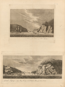
A view of the entrance of Petit Passage ; Grand Passage in the Bay Fundy, on the western shore of Nova Scotia
‹ Prev
Next ›
1
2
3
4
5
6
7
…
437
438
![[Southwest coast of Nova Scotia from Cape Sable to Cape St. Mary]](https://bpldcassets.blob.core.windows.net/derivatives/images/commonwealth:t722hs70t/image_thumbnail_300.jpg)
![[Southwest coast of Nova Scotia from Cape Sable to Cape St. Mary]](https://bpldcassets.blob.core.windows.net/derivatives/images/commonwealth:t722hs72c/image_thumbnail_300.jpg)
![[Torbay]](https://bpldcassets.blob.core.windows.net/derivatives/images/commonwealth:z603vj992/image_thumbnail_300.jpg)