Toggle navigation
LMEC Home
Exhibitions
Georeferencing
Tools for Teachers
Collections
My Favorites
Sign Up / Log In
Search
Search the map portal
Map Collection
Map Collection
Map Sets
Search
Search
Search for
Search In
All Fields
Creator
Title
Subject
Place
Search All Digital Collections
Advanced Search
8853 Results
My Search
Start Over
More Like
commonwealth:cj82m568c
Remove constraint More Like: commonwealth:cj82m568c
Filter your Search
Place
North and Central America
6,080
United States
4,926
Massachusetts
2,080
Europe
1,397
Suffolk (county)
1,046
Boston
1,019
Canada
540
Asia
438
more
Place
»
Topic
Boston (Mass.)--Maps
586
United States--Maps
284
Real property--Massachusetts--Boston--Maps
175
Massachusetts--Maps
163
United States--History--French and Indian War, 1754-1763--Maps
162
Landowners--Massachusetts--Boston--Maps
133
New England--Maps
104
North America--Maps--Early works to 1800
103
more
Topic
»
Date
Date range begin
–
Date range end
Current results range from
1482
to
2023
View distribution
Creator
United States. Hydrographic Office
595
O.H. Bailey & Co
148
Des Barres, Joseph F. W. (Joseph Frederick Wallet), 1722-1824
123
United States. Post Office Dept
120
Ptolemy, 2nd cent
100
Jefferys, Thomas, -1771
98
Walling, Henry Francis, 1825-1888
94
Geological Survey (U.S.)
86
more
Creator
»
Format
Maps/Atlases
8,792
Manuscripts
215
Prints
57
Books
36
Objects/Artifacts
10
Drawings/Illustrations
8
Posters
5
Georeferenced
Yes
869
No
7,984
Collection
Norman B. Leventhal Map & Education Center Collection
8,694
Boston and New England Maps
2,233
Urban Maps
2,023
Maritime Charts and Atlases
1,083
American Revolutionary War-Era Maps
774
William L. Clements Library Collection
149
Boston Redevelopment Authority Collection
87
Richard H. Brown Revolutionary War Map Collection at Mount Vernon
5
more
Collection
»
Available to use
No known restrictions
8,553
Creative Commons license
52
Search Constraints
Sort by relevance
relevance
title
date (asc)
date (desc)
Number of results to display per page
20 per page
10
per page
20
per page
50
per page
100
per page
View results as:
grid view
map view
Search Results
801.
Beschryvinghe der eylanden van Cuba, Hispaniola, Iamaica, S. Ioannis ende Margarita
802.
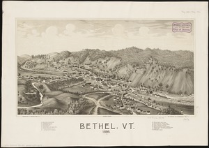
Bethel, Vt : 1886
803.
Bicycle map of Massachusetts
804.
Bicycle map of north eastern Massachusetts
805.
Bicycle map of south eastern Massachusetts
806.
Bicycle map of western Massachusetts
807.
Bigini or Pescadores Island ; Radogala and Korsakoff Islands
808.
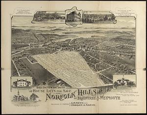
Bird's eye view and sketch of house lots for sale on Norfolk Hills in Braintree & Weymouth : belonging to Messrs A.H. Hews and...
809.
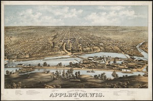
Bird's eye view of Appleton, Wis : 1874
810.
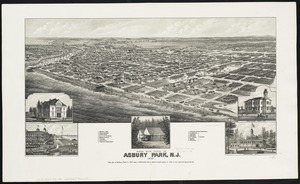
Bird's eye view of Asbury Park, N.J
811.
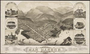
Bird's eye view of Bar Harbor, Mount Desert Island, Hancock Co., Maine, 1886
812.
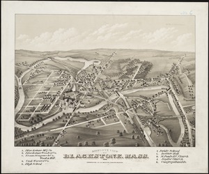
Bird's eye view of Blackstone, Mass : 1879
813.
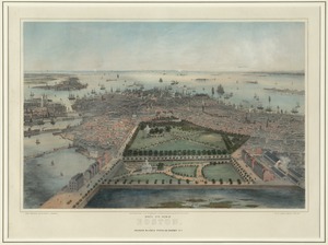
Bird's eye view of Boston
814.
Bird's eye view of Boston
815.
Bird's eye view of Boston
816.
Bird's eye view of Boston
817.
Bird's eye view of Boston Harbor and south shore to Provincetown showing steamboat routes
818.
Bird's eye view of Bristol, R.I : 1877
819.
Bird's eye view of Cape Cod
820.
Bird's eye view of Carbondale, Pa
‹ Prev
Next ›
1
2
…
37
38
39
40
41
42
43
44
45
…
442
443