Toggle navigation
LMEC Home
Exhibitions
Georeferencing
Tools for Teachers
Collections
My Favorites
Sign Up / Log In
Search
Search the map portal
Map Collection
Map Collection
Map Sets
Search
Search
Search for
Search In
All Fields
Creator
Title
Subject
Place
Search All Digital Collections
Advanced Search
8854 Results
My Search
Start Over
More Like
commonwealth:cj82m5648
Remove constraint More Like: commonwealth:cj82m5648
Filter your Search
Place
North and Central America
6,081
United States
4,926
Massachusetts
2,080
Europe
1,397
Suffolk (county)
1,046
Boston
1,019
Canada
540
Asia
438
more
Place
»
Topic
Boston (Mass.)--Maps
586
United States--Maps
284
Real property--Massachusetts--Boston--Maps
175
Massachusetts--Maps
163
United States--History--French and Indian War, 1754-1763--Maps
162
Landowners--Massachusetts--Boston--Maps
133
New England--Maps
104
North America--Maps--Early works to 1800
103
more
Topic
»
Date
Date range begin
–
Date range end
Current results range from
1482
to
2023
View distribution
Creator
United States. Hydrographic Office
595
O.H. Bailey & Co
148
Des Barres, Joseph F. W. (Joseph Frederick Wallet), 1722-1824
123
United States. Post Office Dept
120
Ptolemy, 2nd cent
100
Jefferys, Thomas, -1771
99
Walling, Henry Francis, 1825-1888
94
Geological Survey (U.S.)
86
more
Creator
»
Format
Maps/Atlases
8,793
Manuscripts
215
Prints
57
Books
36
Objects/Artifacts
10
Drawings/Illustrations
8
Posters
5
Georeferenced
Yes
869
No
7,985
Collection
Norman B. Leventhal Map & Education Center Collection
8,694
Boston and New England Maps
2,233
Urban Maps
2,023
Maritime Charts and Atlases
1,083
American Revolutionary War-Era Maps
775
William L. Clements Library Collection
149
Boston Redevelopment Authority Collection
87
Richard H. Brown Revolutionary War Map Collection at Mount Vernon
6
more
Collection
»
Available to use
No known restrictions
8,553
Creative Commons license
53
Search Constraints
Sort by relevance
relevance
title
date (asc)
date (desc)
Number of results to display per page
20 per page
10
per page
20
per page
50
per page
100
per page
View results as:
grid view
map view
Search Results
821.
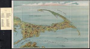
Bird's eye view of Cape Cod
822.
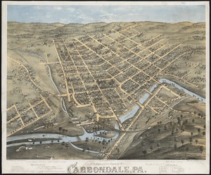
Bird's eye view of Carbondale, Pa
823.
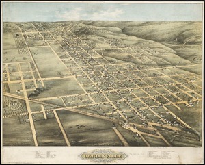
Bird's eye view of Carlinville, Macoupin County Ill : 1873
824.
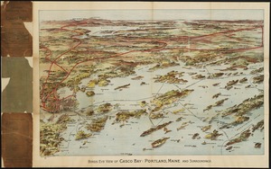
Birds eye view of Casco Bay, Portland, Maine, and surroundings
825.
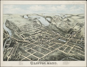
Bird's eye view of Clinton, Mass : 1876
826.
Bird's eye view of Collingwood, Ontario, Canada
827.
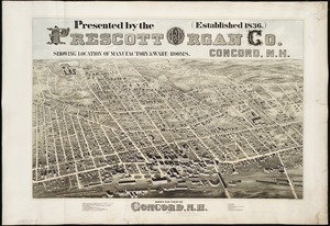
Bird's eye view of Concord, N.H : 1875
828.
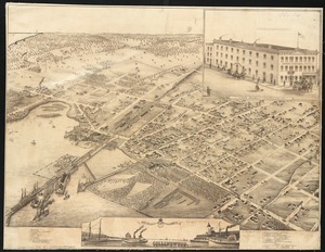
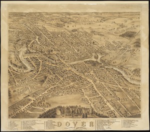
Bird's eye view of Dover, Strafford Co., New Hampshire : 1877, looking southwest
829.
A Bird's eye view of Dublin
830.
Bird's eye view of Eastport, Washington Co., Maine
831.
Bird's eye view of Fitchburg, Mass : 1875
832.
Birds eye view of Florida and part of Georgia and Alabama
833.
Bird's eye view of Fort Edward, New York : 1875
834.
Bird's eye view of Great Falls, Strafford Co., New Hampshire & Berwick, York Co., Maine, 1877 : from position north west,...
835.
Bird's eye view of Hancock, L.S. Mich, 1873 : looking north west
836.
Bird's eye view of Holyoke, Mass : 1877
837.
Bird's eye view of Houghton, L.S., Michigan, 1872 : looking south east
838.
Bird's eye view of Hudson, Mass : 1878
839.
Bird's eye view of Ishpeming, L.S. Michigan : 1871
840.
Bird's eye view of Laconia, Belknap County, N.H : 1883
‹ Prev
Next ›
1
2
…
38
39
40
41
42
43
44
45
46
…
442
443