Toggle navigation
LMEC Home
Exhibitions
Georeferencing
Tools for Teachers
Collections
My Favorites
Sign Up / Log In
Search
Search the map portal
Map Collection
Map Collection
Map Sets
Search
Search
Search for
Search In
All Fields
Creator
Title
Subject
Place
Search All Digital Collections
Advanced Search
8875 Results
My Search
Start Over
More Like
commonwealth:cj82m177h
Remove constraint More Like: commonwealth:cj82m177h
Filter your Search
Place
North and Central America
6,106
United States
5,022
Massachusetts
2,140
Europe
1,396
Suffolk (county)
1,210
Boston
1,183
Canada
449
Asia
438
more
Place
»
Topic
Boston (Mass.)--Maps
752
United States--Maps
282
Real property--Massachusetts--Boston--Maps
195
Massachusetts--Maps
166
City planning--Massachusetts--Boston--Maps
158
Landowners--Massachusetts--Boston--Maps
142
New England--Maps
104
North America--Maps--Early works to 1800
103
more
Topic
»
Date
Date range begin
–
Date range end
Current results range from
1482
to
2023
View distribution
Creator
United States. Hydrographic Office
595
Boston Redevelopment Authority
162
O.H. Bailey & Co
148
Des Barres, Joseph F. W. (Joseph Frederick Wallet), 1722-1824
124
United States. Post Office Dept
120
Ptolemy, 2nd cent
100
Walling, Henry Francis, 1825-1888
94
Geological Survey (U.S.)
87
more
Creator
»
Format
Maps/Atlases
8,815
Manuscripts
215
Prints
56
Books
36
Objects/Artifacts
10
Drawings/Illustrations
8
Posters
6
Georeferenced
Yes
885
No
7,990
Collection
Norman B. Leventhal Map & Education Center Collection
8,731
Boston and New England Maps
2,366
Urban Maps
2,141
Maritime Charts and Atlases
1,087
American Revolutionary War-Era Maps
643
Boston Redevelopment Authority Collection
192
Mapping Boston Collection
27
William L. Clements Library Collection
15
more
Collection
»
Available to use
No known restrictions
8,666
Creative Commons license
77
Search Constraints
Sort by relevance
relevance
title
date (asc)
date (desc)
Number of results to display per page
20 per page
10
per page
20
per page
50
per page
100
per page
View results as:
grid view
map view
Search Results
8441.
Via RCA : a direct marine radio service to and from ships at sea
8442.
Viaggio ai tre laghi Maggiore, di Lugano e di Como al Monte Rosa, al Sempione ed al Sacro Monte di Varallo
8443.
Vicksburg and its defences : constructed and engraved to illustrate "The war with the South"
8444.
Victoria
8445.
Victoria
8446.
Victory map
8447.
Victory map 1919
8448.
The victory war map
8449.
Viennense territorium ob res bellicas inter Christianos et Turcas nuperrime editum
8450.
Vieux Paris et ses monuments (XVIIe siècle) : avec le tracé de ses limites sous Philippe-Auguste, Charles VI, Louis XII et...
8451.
A view from the south eastward of Halifax Harbor : Appearance of the shore, (at three miles off,) four or five leagues to the...
8452.
View of Amherst, Mass
8453.
View of Andover, Massachusetts : 1882
8454.
View of Ansonia, Conn : 1875
8455.
View of Ashland, Mass : 1878
8456.
View of Athol, Mass : 1878
8457.
View of Attleborough, Mass : East Village, 1878
8458.
View of Bethel, Conn
8459.
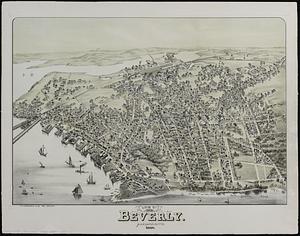
View of Beverly, Mass
8460.
View of Beverly, Massachusetts, 1886
‹ Prev
Next ›
1
2
…
419
420
421
422
423
424
425
426
427
…
443
444