Toggle navigation
LMEC Home
Exhibitions
Georeferencing
Tools for Teachers
Collections
My Favorites
Sign Up / Log In
Search
Search the map portal
Map Collection
Map Collection
Map Sets
Search
Search
Search for
Search In
All Fields
Creator
Title
Subject
Place
Search All Digital Collections
Advanced Search
8743 Results
My Search
Start Over
More Like
commonwealth:cj82kv736
Remove constraint More Like: commonwealth:cj82kv736
Filter your Search
Place
North and Central America
5,971
United States
4,891
Massachusetts
2,079
Europe
1,396
Suffolk (county)
1,046
Boston
1,019
Canada
463
Asia
438
more
Place
»
Topic
Boston (Mass.)--Maps
586
United States--Maps
330
Real property--Massachusetts--Boston--Maps
175
Massachusetts--Maps
162
Landowners--Massachusetts--Boston--Maps
133
North America--Maps--Early works to 1800
103
New England--Maps
102
Europe--Maps
79
more
Topic
»
Date
Date range begin
–
Date range end
Current results range from
1482
to
2023
View distribution
Creator
United States. Hydrographic Office
595
O.H. Bailey & Co
148
Des Barres, Joseph F. W. (Joseph Frederick Wallet), 1722-1824
123
United States. Post Office Dept
120
Ptolemy, 2nd cent
100
Walling, Henry Francis, 1825-1888
94
Geological Survey (U.S.)
87
Jefferys, Thomas, -1771
85
more
Creator
»
Format
Maps/Atlases
8,683
Manuscripts
215
Prints
56
Books
36
Objects/Artifacts
10
Drawings/Illustrations
8
Posters
5
Georeferenced
Yes
871
No
7,872
Collection
Norman B. Leventhal Map & Education Center Collection
8,700
Boston and New England Maps
2,233
Urban Maps
2,023
Maritime Charts and Atlases
1,083
American Revolutionary War-Era Maps
657
Boston Redevelopment Authority Collection
87
Maps from AAS
20
William L. Clements Library Collection
13
more
Collection
»
Available to use
No known restrictions
8,556
Creative Commons license
50
Search Constraints
Sort by relevance
relevance
title
date (asc)
date (desc)
Number of results to display per page
20 per page
10
per page
20
per page
50
per page
100
per page
View results as:
grid view
map view
Search Results
201.
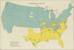
Presidential election 1904
202.
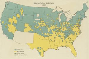
Presidential election 1908
203.
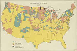
Presidential election 1912
204.
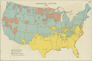
Presidential election 1924
205.
Property qualifications for suffrage, 1775
206.
Property qualifications for suffrage, 1800
207.
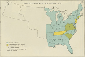
Property qualifications for suffrage, 1830
208.
Property qualifications for suffrage, 1860
209.
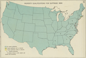
Property qualifications for suffrage, 1890
210.
Property qualifications for suffrage, 1920
211.
Public lands of the United States, 1850
212.
Public lands of the United States, 1870
213.
Public lands of the United States, 1890
214.
Public lands of the United States, 1910
215.
P.W.A. and industry : how benefits are spread
216.
P.W.A. in action
217.
PWA rebuilds the nation
218.
Radio map of the United States
219.
Radio reference map of the United States
220.
Rainfall-chart of the United States : showing the distribution by isohyetal curves of the mean precipitation in rain ...
‹ Prev
Next ›
1
2
…
7
8
9
10
11
12
13
14
15
…
437
438